Last Updated: 10th Jul 2024
Daniells Dash
Last Updated: 10th Jul 2024
Open
Grunt Factor: 25 ?
Gnarl Factor: 27 ?
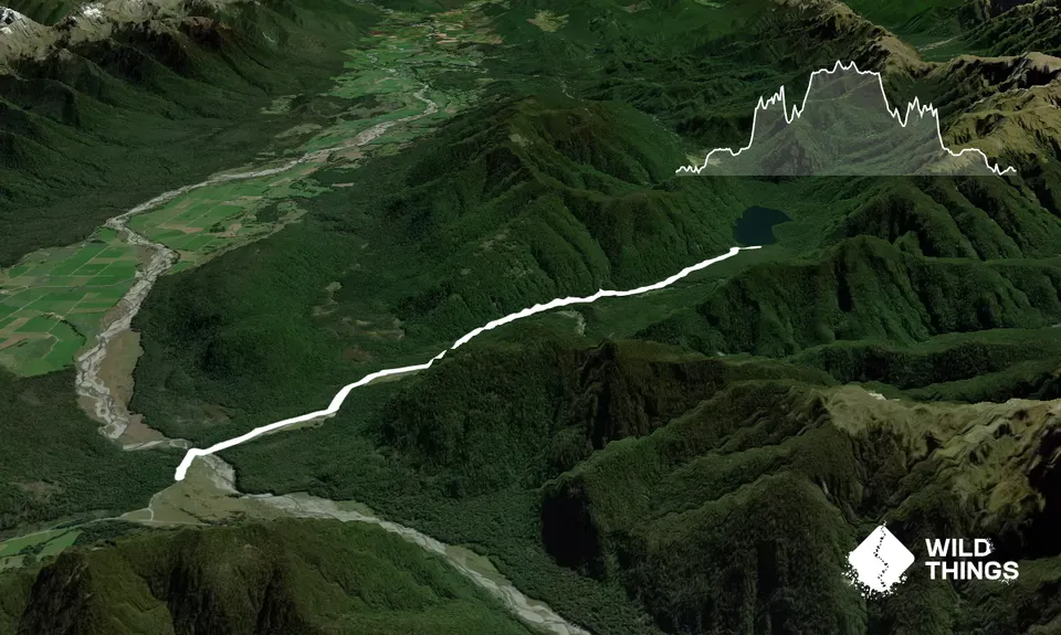
15.8km
265m
265m
578m
Trail Map
This Topo layer only covers NSW/ACT.
Switch to another map layer when viewing outside this area.
Switch to another map layer when viewing outside this area.


