Wild Things - New Zealand's trail running community
New Zealand's trail running community

Login


don't have an account?

Tuahu To Wairere , Waikato

Trail Directory proudly supported by Further Faster

Update Your Header Picture

Tuahu To Wairere Intermediate - Experienced

Submitted by Linda Downes

Info Info
Map Loading

Trail Information

36.00km

1450m

1450m


Waikato

Te Aroha

Front country - easily accessible

Point to Point (one way)

Very hilly

Native bush
Open ridges/tops

Intermediate - Experienced

Not Suitable (Slow)
9 (Moderate)
5 (Fast)

-9.2%

+8.9%

Download PDF Guide

Fastest Known Times (FKTs)

Please set your gender to see your position on the FKT leaderboards.

Men

Women

Filter FKTs

The more , the harder the FKT will be to beat. Learn about Fastest Known Times.

Missing your time?

Register or login as a VIP and get yourself on the FKT leaderboard!

Register Now

Description

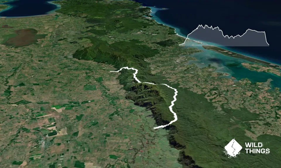
Being a point to point run, two cars will be needed; park one at Wairere Falls car park and drive 10 minutes to Tuahu Track (otherwise a drop-off and pickup will be required).

The track can be run in either direction; these instructions are from north to south.

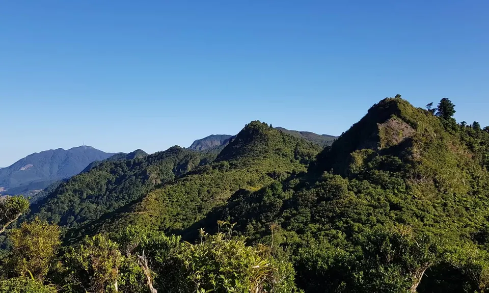
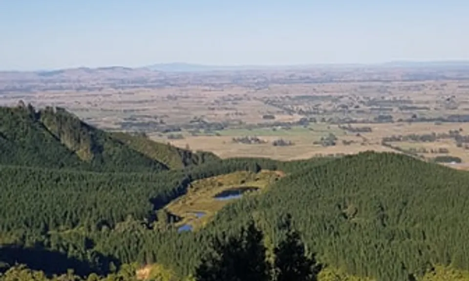
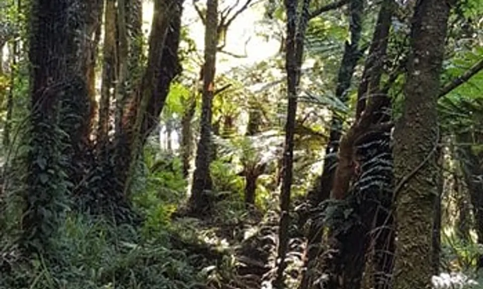
There’s a nice flat start along gravel for about 1 km followed by a steep climb into the bush which is soon rewarded with a view of the Waikato and Killarney Lakes. There are a few obstacles to get over and around on Tuahu Track but the navigation is easy. Turn right (south) at the North/South Track junction.

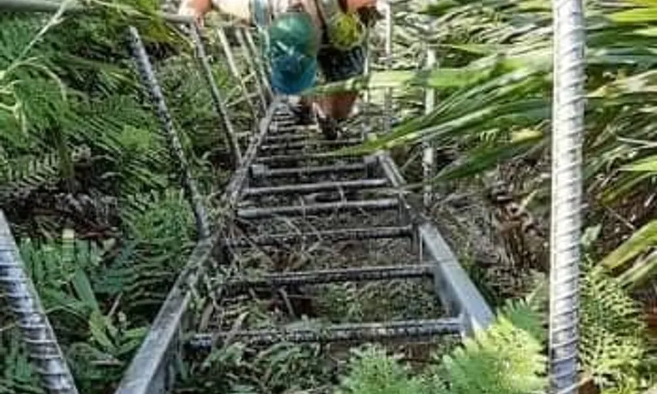
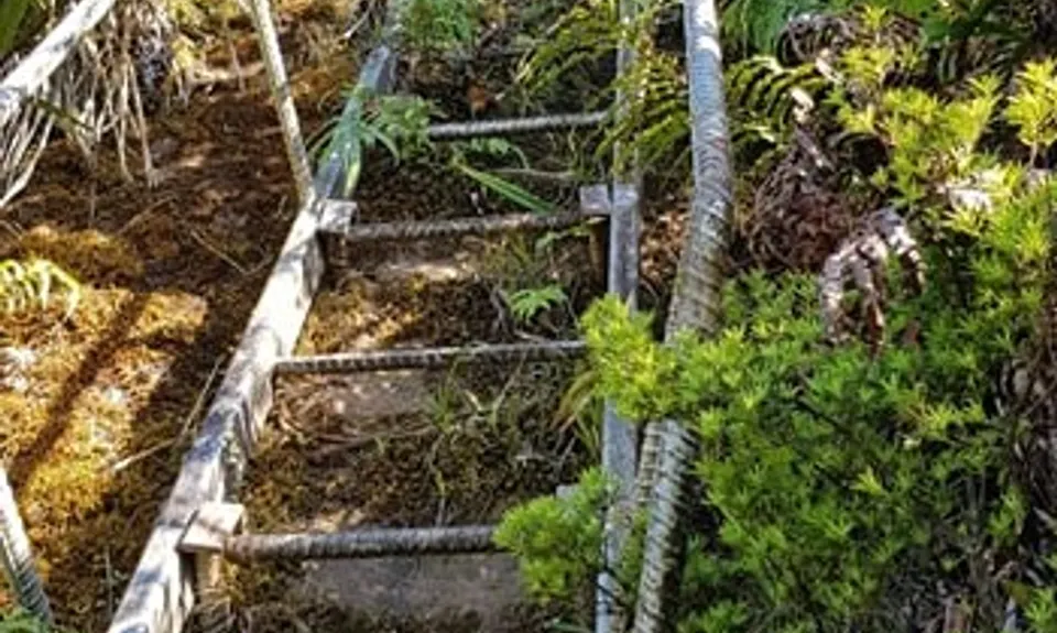
It’s slow going along the ridgeline climbing narrow sections with some stairs and ladders but the view is spectacular! Motutapere Hut is a nice little stop. The track opens out into grassy areas near the Thompsons Track junction which are a little difficult to navigate (use the Topo Map app to stay on track).

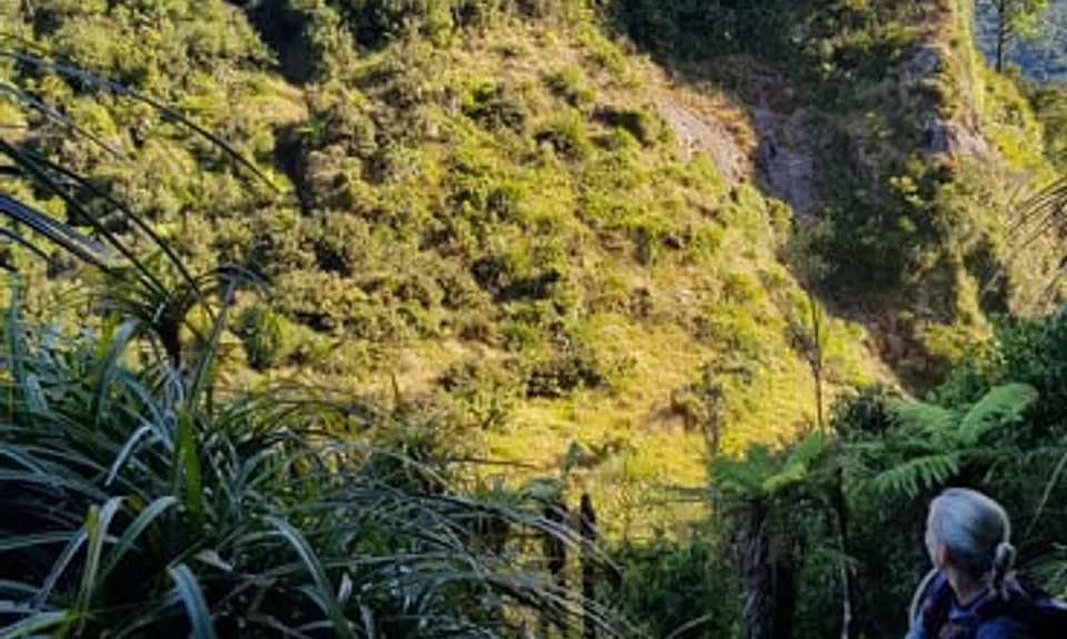
After the Kauritatahi Hut Track junction the North/South Track descends toward the Katikati side of the Kaimai’s with a few river crossings which feels quite remote. There are two track exits out to Aongatete and the track is well used, open and nicely pruned in this section.

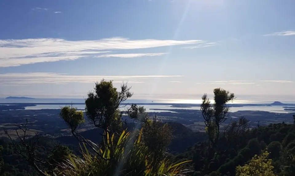
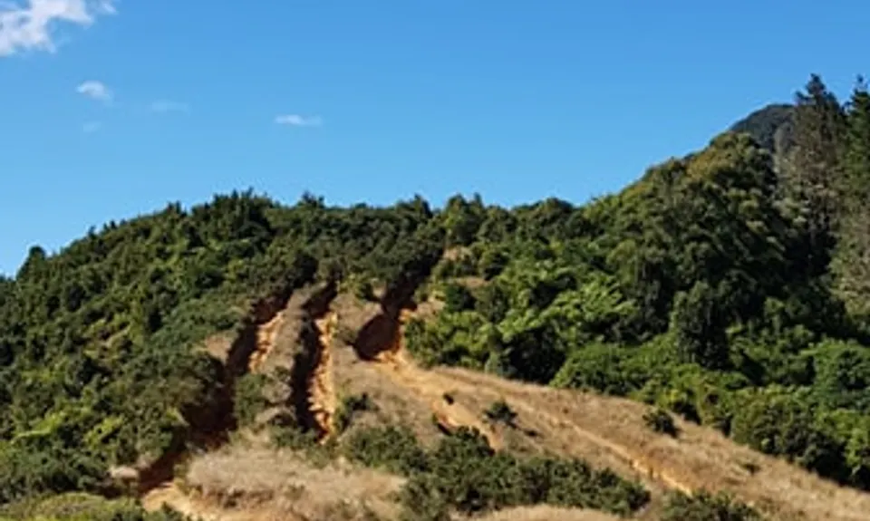
The track gradually climbs towards Wairere and is a bit overgrown with cutty grass. Turn right at the Wairere Falls junction, stop and take in the view at the top of the waterfall and then backtrack a minute to the Goodwin Road sign and head down the busy Wairere Falls track to the carpark.


Trail Community

Find people who are interested in this run.

You must register or login to view this content.

Features of interest

Stunning Views on the ridge line of both side of the kamiai ranges. Wairere Waterfall at the end


Make Up of Run

Technical Single Track: 70%

Moderate Single Track: 20%

Easy Single Track: 5%

Gravel Road: 5%


Route Data

Reviews:

You must register or login to view this content.

Photos:

You must register or login to view this content.

Your Trail Wishlist

All the runs that are on your To Do list (no limit).

Add to wishlist view wishlist

Your Trail Dreamlist

The runs you most want to do (limited to 10).

Add to dreamlist view dreamlist

Wild Explorers

I did it!
  • Access

    Between Te Aroha and Matamata there is a small settlement called Manawaru. You need to turn on to Shaftsbury Rd, which then turns into Thompsons Road. There is a sign that says 'Thompsons Track' on the turn-off in Manawaru.

    At the end of Thompsons road turn left onto Wairakau Road, about 1km up this gravel road on the right is a small grassy parking area, and a shoe disinfectant station and a sign.

    Enough parking for 5-7 vehicles, very quiet area.

    You'll finish at Wairere car park where there is ample parking.

    11 km

    11 minutes

    No

    No

  • Staying Safe

    Moderate.

    Nav was moderate for most of the run. hard in couple of places. follow the signs and follow the doc triangles. have Topo maps app on your mobile or atleast printed out and on you at all times.
    Mobile coverage is fantastic on the ridge line and non-existent through the Valleys heading toward Aongatete

    Patchy.

    Long-sleeved thermal top, Seam-sealed waterproof jacket, Beanie/thermal headwear, Personal Locator Beacon (PLB), Whistle, First aid kit, Extra food for emergencies, Survival bag, Cellphone, Compass, Map, Headtorch and spare batteries, Gaiters.

    Lots of streams and rivers. We drank out of the bigger rivers.

    Wouldn't recommend doing this in winter or bad weather.
    There are places where its muddy and the ridge line would be just too dangerous in windy/wet weather

    The North/South track is an expert rated tramping track. back-country and nav skills are needed. There are plenty of hazards and obstacles that you would expect in a remote bush setting. Fallen Trees, Steep buffs, Steep ladders, River crossings, Cutty grass, Unpredictable weather, Steep Decents & ascents

  • Blog Posts and Articles
  • Sponsor this trail

    If you are interested in learning about sponsorship opportunities, please get in touch below:

    Submit

Got a favourite trail? Tell us about it.

Share the love and add your favourite trail(s) to our growing trail directory.

Submit A Trail

Become a member today

Start enjoying the many benefits to becoming a member of our thriving community.

Become a member

Great brands at great prices with our VIP member's discount

Stay up to date

Sign up to our newsletter for latest offers and trail guides

Share this trail with a friend:

VIP Membership

Please register as a VIP or login to your VIP account to view this content.

Cancel Login Register

Membership Required

You can see up to three trail guides without being logged in but after that we require you to be logged in to your Free or VIP account. If you don’t yet have an account you can register here.

Login Register