Front country - easily accessible
Combo
Undulating, some big hills
Native bush
Plantation/exotic forest
Open farmlands
Gravel Road
Farm Road / 4WD Track
Moderate Single Track
Technical Single Track
Average Uphill Gradient: +6.8%
Average Downhill Gradient: -8.0%
VIP Feature: Send this route to your Garmin account so you can follow the course on your Garmin device.
Login as a VIP to see the trailhead information.
4.40:00
Slow
3.30:00
Moderate
2.20
Fast
You start off straight into a steady climb through farmland, giving you beautiful views of the Waikato. On reaching the bush you'll climb steeply for a little bit before it eases off.
Ignore the 1st turn off to Mangamuka on your right keep going untill you reach North/South junction. Once you reach the Junction head south, Youll soon reach the beaut new hut called Te Whare Okioki. Keep heading south for a little bit longer and you will come to a sign that says Mangamuka hut on your right. Turn here and get ready for some adventure - this track is slightly overgrown, quite technical and you need to be aware of your navigation and follow the markers! It's mostly orange DoC triangles, however there a few random old-school reflectors and ribbons in a few trees. As soon as you're on this track it's quite a steep little climb and then down to quite a boggy area with cutty grass. If there has been rain or your doing this winter youll be getting muddy! Not far after the bog youll come out at Mangamuka hut, walk around the other side and the track continues on. When you get to Te Tuhi Track it's a left Turn and down you go back down the steep hill that you climbed at the start.
If you know of any public toilets near the trail start or on the route, please login and then let us know so we can update this section.
Parking is limited for only around 5 vehicles, pretty safe location as its near a few farm houses.
12 km
12 minutes
Unknown
No
Moderate.
Follow the orange doc markers, read the signs
Very patchy.
Long-sleeved thermal top, Seam-sealed waterproof jacket, Beanie/thermal headwear, Personal Locator Beacon (PLB), Whistle, First aid kit, Extra food for emergencies, Survival bag, Cellphone, Compass, Map, Gaiters
A few streams, they look clean but always take plenty of water just in case
In winter or after a lot of rain the Mangamuka hut track would be quite difficult. Approach with caution or consider a different route.
Mud, bog, tree roots, fallen trees, several stream crossings
Trail Legend
Login as a VIP to become a Trail Legend. Learn about Trail Legends.
Fastest Known Times (FKTs)
You and 
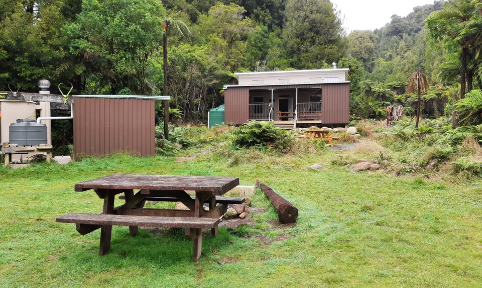
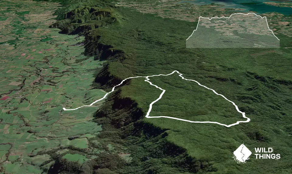
Te Whare Okioki & Mangamuka Huts Loop
As a VIP member you can record private notes for this trail, see all of your times and more.
Already have an account? Login now
Did this track over two days - staying a night at Te Whare Okioki. It's an awesome adventure if you're into that kind of thing! The track to Mangamuka hut is no longer maintained but is still passable, just. After Cyclone Tam there is significant tree fall which requires negotiating around to find the track again, through cutty grass and suplejack. Sometimes it took us 10 minutes to find the track again. There are some lovely sections on the ridgeline that are runnable but generally it's more a bush bashing technical kind of adventure day! Some say it's boggy but not as bad as Pirongia so I was plesantly surprised!
11 hours ago
Fun, interesting, but tough track. Confirm that section past Mangamuka hut is not easy to ,navigate, got a bit lost in the swamp & rushes & cutty grass, Suggest gaiters or calf socks to protect lower legs from being lacerated to bits. Quads burning coming down the Te Huhi track.
June 5, 2021
For some reason I always spend time trying to figure out where to go at the beginning farmland bit. Doesn't really matter too much, only thing to know is keep heading up and you'll need to go "through" some "fences" by grabbing the orange handles and unhooking the nylon rope and putting it back of course! Fair old slog for the first bit and as Tony has pointed out Mangamuka is overgrown and if you plan to travel at any speed prepare yourself to come a gutser as some stage. I think I fell over 4 times. All good fun and thanks for sharing Linda. Note that the map (and Doc map as well) shows Te Whare Okioki hut as Ngamuwahine Shelter as the new hut was built on the same site.
October 4, 2020
TB
Great run! The Mangamuka trail off the North South trail past Mangamuka hut and all the way back to the te Tui trail is fairly overgrown and technical and definitely not a fast trail but easy enough to navigate
February 24, 2020
These overlap with this trail to some degree. You may wish to combine them but please note that to qualify for FKTs on these runs you should record a separate activity for each.