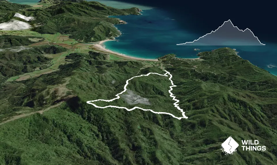
Matamataharakeke, Waikawau BayIntermediate
Submitted by Reesh Casey
Intermediate
1:15 (Slow)
0:55 (Moderate)
0:35 (Fast)
-12.9%
+10.9%
Fastest Known Times (FKTs)
Please set your gender to see your position on the FKT leaderboards.
Men
Women
Filter FKTs
The more , the harder the FKT will be to beat. Learn about Fastest Known Times.
Description
Well marked trail. Usually run clockwise. Starts with a gentle climb and a number of small stream crossings and then gets steeper. Turns right (west) to follow a steeply undulating ridge until you get to the highest point, then turns right (north) down a number of stairs to follow an exposed ridge that drops back down to the valley. There's a nice little swimming hole about 100m before the end of the track on your right.
Trail Community
Features of interest
Make Up of Run
Technical Single Track: 100%
Route Data
Reviews:
Photos:
Your Trail Wishlist
All the runs that are on your To Do list (no limit).
Add to wishlist view wishlistWild Explorers
I did it!-
Access
Track starts at southern most paddock of the DOC camp ground. It is clearly marked.
Parking is plenty full and safe
28 km
46 minutes
No
No
-
Staying Safe
Easy.
Very patchy.
Personal Locator Beacon (PLB), Whistle, First aid kit, Cellphone.
Campsite has 'boil first' water
Some steep clay slopes may be difficult after rain
Some steep slopes, don't fall
-
Post run indulgence
Waikawau Bay shop
DOC campground
Only open during the summer and expensive, but its the only shop within about 20km -
Sponsor this trail
See other runs nearby:
Kaipawa Trig
Port Jackson - Wharekaiatua Pa
Castle Rock
Kauri Block and Harray Trails