Last Updated: 3rd Jan 2025
Kaipawa Trig
Last Updated: 3rd Jan 2025
Open
Grunt Factor: 13 ?
Gnarl Factor: 53 ?
6.6km
360m
360m
586m
Last Updated: 3rd Jan 2025
Last Updated: 3rd Jan 2025
Open
Grunt Factor: 13 ?
Gnarl Factor: 53 ?
6.6km
360m
360m
586m
Front country - easily accessible
Out and Back
Undulating, some big hills
Native bush
Easy Single Track
Moderate Single Track
Technical Single Track
Average Uphill Gradient: +15.10%
Average Downhill Gradient: -15.10%
VIP Feature: Send this route to your Garmin account so you can follow the course on your Garmin device.
Become a VIP Member to see the trailhead information.
1:30
Slow
1:10
Moderate
0:45
Fast
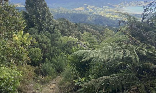
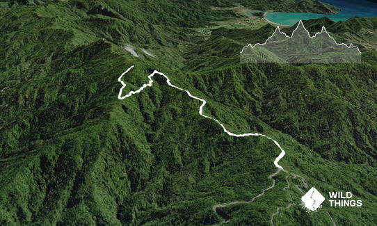
Follow the signposted track up towards the trig. You will follow this track for about 2km until you reach a gate. You will see a sign indicating the direction towards the Trig on your left (don't go past gate as it goes no where). Follow this track and it will take you around the hill side giving you some amazing views and then a steep climb for the final section to the trig.
Return the way you came.
This trail includes the peak Kaipawa.
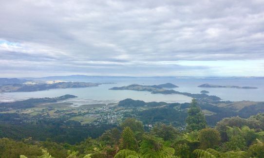
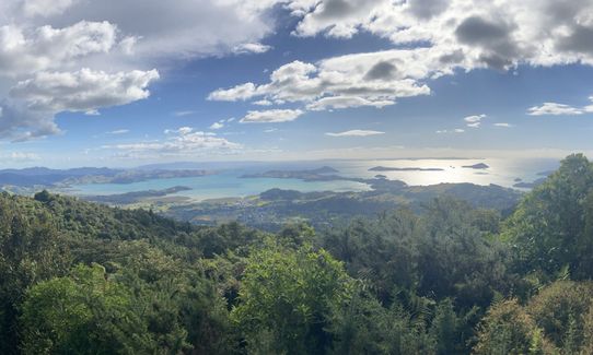
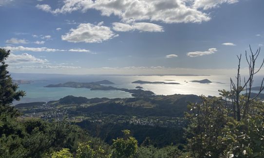
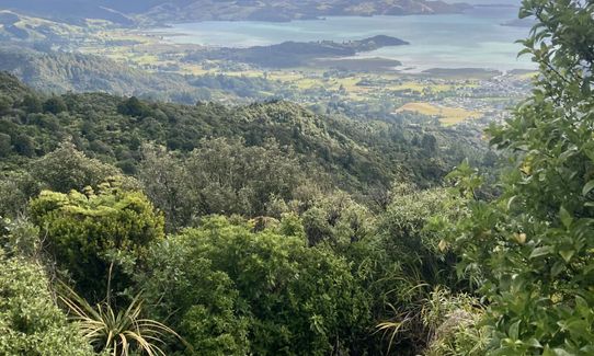
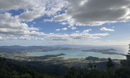
Beautiful native bush with amazing views of Coromandel township and all the way to Auckland (I could see the Sky Tower). Some mine shafts can be seen alongside the track too.
If you know of any public toilets near the trail start or on the route, please login and then let us know so we can update this section.
Small amount of parking on the side of road.
5 km
7 minutes
No
No
Moderate.
Just keep an eye out for the orange track markers
Generally good.
Long-sleeved thermal top, Seam-sealed waterproof jacket, Gloves, Beanie/thermal headwear, Whistle, First aid kit, Extra food for emergencies, Survival blanket, Cellphone, Map
None
While I was there the track condition was excellent, but I could image it would get very muddy after rain. The clay slopes would get very slippy.
Keep to track at all times and do not be tempered to go look into a mine shaft!
Do you have a suggestion on where to go afterwards for the best coffee / cake / breakfast / brunch / beer?
Fastest Known Times (FKTs)
You and Kaipawa Trig
As a VIP member you can record private notes for this trail, see all of your times and more.
Already have an account? Login now
There is a lookout at the trailhead which is a popular spot for cars to stop, limiting carparking during the summer season especially. Most are only there a few minutes so they do tend to turn over fairly quickly.
The trail itself has mossy rocks and clay in the first 2km which can be slippery at times. As you sidle around the hillside there are two slips - one small and one quite large, which have a well-formed path across them. The last 500m from the junction to the trig was quite overgrown, lots of gorse nipping at the ankles. No views at the trig itself, but pleny during that final ascent.
January 5, 2025
Nice little trail. Even after all the recent rain it wasn't too slippery. There is one mudslide over the trail but path both below and above to get through. I recommend the upper path.
Beautiful views help distract from the final steep climb to the trig.
September 8, 2020
Send to your phone
Scan the below QR code to open this trail on your phone.

Tip: position the QR code in your phone camera screen.
Plan smarter, stay motivated, track your progress, and unlock the full Wild Things experience — while saving along the way.


