Last Updated: 18th Jan 2025
Kaituna Track Wilderness Experience
Last Updated: 18th Jan 2025
Grunt Factor: 36 ?
Gnarl Factor: 61 ?
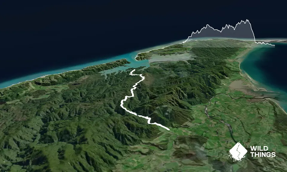
17.0km
720m
760m
460m
Trail Map
This Topo layer only covers NSW/ACT.
Switch to another map layer when viewing outside this area.
Switch to another map layer when viewing outside this area.


