Last Updated: 30th Jan 2025
Heaphy East to West
Last Updated: 30th Jan 2025
Open
Grunt Factor: 88 ?
Gnarl Factor: 19 ?
78.4km
1620m
1725m
931m


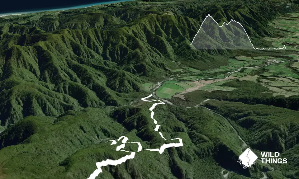
Trail Map
This Topo layer only covers NSW/ACT.
Switch to another map layer when viewing outside this area.
Switch to another map layer when viewing outside this area.


