Last Updated: 24th Dec 2023
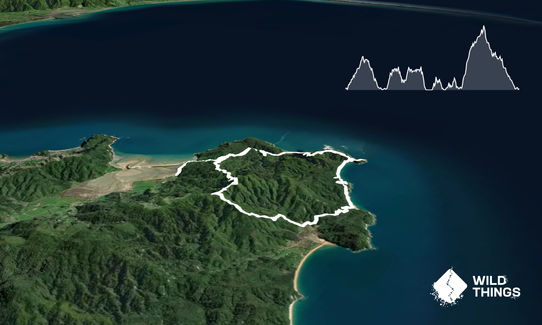
Separation Point Loop
Last Updated: 24th Dec 2023
Grunt Factor: 35 ?
Gnarl Factor: 29 ?
26.5km
1070m
1070m
390m


Last Updated: 24th Dec 2023
Last Updated: 24th Dec 2023
Grunt Factor: 35 ?
Gnarl Factor: 29 ?
26.5km
1070m
1070m
390m
Front country - easily accessible
Loop
Very hilly
Native bush
Beach
Coastal
Easy Single Track
Moderate Single Track
Average Uphill Gradient: +8.9%
Average Downhill Gradient: -8.9%
VIP Feature: Send this route to your Garmin account so you can follow the course on your Garmin device.
Login as a VIP to see the trailhead information.
4:00
Slow
3:15
Moderate
2:30
Fast
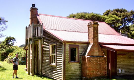
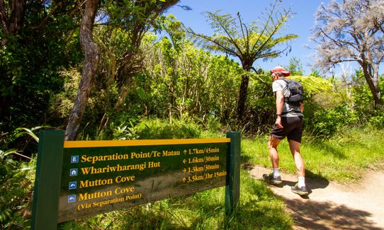
From the car park take the Inland Track towards Whariwharangi Hut. This takes you pretty much into a well-graded 200m climb over about 2 kms. At the saddle continue straight on and enjoy the beautiful downhill to one of the nicest huts in the country, Whariwharangi (well worth a stop to take a look).
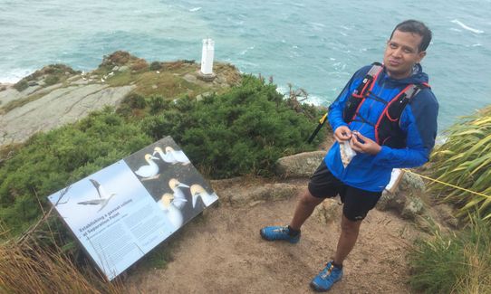
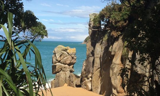
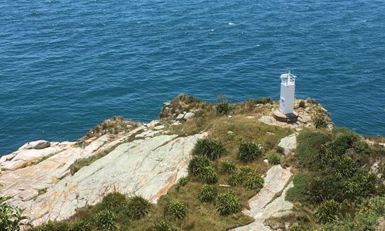
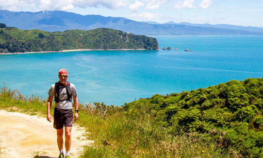
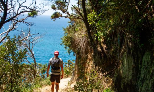
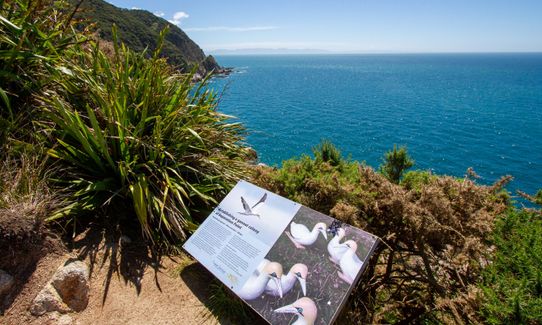
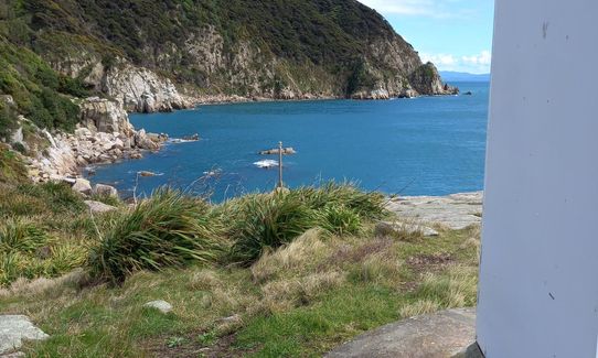
The trail follows the coast for a short way before climbing again to another low saddle. Here you turn left on to Separation Point Track and follow it all the way out to the spectacular headland that overlooks the Tasman Sea.
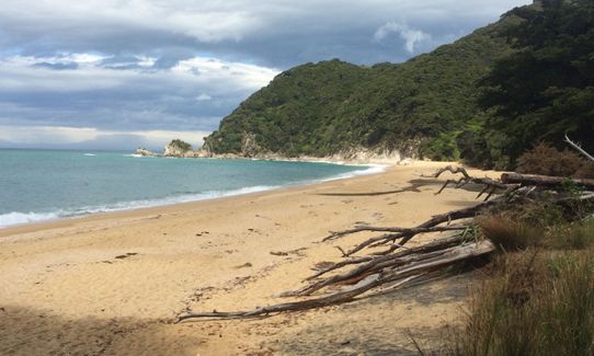
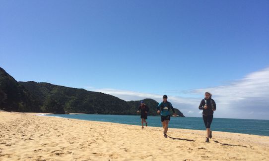
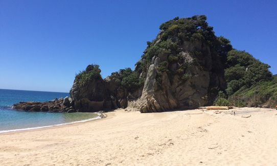
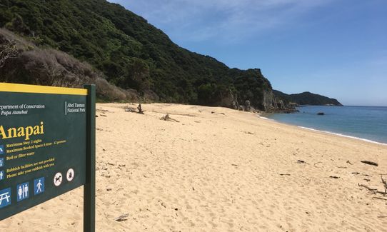
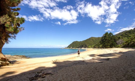
Back track a short way, then turn left to drop to Mutton Cove, then up and over to glorious Anapai Bay. Take to the beach here and follow it to the far end where you pick up the track towards Totaranui.
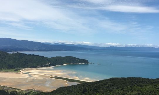
You now have another well-graded ascent and descent. At the bottom of the hill, ignore signs to Totaranui (unless you want a side trip) and instead turn right on to Gibbs Track. Over the next 3-4 kms this climbs 400m to just under Gibbs Hill before starting the rolling descent back to the first saddle and the junction with the Inland Track. Turn left and enjoy a final downhill blast to return to your car.
This trail includes the peak Gibbs Hill.
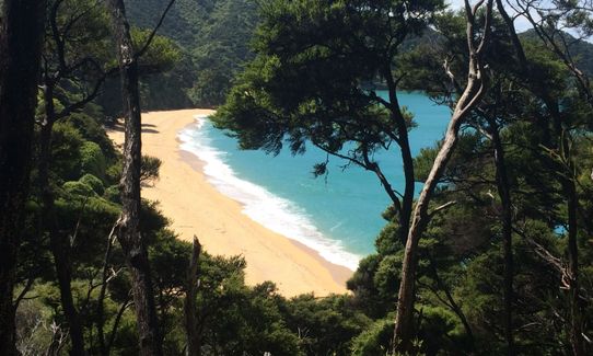
Separation Point is home to gannets and is a spectacular spot in its own right. The run includes some beautiful sections of bush and golden sand beaches. This is the relatively quiet, less travelled end of the world famous Abel Tasman Coastal Track.
If you know of any public toilets near the trail start or on the route, please login and then let us know so we can update this section.
Plenty of parking with toilets, information board and a day shelter. Take the usual precautions with valuables.
25 km
34 minutes
Unknown
No
Moderate.
Well signposted for the most part but worth keeping an eye on the map and signs.
Very patchy.
Short-sleeved thermal top, Seam-sealed waterproof jacket, Whistle, First aid kit, Extra food for emergencies, Survival bag, Cellphone, Map
The hut has drinking water but other than this there is little reliable water along the route. Worth carrying a couple of litres in a bladder or bottles.
This area of the country has a relatively mild climate and winter is much quieter on the trails than summer. That said it can get pretty muddy after heavy rain.
Nothing specific.
Fastest Known Times (FKTs)
You and Separation Point Loop
As a VIP member you can record private notes for this trail, see all of your times and more.
Already have an account? Login now
The best of the Totaranui loops I think. Doc has been applying mouth to mouth to the trails post flood! With some minor landscape changes along the beach sections if you want to keep your feet 100% dry then maybe avoid peak of high tide.
September 14, 2022
Great day out. All views and stunning beaches. Trails are very easy with gentle rolling hills. A bit of a slog up Gibbs Hill but well worth it at the top. A fantastic down hill run from the top of Gibbs Hill back to Wainui carpark with amazing views all the way down.
November 30, 2020
SP
This is a great part of the Abel Tasman, slightly less people but still beautiful beaches. Gibbs section is hot and steep
April 27, 2020
I ran this starting at Totaranui where I was camping so was able to start with the big hike up Gibbs Hill for the fabulous views then enjoy the rest of the undulating course. I made sure to enjoy the journey and stop and enjoy the fabulous beaches it took me through. Great holiday run.
January 12, 2020
These overlap with this trail to some degree. You may wish to combine them but please note that to qualify for FKTs on these runs you should record a separate activity for each.
Send to your phone
Scan the below QR code to open this trail on your phone.

Tip: position the QR code in your phone camera screen.


