Last Updated: 4th Jan 2025
Parapara Peak
Last Updated: 4th Jan 2025
Open
Grunt Factor: 40 ?
Gnarl Factor: 71 ?
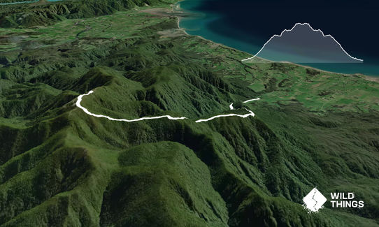
18.0km
1290m
1290m
1240m
Last Updated: 4th Jan 2025
Last Updated: 4th Jan 2025
Open
Grunt Factor: 40 ?
Gnarl Factor: 71 ?
18.0km
1290m
1290m
1240m
Front country - easily accessible
Out and Back
Mountainous
Native bush
Open ridges/tops
Easy Single Track
Moderate Single Track
Technical Single Track
Average Uphill Gradient: +17.5%
Average Downhill Gradient: -17.5%
VIP Feature: Send this route to your Garmin account so you can follow the course on your Garmin device.
Login as a VIP to see the trailhead information.
4:00
Slow
2:30
Moderate
1:45
Fast
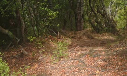
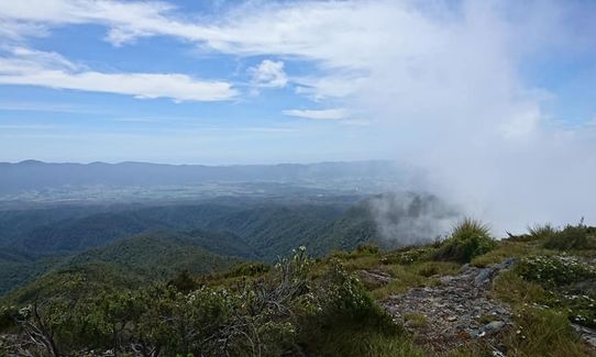
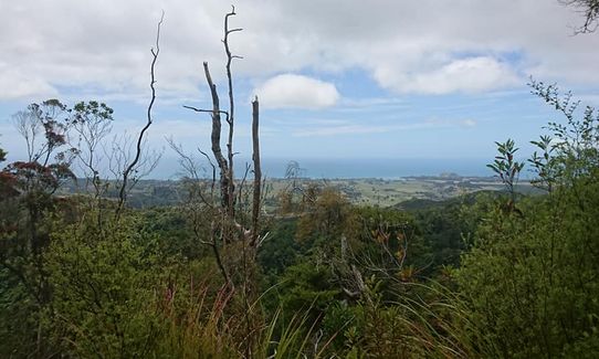
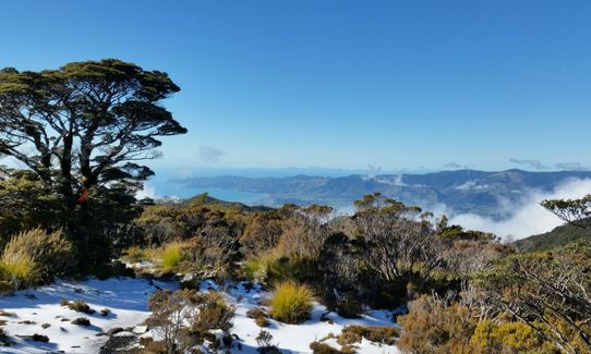
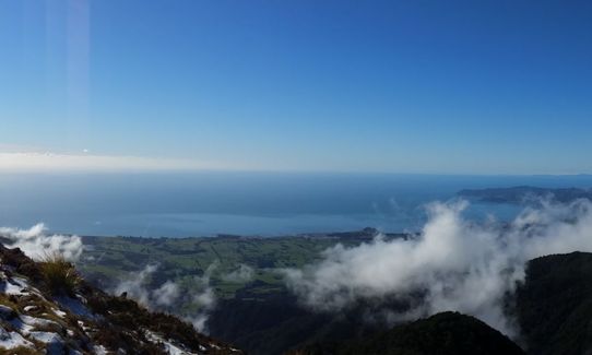
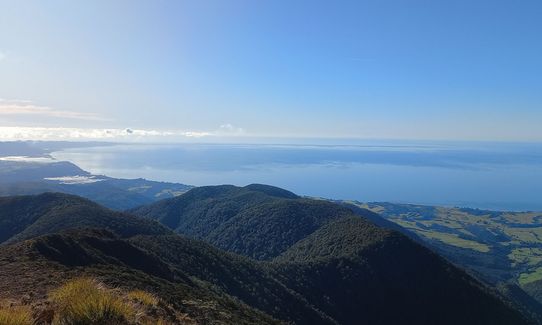
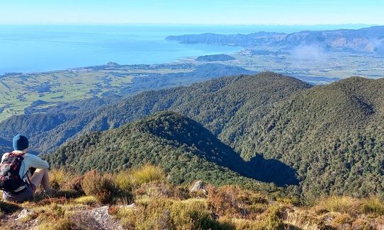
Cross the river( feet will get wet) and follow the well marked track beside the river. There are quite a few slips that have taken out portions of the track as you meander your way beside/boulder hopping up the river (keep a look out for cairns to mark the trail.) The track will break from the river at approx 2km and you'll start heading up the hill on a nice easy track. Keep following this and you'll come across a few good areas for pictures out over the bay.
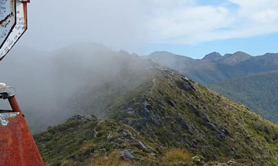
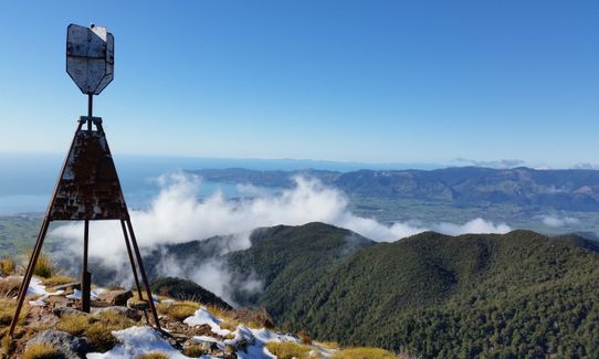
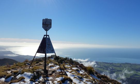
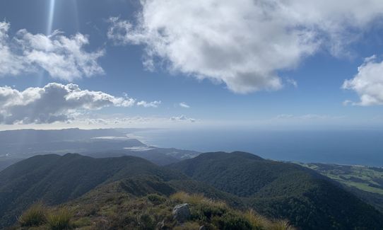
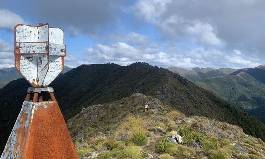
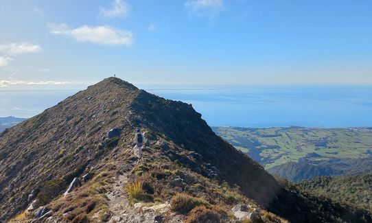
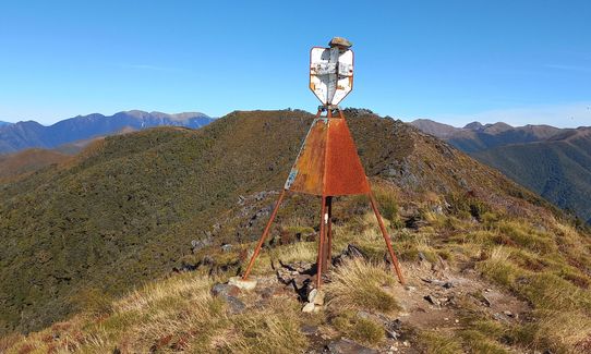
The track will start to become a lot more rugged as you progress upwards, sometimes requiring to be on all fours to scramble up the track as it becomes extremely steep and other times you'll have to navigate small outcroppings of rock. A small sign on a tree saying "Pare para peak track" marks approx halfway point. Once you break through the treeline it'll be sharp rock and scree to the to. Look to your right and you'll see the trig along the ridgeline the marks the end of the track. Be extremely careful on the way down as the track is covered in slippery roots and rocks which you will have to navigate and steep areas to climb down.
This trail includes the peak Parapara Peak.
River crossing marks the start of the track. Trig station marks the end of the track.
If you know of any public toilets near the trail start or on the route, please login and then let us know so we can update this section.
Parking space is available
12 km
14 minutes
No
No
Moderate.
Non-existent.
Thermal leggings, Long-sleeved thermal top, Seam-sealed waterproof jacket, Gloves, Beanie/thermal headwear, Whistle, First aid kit, Extra food for emergencies, Survival bag, Cellphone, Map, Gaiters
River at the start, unknown of potable (good for a swim though once finished)
Very exposed at the top
Once of the scariest downhills I have done, so many roots and hidden rocks.
Trail Legend
Login as a VIP to become a Trail Legend. Learn about Trail Legends.
Fastest Known Times (FKTs)
You and Parapara Peak
As a VIP member you can record private notes for this trail, see all of your times and more.
Already have an account? Login now
Love this trail. Steeper than you might think and total vert closer to 1500m (confining terrain where the GPX struggles). Also no water after the first half an hour.
October 30, 2023
Beautiful views from the trig point! Lucky to do it when it was on the drier side as otherwise could imagine it being a bit treacherous.
June 13, 2023
Tough but a really good trail. Loved the views and the geology. Filled our water up at the bivvy to the left of the track before the trig.
January 1, 2020
Send to your phone
Scan the below QR code to open this trail on your phone.

Tip: position the QR code in your phone camera screen.


