Last Updated: 30th Jan 2025
Heaphy East to West
Submitted by Steve Beatson
Last Updated: 30th Jan 2025
Open
Grunt Factor: 88 ?
Gnarl Factor: 19 ?
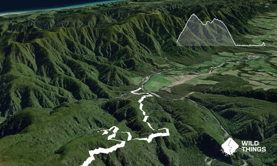
78.4km
1620m
1725m
931m
Last Updated: 30th Jan 2025
Submitted by Steve Beatson
Last Updated: 30th Jan 2025
Open
Grunt Factor: 88 ?
Gnarl Factor: 19 ?
78.4km
1620m
1725m
931m
Back country - remote
Point to Point (one way)
Undulating, some big hills
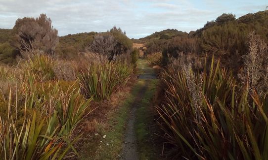
Native bush
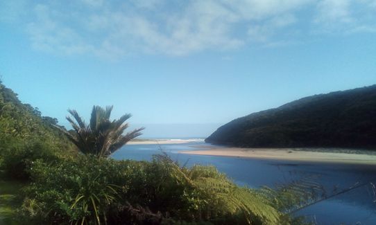
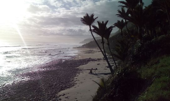
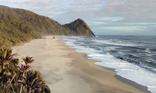
Coastal
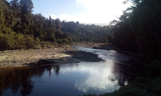
Riverside
Open tussock/grasslands
Easy Single Track
Moderate Single Track
Average Uphill Gradient: +4.7%
Average Downhill Gradient: -4.8%
VIP Feature: Send this route to your Garmin account so you can follow the course on your Garmin device.
Login as a VIP to see the trailhead information.
Not suitable
Slow
12.00:00
Moderate
8.00
Fast
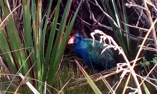
Well signposted, track fairly easy going overall, a bit stony in places but nothing tricky. Coastal and boggy parts can get flooded after big rains, prone to mist / fog through the mountain section between Perry Saddle and Mackay huts. All big and medium rivers / streams are bridged, no need to carry much water since streams are everywhere (and sandflies!). Huts or shelters are 7 - 14 km apart, but overnight stays need to be booked with DOC (as per Great Walk). Don't forget your rain gear, this is the West Coast! Keep eyes peeled for takahe!
Great variety makes things interesting: beech forest, tussock downs, temperate rainforest with nikau etc, wild West Coast beaches. Good chance of seeing takahe. Kiwi to hear and, if lucky, see at night,
If you know of any public toilets near the trail start or on the route, please login and then let us know so we can update this section.
Plenty of car parking at each end, which are 450km apart! Arranging a car swap or one of several car relocation services are options. Is a bus from Takaka to start of track and also options to fly back to the start.
37 km
34 minutes
No
No
Easy.
Well signposted along the entire length.
Non-existent.
Waterproof leggings, Thermal leggings, Lightweight fleece top, Short-sleeved thermal top, Long-sleeved thermal top, Seam-sealed waterproof jacket, Gloves, Beanie/thermal headwear, Personal Locator Beacon (PLB), Whistle, First aid kit, Extra food for emergencies, Survival blanket, Cellphone, Map, Headtorch and spare batteries
Plenty of water - huts / shelters approx 7 - 14 km apart. Plus plenty of streams.
It is the West Coast, so can get very wet at any time of the year. Can snow in winter.
DOC advise that sections Saxon Hut to James Mackay Hut can be affected by heavy rain, a section from Lewis Hut to Heaphy Hut (following the Heaphy River) can flood during heavy rain and big tides, and that sections from Heaphy Hut to Kohaihai road end can be affected by high tides.
Vinnie's Cafe
Karamea
https://www.facebook.com/pages/category/Caterer/Vinnies-cafe-1311568395570289/
Laid back friendly place for a coffee and cooked breakfast while talking about the previous day's adventures on the Heaphy. Is a bit hard to spot, but located next to the Four Square .
Riverstone Motels
Karamea - just across the bridge out of town to the south.
https://riverstonekaramea.co.nz/
Open air spa pool to soak in after the big day on the track.
Modern accommodation and great hosts.
Trail Legend
Login as a VIP to become a Trail Legend. Learn about Trail Legends.
Fastest Known Times (FKTs)
You and Heaphy East to West
As a VIP member you can record private notes for this trail, see all of your times and more.
Already have an account? Login now
Send to your phone
Scan the below QR code to open this trail on your phone.

Tip: position the QR code in your phone camera screen.


