Last Updated: 11th Mar 2024

Intermediate

Save Trail Save

I've done it Done

Timaru Creek Loop

Lake Hawea, Otago

Submitted by Ben Wallbank

Last Updated: 11th Mar 2024

Intermediate

Save Trail Save

I've done it Done

Open

Grunt Factor: 24 ?

Gnarl Factor: 65 ?

12.5km

650m

650m

760m


Login as a VIP to see driving directions, distance and time.

Trail Map

Type of Run

Front country - easily accessible

Loop

Undulating, some big hills

Native bush

Riverside

Run Makeup

10%
30%
40%
20%

Farm Road / 4WD Track

Easy Single Track

Technical Single Track

Untracked / Route only

Average Uphill Gradient: +15.2%

Average Downhill Gradient: -15.2%

Trailhead

Login as a VIP to see the trailhead information.

Estimated Times to Run

3:00

Slow

2:30

Moderate

1:45

Fast

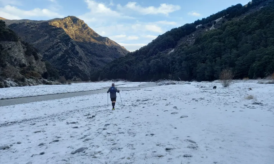
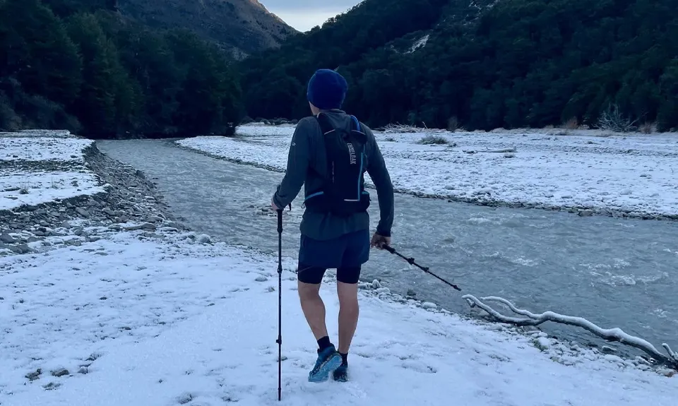
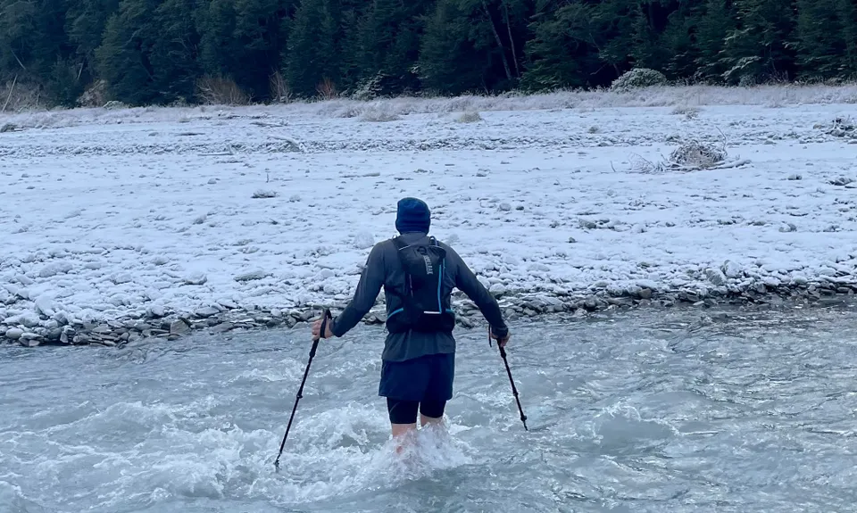
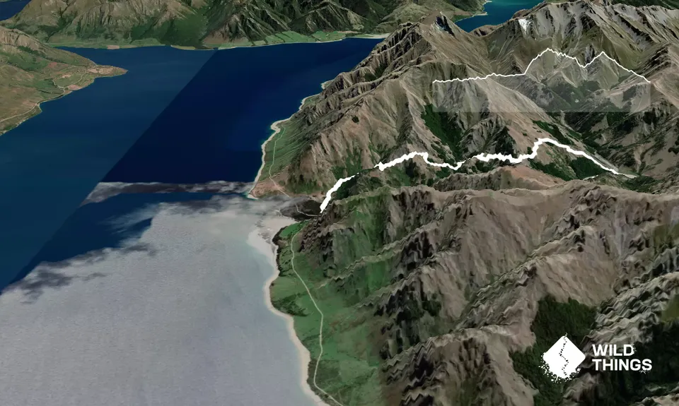
The best way to describe this is like a mini Goats Pass! It's awesome fun, and not without some bumps to get you working! The loop can be done in either direction. Clockwise has you doing the ascent first and wet feet int he second half. Anti-clockwise has river crossings first, and a steep grunt second half. Either way, you're going 'up' and getting wet. The Timaru River is STRONG! DO NOT ATTEMPT THE LOOP AFTER HEAVY RAIN! With no rain, you can expect some crossings to be around a meter deep, and it's flowing. If the river appears overly brown or completly chalky, don't do it.

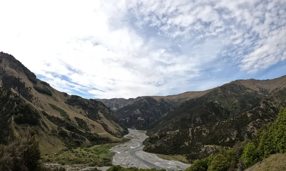
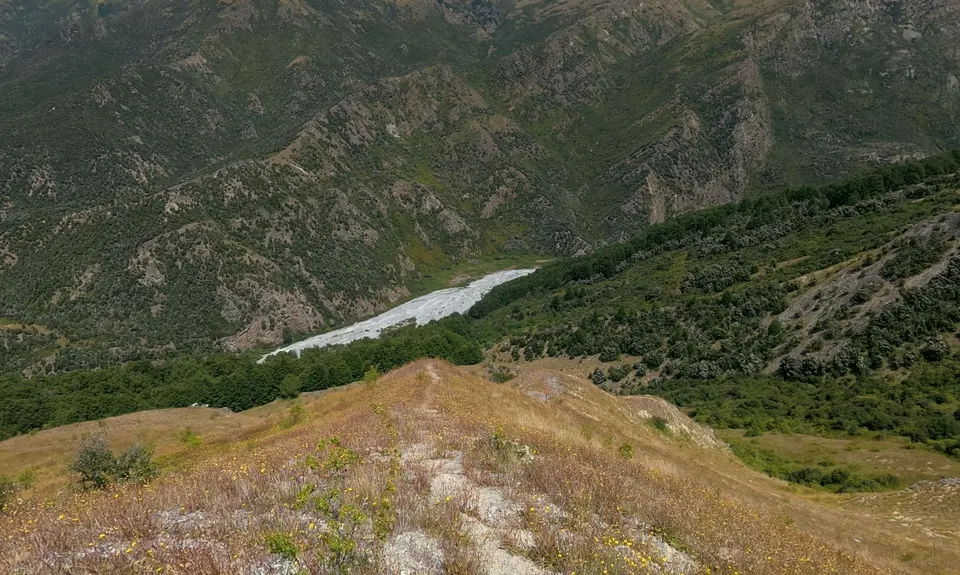
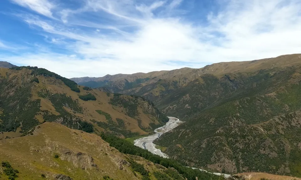
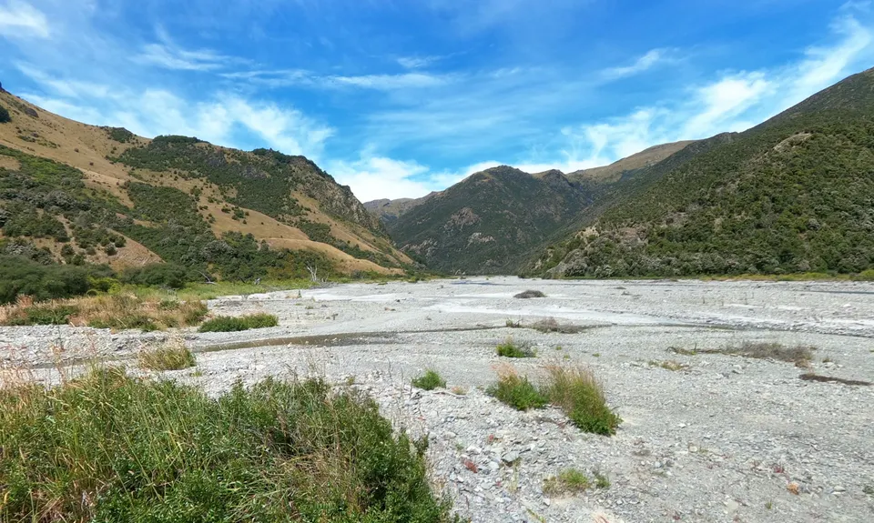
The high track (clockwise) is accessed over the bridge at the carpark, the track is on your right 50m up the gravel road. This is well marked and takes you past the Corner Peak track. Just keep going. At some point it might have been a farm track, but it's far too narrow now, with lots of rock hopping to be done. You'll descend this to a large braided part of the Timaru River. There are no marker poles from here. Basically, exit the bush and turn right, heading downstream.....a map/gps is a good idea for this one.

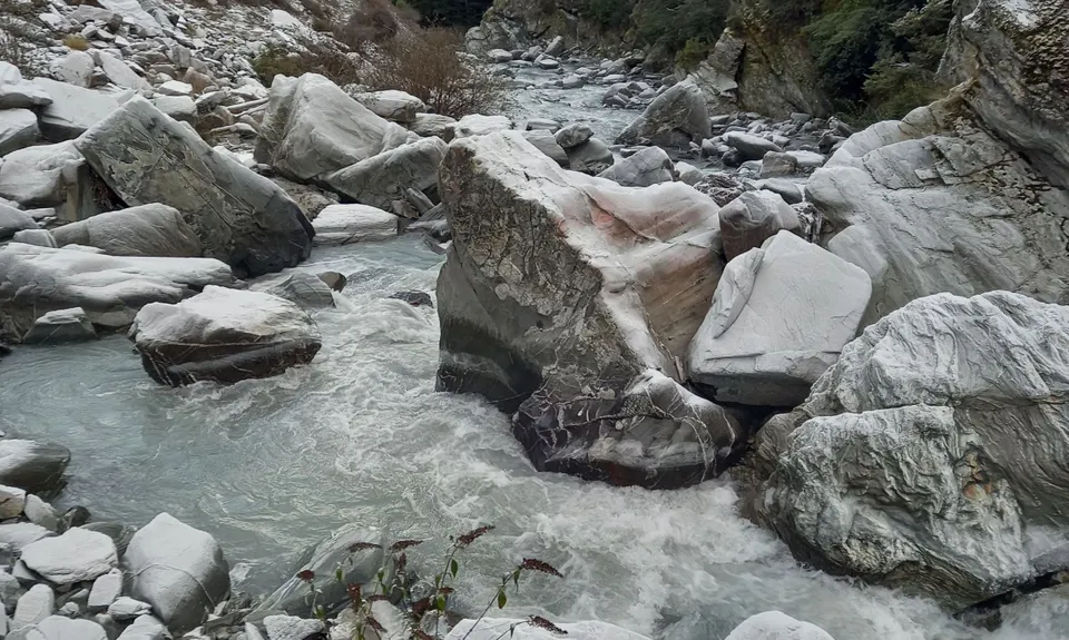
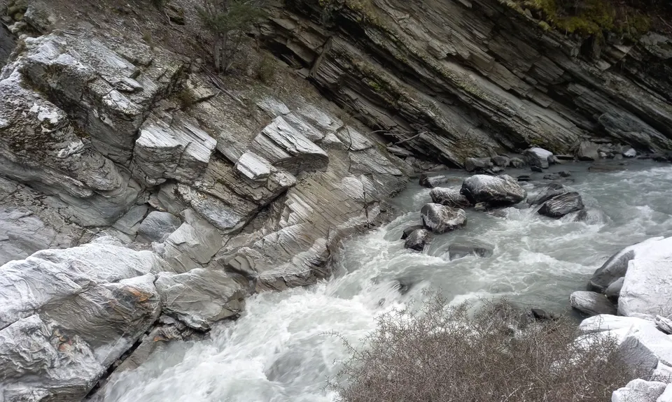
You go downstream for a couple of k's, picking your own lines. The track will begin again on the true left of the river. There is an orange marker on a pole. From here is it gets seriously fun!! Follow the route, scramble over boulders, pick your lines. There are several river crossings now to get back to the car park. Going in this direction is actually easier to see the markers. Doing the anti-clockwise route actually poses some difficulty as the poles aren't that visible until you're almost on them. Either way, enjoy it, be just be aware of the depth and flow. We can't emphasise just how misleading the strength of this relatively small river is. Back to the car park for a dip in the river just up stream from the bridge.

6 km

11 minutes

Unknown

No

Moderate.

Non-existent.

Short-sleeved thermal top, Windproof jacket, Personal Locator Beacon (PLB), Whistle, First aid kit, Extra food for emergencies, Survival blanket, Cellphone, Map, Gaiters

The river 'should' be fine, but treatment tablets are generally a good idea.

Not after rain.

River River River!

Trail Legend

AE

Adam Eason

has completed Timaru Creek Loop once in the last year.

Learn about Trail Legends.

You and Timaru Creek Loop

As a VIP member you can record private notes for this trail, see all of your times and more.

Register Now

Already have an account? Login now

Trail Reviews

Epic loop trail close to Wānaka. This loop is a fun adventure with a lot of variety. Epic views, single goat track, rock scrambling and river crossings. It's definately not boring and we saw no one, even on a beaut day during the busy season! We did this trail clockwise to get the mountain climb done first, thinking the river trail would be easy and fast. By the time you start walking the river trail, it's only 4km back to the carpark but it's not fast at all with lots of boulder climbing and river crossings. Also, the bits of trail around the river are very over grown. I would recommend wearing long socks as there are lots of spiky bushes such as matagouri.

Tracy Elley

March 10

Epic run with sweeping views over the lake and the Hawea conservation area. Don’t let the views fool you though this is a mission. Good, tough climbing with technicality thrown in and about 15 river crossings. Avoid after rains or on hit days as there is minimal to no shelter.

Sam Brown

January 9, 2022

A lot of winter snow melt clearly happening right now and the crossings are challenging. Beaut of a day still though.

Ben Wallbank

July 31, 2021

Loved this trail but more of a summer run.
Plenty of river crossing and not much sun.
Can't wait to try again when its warmer!!!

Adam Clifford

July 11, 2021

Login to submit a review

Trail Running Community

Find people who are interested in or have completed this trail run.

You must register or login to view this feature.

Register Now

Overlapping Trails

These overlap with this trail to some degree. You may wish to combine them but please note that to qualify for FKTs on these runs you should record a separate activity for each.

Dingle & Corner

Dingle & Corner

Length: 28.5km

Level: Experienced

Other trails nearby
Silver Island

Silver Island

Length: 15.5km

Level: Beginner

Big Breast Loop

Big Breast Loop

Length: 38.0km

Level: Beginner - Intermediate

Timaru High River Track

Timaru High River Track

Length: 13.6km

Level: Beginner - Intermediate

Isthmus Peak and Glen Dene Ridge

Isthmus Peak and Glen Dene Ridge

Length: 36.7km

Level: Beginner - Intermediate

Find more trails and peaks nearby