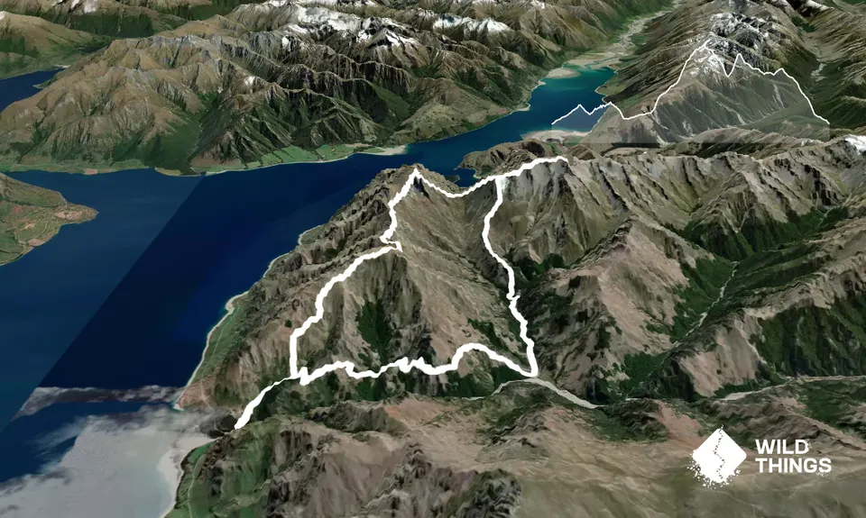
Start on the gravel road, over the bridge and up the hill. In a very short distance (less than 100m) you'll see the DoC track heading into the bush on your right - take this and enjoy a gradual uphill section through lovely kanuka regrowth forest.
This soon joins up with a 4WD track that becomes the Timaru High River Track. Follow this, ignoring the track on your left to Corner Peak (this is your way down) for some 5 or 6 kms. It's a bit of a rollercoaster that will eventually spit you out on to the scrubby flats of Deer Spur Creek (you should be able to see Junction Hut on the far side).
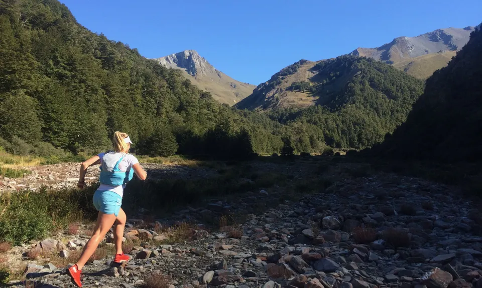
Make your own way (there are no poles or route markers) up the creek in a northerly direction. In around a km you'll come to a pinch where the bush closes in and you need to scramble upstream over fallen trees and some large rocks. Stay in or close to the river bed and you can't go wrong. You'll be glad of those Moxie gaiters as you battle up here!
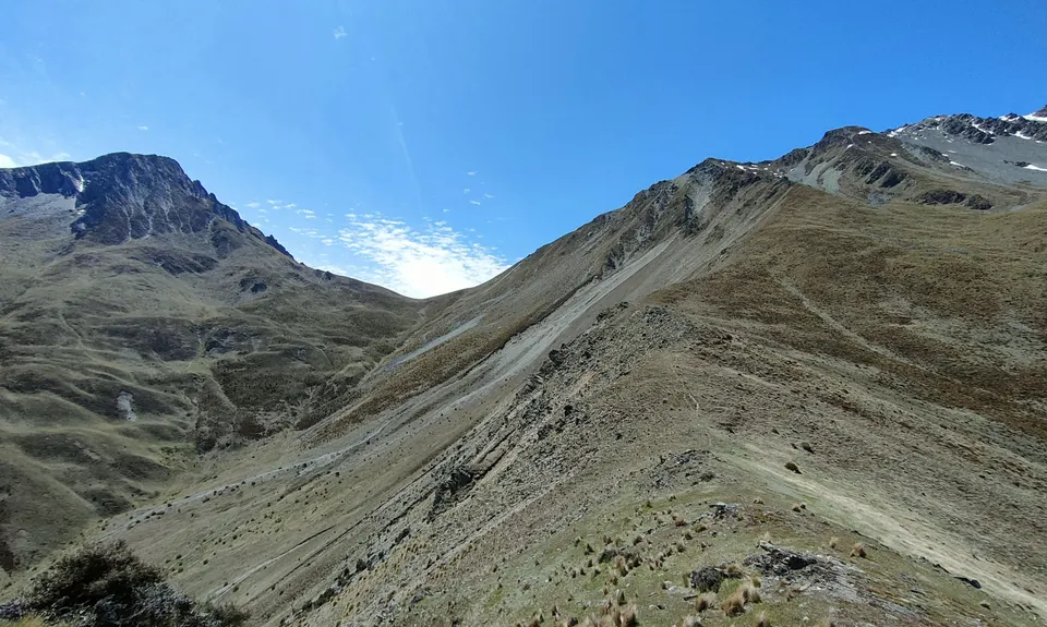
Once you emerge from this section the valley opens out again and offers clearer travel on the true right of the stream to a stream junction. Crossing here, stay on the true right of the more easterly branch. There are still no marker poles so take care getting this right. After another few hundred metres (you'll now have about 10k total on your watch) you need to fill up on water from the stream - this is your last chance, don't miss out. Looking to your left (west) you'll see the toe end of the bush-clad Deer Creek Spur. There's no trail but the bush is reasonably open (other than some scrubby bits at the very bottom) and you can make the crest of the ridge via a short, steep climb.
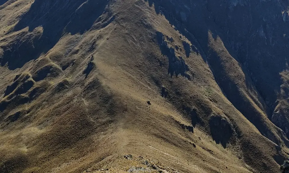
Once you hit the crest of the spur just keep following it uphill (north), sticking as close to the ridge as possible. It requires a little light bush bashing and working around obstacles, but nothing too bad. Eventually you'll get above the bushline and can start drinking in the amazing views. Continue over Pt 1070 (you might actually get some running along here) before the spur steepens and then steepens some more as you work your way towards the main west ridge of Dingle Peak.
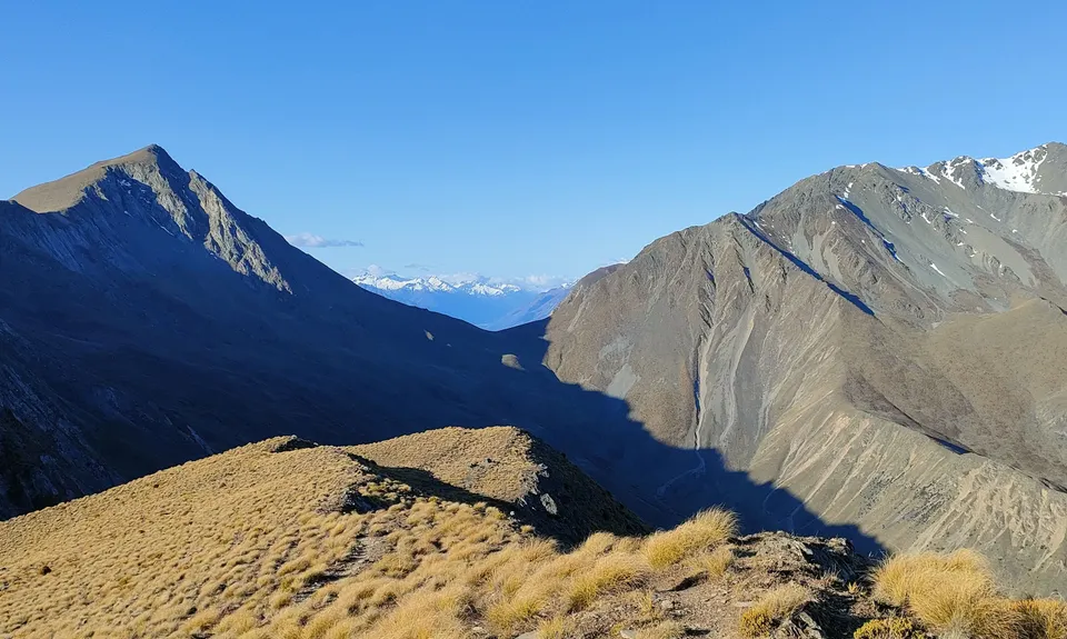
On making the main ridge head right (east) sticking to the ridgeline or just to the north of it. It's easier than it looks from below and finishes with a really mellow shallow scree field that takes you pretty much all the way to the summit of Dingle Peak. Drink in the incredible views and fuel up - you still have a long way to go!
Retracing your steps back down the ridge you'll pass the spot where you joined it on your way up and then start tackling a steep, gnarly section that eventually runs out into the saddle between the day's two peaks. There are still no marker poles so find your own route, picking your way carefully over loose, broken rock.
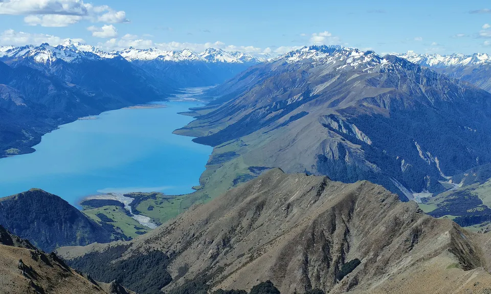
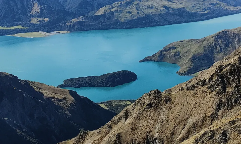
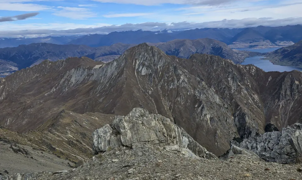
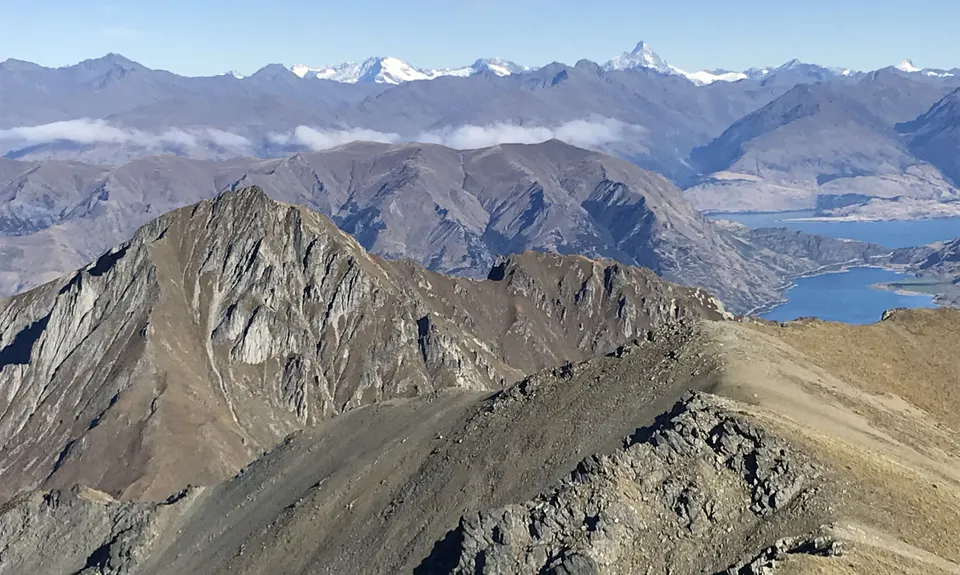
From the saddle you keep heading pretty much due west up ever-steepening slopes that eventually become a steep gully leading to the southern ridge of Corner Peak just below the summit. This is a real grunt and can be stinking hot work in summer. Once on top head right (north) up the last wee bit of hill and you'll soon be rejoicing in some of the finest mountain and lake views anywhere on the planet. Corner Peak is amazing!
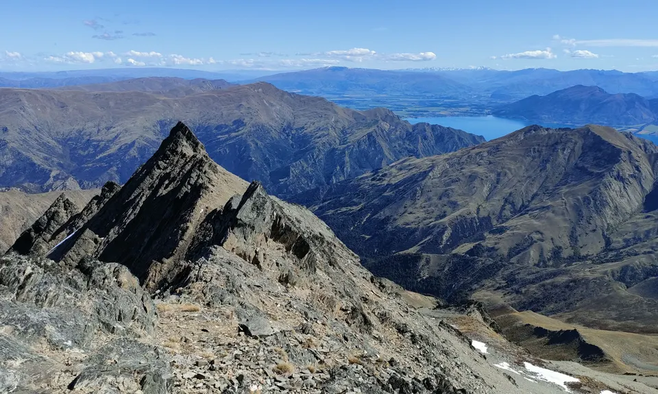
From the summit head down the southern ridge (still no poles) to a very shallow saddle and then start the traverse to the east of the gnarly ridgeline (do NOT be tempted to stick to the ridge - it gets very scary further along!). There's a faintly worn trail and cairns marking the way through the scrub. Keep a sharp eye out for the cairns as they are your best friend for winding your way through this to the safe haven of the poled route down.
The final 7kms of your epic outing are mostly runnable following the poles that mark the DoC Corner Peak Route. There are plenty of gnarly sections, including a couple that need a wee scramble and a head for heights, but nothing too dramatic - the mountain goats will manage to run it all!
Towards the bottom of the single track poled route the gradient gets pretty steep and your quads will be cursing you. But then you re-meet the 4WD track that you started out on. Turn right and follow this back into the kanuka, out to the road and turn left back to the car.
The river provides a great place to cool off if it's a hot summer's day.
.jpeg)
.jpeg)
.jpeg)
.jpeg)
.jpeg)
.jpeg)