Last Updated: 24th Sep 2023

Beginner - Intermediate

Save Trail Save

I've done it Done

Parihaka Hatea Loop

Whangarei, Northland

Submitted by Dianne Zucchetto

Last Updated: 24th Sep 2023

Beginner - Intermediate

Save Trail Save

I've done it Done

Open

Grunt Factor: 14 ?

Gnarl Factor: 27 ?

13.5km

370m

370m

235m


Login as a VIP to see driving directions, distance and time.

Trail Map

Type of Run

Urban fringe

Loop

Undulating, small hills only

Native bush

Plantation/exotic forest

Riverside

Run Makeup

35%
5%
10%
45%
5%

Sealed Road

Gravel Road

Easy Single Track

Moderate Single Track

Technical Single Track

Average Uphill Gradient: +5.2%

Average Downhill Gradient: -6.4%

Trailhead

Login as a VIP to see the trailhead information.

Estimated Times to Run

2:30

Slow

1:45

Moderate

1:15

Fast

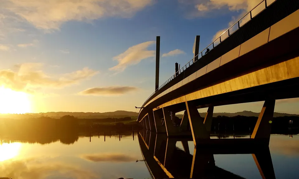
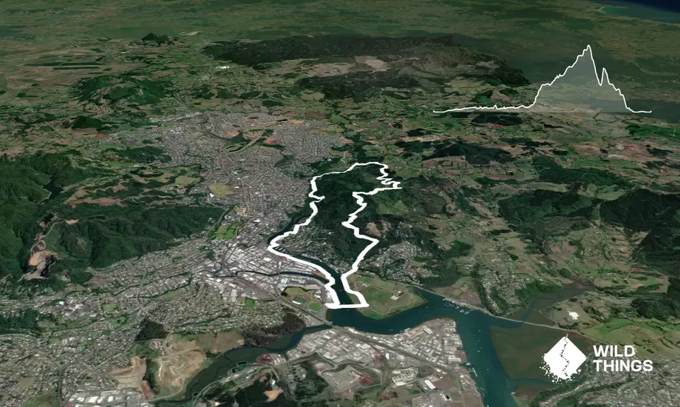
Starting at Te Matau a Pohe Bascule Bridge car park, head north (left) along the Hatea River toward the Town Basin. Cross Riverside Drive at the Canopy Bridge and follow the river past the indoor swimming pools. The path turns into a boardwalk through the mangroves before joining with Ewing Road.

Turn left onto Ewing Road, and follow to the end where there is a path and stairs on the right, connecting with Vale Road. Turn left at the top of the stairs and follow to the end of Vale Road to connect with the gravel path into the Parihaka Forest. At the end of the gravel path, turn right onto Whareora Road.

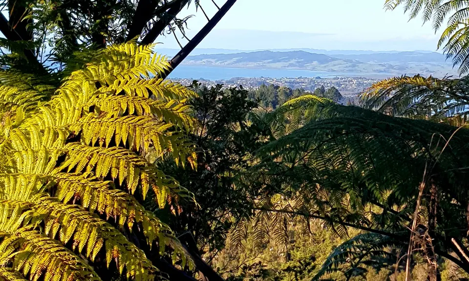
Follow Whareora Road to A H Reed Memorial Park. Opposite A H Reed Memorial Park is Goetzee Track. Follow Goetzee Track up to the mountain bike park and Spider Junction. Take care in the mountain bike park and do not enter the mountain bike tracks. Turn right at Spider Junction, following the gravel road uphill toward the summit of Mount Parihaka.

The gravel road connects with the top of Memorial Drive, follow the road and stairs to the summit. Take in the view and enjoy a breather before taking Ross Track on the left next to the lookout. Follow Ross Track down until you see Mackesy Bush track on the left. Head back uphill on Mackesy Bush track. This section of track has recently been upgraded with the installation of lots of stairs.

There are options to connect to Memorial Drive, but keep right to connect to Riverside Drive. Once on Riverside Drive, cross the road at the pedestrian crossing and continue straight ahead onto the Hatea Loop, past the BMX track and over the bascule bridge, back to the start.

This trail includes the peak Parihaka.

Incorporates the Hatea Loop - Huarahi o te Whai (Pathway of Opportunity), Whangarei Town Basin Marina, sculpture park, and heritage information. The Parihaka scenic reserve contains stands of Kauri. Mount Parihaka is a former pa site and is one of the most significant mountains for Maori in Northland.

Unlimited parking, including freedom camping. Close to public transport route as well.

4 km

6 minutes

Unknown

No

Easy.

GoetzeeTrack can be difficult to find, as the sign is often covered by long grass.
Take care also at the end of Goetzee Track, at Spider Junction. There are a few tracks going in different directions. Keep to the right and head uphill.

Perfect throughout.

Long-sleeved thermal top, Seam-sealed waterproof jacket, Whistle, First aid kit, Extra food for emergencies, Cellphone, Map

Plenty of water fountains along the Hatea Loop and at A H Reed Memorial Park. No water available in the Parihaka Reserve forest.

Goetzee gets very slippery and muddy after rain. The rest of the trails are all weather tracks. But take care in the wet on the downhill sections.

Take care along Goetzee Track and around the mountain bike park. Look out for mountain bikers.

Trail Legend

Raewyn Peters

Raewyn Peters

has completed Parihaka Hatea Loop once in the last year.

Learn about Trail Legends.

You and Parihaka Hatea Loop

As a VIP member you can record private notes for this trail, see all of your times and more.

Register Now

Already have an account? Login now

Trail Reviews

Great loop incorporating several of the tracks in Whangarei

Thomas Evans

May 9, 2021

Variety of running surfaces, mostly easy running magnificent views from top of Parihaka maunga

Denise Limby

June 8, 2020

Login to submit a review

Trail Running Community

Find people who are interested in or have completed this trail run.

You must register or login to view this feature.

Register Now

Overlapping Trails

These overlap with this trail to some degree. You may wish to combine them but please note that to qualify for FKTs on these runs you should record a separate activity for each.

Town Basin, Whangarei Falls & Parihaka

Town Basin, Whangarei Falls & Parihaka

Length: 15.8km

Level: Beginner - Intermediate

Other trails nearby
Hatea River Trail

Hatea River Trail

Length: 12.5km

Level: Beginner - Intermediate

Teal Bay, Te Araroa Trail Loop

Teal Bay, Te Araroa Trail Loop

Length: 17.1km

Level: Beginner - Intermediate

Taraire Ridge and Pukenui Loop

Taraire Ridge and Pukenui Loop

Length: 10.4km

Level: Beginner - Intermediate

3 Pigs Trail

3 Pigs Trail

Length: 21.0km

Level: Intermediate

Find more trails and peaks nearby