Last Updated: 15th Jan 2024

Beginner

Save Trail Save

I've done it Done

Mount Aubrey Loop

Whangarei, Northland

Submitted by Mike Tennent

Last Updated: 15th Jan 2024

Beginner

Save Trail Save

I've done it Done

Open

Grunt Factor: 8 ?

Gnarl Factor: 28 ?

6.2km

350m

350m

193m


Login as a VIP to see driving directions, distance and time.

Trail Map

Type of Run

Urban

Loop

Undulating, some big hills

Native bush

Coastal

Open ridges/tops

Run Makeup

20%
5%
55%
10%
10%

Sealed Road

Gravel Road

Easy Single Track

Moderate Single Track

Technical Single Track

Average Uphill Gradient: +11.4%

Average Downhill Gradient: -13.6%

Trailhead

Login as a VIP to see the trailhead information.

Estimated Times to Run

1:45

Slow

1:15

Moderate

0:50

Fast

Once parked run about 100 metres back the way you drove in and just as the road starts to rise there is a wooden staircase on the left... head in there.

In about 100m (of mainly climbing) you will come out onto a playground, head over that onto the street, head down the left looking for the Te Araroa Trail sign pointing to a walkway between house to the left. Follow this down then right across the front lawn of a house to the orange triangles you can see beckoning, then follow that trail to the road again.

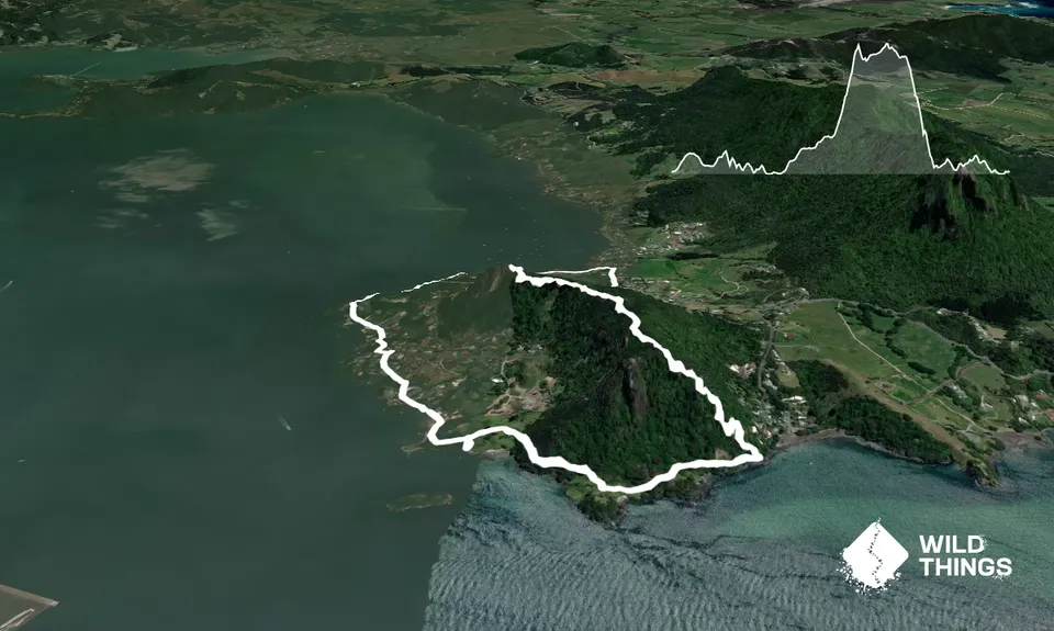
Follow this road and keep on it as it veers left. You will see multiple driveways at the end, but one semi-road has several signs ... ignore them and head up there and in about 100m you will reach the start of another trail - the Reotahi Walking track. Follow this along the coast. When it ends follow the road for about 500m until you see a grassy field on your right with another road above it.

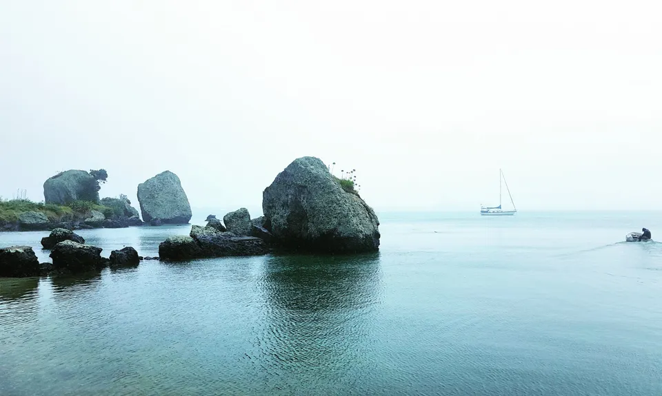
Cut across the field and up onto that road and turn right. Follow that up and turn right into Reotahi Rd again. Head up Reotahi Rd until you reach the signs on the left for Tiller Park. Head in there and onto the trail up and over Mt Aubrey. Lots of steps and a pretty straightforward trail. Several of the big rock formations have unofficial side trails up and on to them.I went part way up one but it got too slippery for me and I aborted... be very careful if you do go up.

Follow the main trail right along the top of the range and down the other side. At the bottom you will reach a cross trail, turn right and follow this to your car.

This trail includes the peak Mount Aubrey.

Some amazing shape and character coastal rock formations and some great views. And lots of steps!

Parking for a few vehicles.

29 km

33 minutes

Unknown

No

Moderate.

Take a copy of my map or ask the guys to put it on RunHunters. If you study my guide and have a map on your phone you should have no problem.

Generally good.

Seam-sealed waterproof jacket, Gloves, Beanie/thermal headwear, Whistle, First aid kit, Extra food for emergencies, Cellphone, Map

No fresh water

Could be a bit slippery, especially the down section after rain.

A few steep fall-offs to take care on, generally ok

Trail Legend

NG

Natalie Ganley

has completed Mount Aubrey Loop 3 times in the last year.

Learn about Trail Legends.

You and Mount Aubrey Loop

As a VIP member you can record private notes for this trail, see all of your times and more.

Register Now

Already have an account? Login now

Trail Reviews

Be the first to submit a review for Mount Aubrey Loop!

Login to submit a review

Trail Running Community

Find people who are interested in or have completed this trail run.

You must register or login to view this feature.

Register Now

Other trails nearby
Taraire Ridge and Pukenui Loop

Taraire Ridge and Pukenui Loop

Length: 10.4km

Level: Beginner - Intermediate

Old Coach

Old Coach

Length: 28.4km

Level: Beginner - Intermediate

1100 Steps to WOW!

1100 Steps to WOW!

Length: 3.7km

Level: Beginner

BDO Parihaka Trail Run

BDO Parihaka Trail Run

Length: 21.5km

Level: Beginner

Find more trails and peaks nearby