Last Updated: 21st Sep 2023
Tutira trig
Submitted by Lyn Stanton
Last Updated: 21st Sep 2023
Grunt Factor: 16 ?
Gnarl Factor: 49 ?
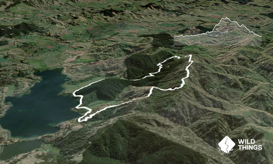
8.6km
395m
395m
490m
Last Updated: 21st Sep 2023
Submitted by Lyn Stanton
Last Updated: 21st Sep 2023
Grunt Factor: 16 ?
Gnarl Factor: 49 ?
8.6km
395m
395m
490m
Front country - easily accessible
Loop
Undulating, some big hills
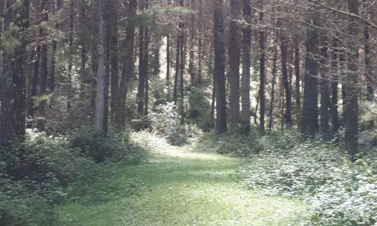
Native bush
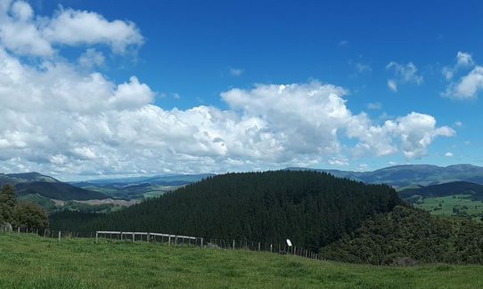
Plantation/exotic forest
Open farmlands
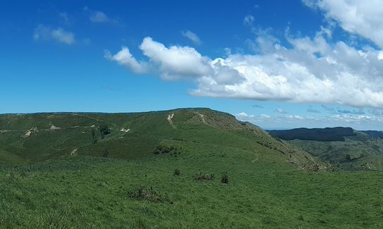
Open ridges/tops
Farm Road / 4WD Track
Easy Single Track
Untracked / Route only
Average Uphill Gradient: +12.3%
Average Downhill Gradient: -10.9%
VIP Feature: Send this route to your Garmin account so you can follow the course on your Garmin device.
Login as a VIP to see the trailhead information.
2:00
Slow
2:30
Moderate
1:00
Fast
This is a short but very satisfying run, excellent if you find yourself with a free half day in the Napier area. Could also satisfy walking members of party.
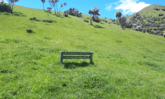
Starting from stile by gate at road end, take the left track at the immediate fork for a gentle 2k of easy grassy single track by the forest edge, cattle for company. Then on farm road. There are coloured posts to follow. Gradually climbs into forest and then to a junction where a walker can loop back to the start (4 easy km altogether). The blue signs are very confusing as the arrows don't seem to relate well to the actual tracks!
Ignore the 4wd track up the pine forest ridge and keep left on the grassier 4wd track for a gentler climb. This becomes very muddy in places and watch out for ongaonga (stinging nettle). Track undulates a bit winding up the hill keep following posts with orange tops. Around 4k emerge from forest and climb steeply up on a grassy track to a saddle with some great views. Better to come. There is a sign indicating a lower track or to continue to summit. Take the left route - the track is not obvious underfoot but if you look up you can see a couple of orange topped poles on the skyline - head for those, its quite a steep grassy scramble.
Awesome views as you reach the top ridgeline and then it is an obvious down and up to the trig itself. Time for selfie! All downhill now and will be very fast for the skilled downhill runner. Follow the posts. This route takes the shorter route back to the carpark - there is a signposted junction where you could take a slightly longer option (Pere's Track) which will bring you back to the lake via the small adjacent Lake Waikopiro and the access road. Either way once you reach the access road/lakeside turn right past the campground to where you parked. Picnic tables and a swim in the lake await!
Fantastic views from top of inland Kaweka and Maungaharuru Ranges and coastal Hawke’s Bay from Mahia Peninsula to Cape Kidnappers
If you know of any public toilets near the trail start or on the route, please login and then let us know so we can update this section.
There is space for a couple of cars by the gate, or further back along the approach road.
40 km
39 minutes
Unknown
No
Moderate.
Mentioned in description - there are more tracks on the ground than on the map so keep an eye out for the orange topped poles and don't try to understand the logic behind the arrows on the blue signboards!
Patchy.
Windproof jacket, Whistle, First aid kit, Extra food for emergencies, Cellphone, Map
No water on trail. Toilets and water near start/finish at campground.
The section of climb through the forest after the short loop junction was very muddy in places after October/November rain.
Forest section has ongaonga (stinging nettle) in abundance including overhanging track. Do NOT grab this to stabilise in mud! Really hurts and lasts for a few days. Top section of route is very exposed - great views but could be a bit rough in wind/rain. Signposting is a bit haphazard in places - topo map helpful. If it is a nice day you do have the lake below you to keep your bearings!
Fastest Known Times (FKTs)
You and Tutira trig
As a VIP member you can record private notes for this trail, see all of your times and more.
Already have an account? Login now
Send to your phone
Scan the below QR code to open this trail on your phone.

Tip: position the QR code in your phone camera screen.


