Last Updated: 9th Mar 2025
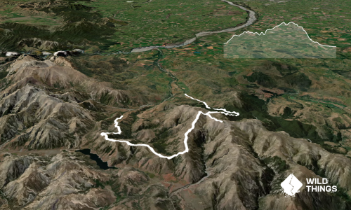
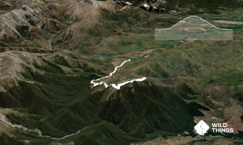
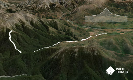
Benmore Hut to the bushline
Last Updated: 9th Mar 2025
Grunt Factor: 36 ?
Gnarl Factor: 59 ?
14.5km
830m
830m
1270m
Last Updated: 9th Mar 2025
Last Updated: 9th Mar 2025
Grunt Factor: 36 ?
Gnarl Factor: 59 ?
14.5km
830m
830m
1270m
Back country - remote
Out and Back
Undulating, some big hills
Dog Friendly
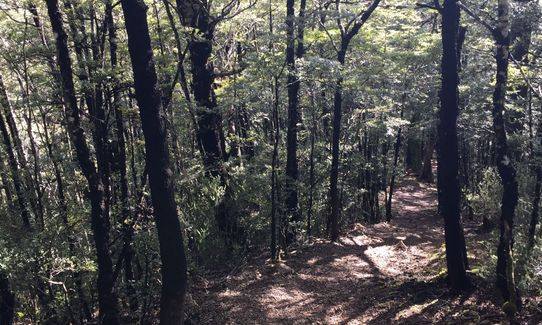
Native bush
Open farmlands
Open tussock/grasslands
Open ridges/tops
Farm Road / 4WD Track
Technical Single Track
Untracked / Route only
Average Uphill Gradient: +11.70%
Average Downhill Gradient: -11.70%
VIP Feature: Send this route to your Garmin account so you can follow the course on your Garmin device.
Become a VIP Member to see the trailhead information.
4:00
Slow
2:30
Moderate
1:45
Fast
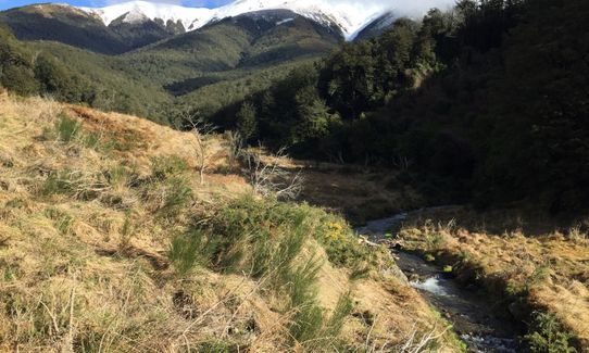
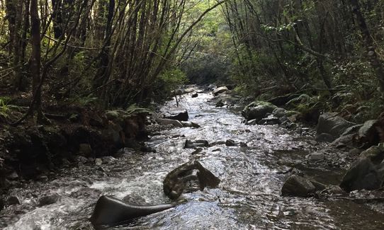
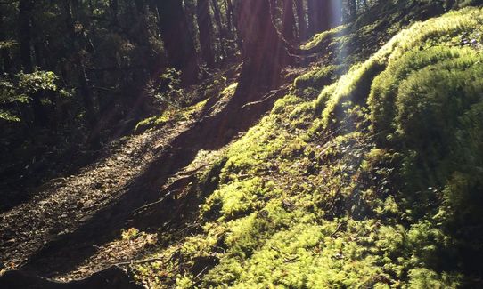
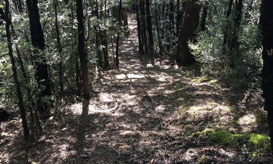
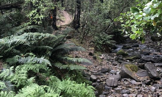
From the car park head through the gate and follow the 4WD track for 2.5 km. At this point you head into the 13 Mile Bush hunting and recreation reserve, you cross the creek a number of times and start to climb up towards the hut.
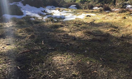
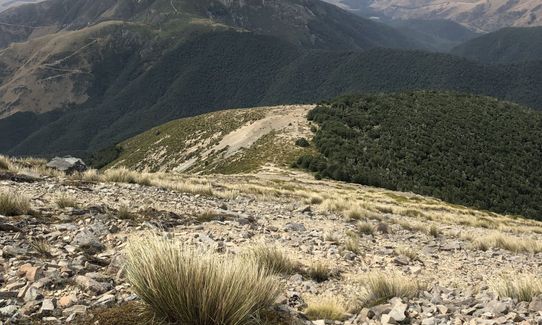
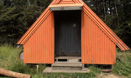
At around 6km you will see the Orange Hut. The track up to the bush line heads directly up the spur to the right of the hut when looking at the door. The trail is officially unmarked but it is fairly easy to follow. When you reach the bushline take note of where you leave the bush as this could be hard to find when you want to re-enter. From this point there is the potential to climb Mt Benmore or head up along the tops and over Rabbit Hill and Trig M. Return the same way.
Nice little 3 bunk hut at about 6km
If you know of any public toilets near the trail start or on the route, please login and then let us know so we can update this section.
Fairly safe as it is on private land, good parking availability.
11 km
11 minutes
Yes
No
Moderate.
Very patchy.
Thermal leggings, Long-sleeved thermal top, Seam-sealed waterproof jacket, Gloves, Beanie/thermal headwear, Personal Locator Beacon (PLB), Whistle, First aid kit, Extra food for emergencies, Cellphone, Map, Crampons / microspikes (for winter conditions)
Lots available up to the hut but none beyond this point
Snow possible in winter, the track has the potential to be very muddy and the creek may be hard to cross after heavy rain.
Multiple Creek crossings, steep slippery slopes, the tops are very exposed from all directions.
Do you have a suggestion on where to go afterwards for the best coffee / cake / breakfast / brunch / beer?
Trail Legend
Login as a VIP to become a Trail Legend. Learn about Trail Legends.
Fastest Known Times (FKTs)
You and Benmore Hut to the bushline
As a VIP member you can record private notes for this trail, see all of your times and more.
Already have an account? Login now
Lovely quick hit-out from Christchurch! A bit of mud (ankle deep) so I was happy to have ankle gaiters. Verrry tempting to keep going up to the top, but I turned around and went back. Unusual hut - would love to stay there with the kids sometime.
April 28, 2025
AR
What a cool track with plenty to keep you interested. Nothing too tricky but lots of ups and downs on the way to the hut. Definitely will be heading back to explore some more and go further up onto the tops. Thanks for adding this wonderful trail!
March 22, 2021
Nice - I followed Fiona's suggestion to head back via the tops/Rabbit Hill/Trig M - makes for a great (almost) circuit (dropped a bike by the road to cycle down the main highway back to the car).
February 4, 2020
I enjoyed this trail a lot, it is very accessible from Christchurch. In summer the track is dry and in good condition but in winter it would be quite muddy and slippery. There are half a dozen crossings of the stream but not that challenging.
February 1, 2020
These overlap with this trail to some degree. You may wish to combine them but please note that to qualify for FKTs on these runs you should record a separate activity for each.
Send to your phone
Scan the below QR code to open this trail on your phone.

Tip: position the QR code in your phone camera screen.
Plan smarter, stay motivated, track your progress, and unlock the full Wild Things experience — while saving along the way.