Last Updated: 13th Sep 2026

Beginner

Save Trail Save

I've done it Done

Summermoa

Linking Pāpāmoa Hills and Summerhill

Submitted by Rob Bathgate

Last Updated: 13th Sep 2026

Beginner

Save Trail Save

I've done it Done

Open

Grunt Factor: 18 ?

Gnarl Factor: 31 ?

12.6km

620m

620m


Become a VIP to see driving directions, distance and time.

Trail Map

This Topo layer only covers NSW/ACT.
Switch to another map layer when viewing outside this area.

Type of Run

Urban fringe

Combo

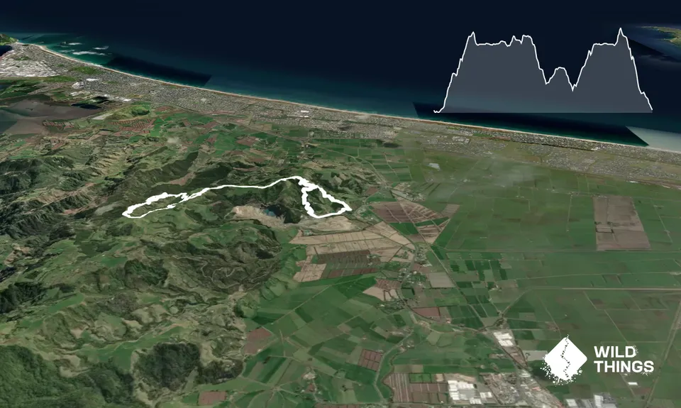
Undulating, some big hills

Native bush

Plantation/exotic forest

Open farmlands

Run Makeup

2%
28%
30%
30%
10%

Sealed Road

Gravel / Boardwalk

Easy Single Track

Moderate Single Track

Technical Single Track

Average Uphill Gradient: +9.80%

Average Downhill Gradient: -9.80%

Garmin Course

VIP Feature: Send this route to your Garmin account so you can follow the course on your Garmin device.

Send to Garmin

Learn about sending to Garmin.

Trailhead

Become a VIP Member to see the trailhead information.

Estimated Times to Run

2:15

Slow

1:30

Moderate

1:00

Fast

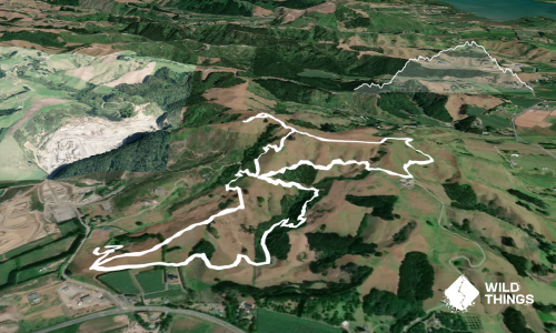
Starting at the main Pāpāmoa Hills carpark, head along the road to the old carpark - a nice flat warmup rather than straight into a climb.

From the old carpark, take the trail up and follow this all the way to the summit of Pāpāmoa. Then, head down the back of the summit, and across the open farmland towards Summerhill.

Once at Summerhill carpark, head through it and cross the road, entering the western Mountain Bike trails. From here, you are in a Mountain Bike Park. Please use with care, always giving way to mountain bikers. Make sure you're aware and able to get out of the way, especially on the downhills. Ensure you always use the trails in the signposted directions only and do not run with headphones, to ensure you can hear anyone coming.

Follow the trail alongside the road until you climb out onto a gravel road, clearing and wooden sculpture. Head up the gravel 4wd for a short distance until you join Corona and Covid trails.

On your way down, stay left on Corona (not onto Covid), and then fork left again at the next track junction. You'll descend into a clearing - go straight across, staying on the same trail until you hit a cross-junction.

This next section may appear convoluted on the map, but it does all make sense and link up nicely when you're out there running!

Take Ken Oath 2 and you'll soon doubleback to the earlier clearing. When at this a second time, go straight across and then left up Ken Oath 1 which soon turns into Smooth Operator.

Once back at the cross-junction you've been to before, take a hard right down Slippery Creek, cross the stream and start climbing up, on the Exit Trail (aka GT Climb). When you pop out at the gravel 4WD road, turn left/up and then straight up through the paddock back to the road crossing at Summerhill car park.

From there, retrace your earlier steps back to Pāpāmoa Hills, ensuring you summit the trig, and then follow the main track all the way back down the to starting carpark.
This trail includes the peak Pāpāmoa.

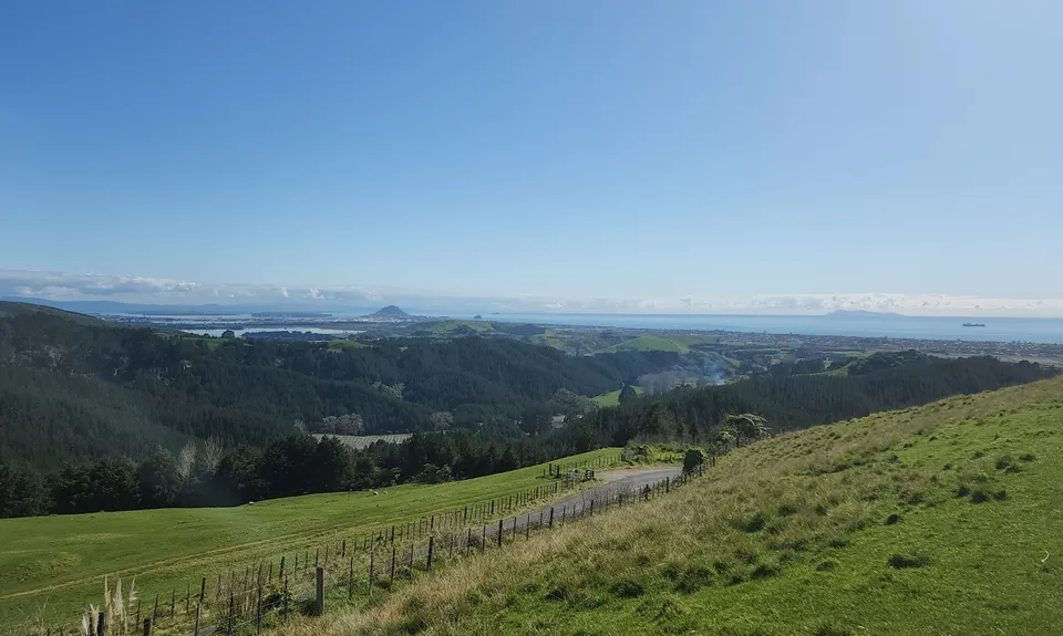
Epic views across the coast.

At both bottom carparks and Summerhill carpark.

Big carpark, with overflow carpark further down Poplar lane.

2 km

3 minutes

No

Moderate.

There are a number of other tracks, especially once in Summerhill - but, if you take a wrong turn, it's usually ok and easy enough to find your way.

Generally good.

Cellphone, Map

None on route but a water foundation at the main bottom carpark.

The information provided is a guide only. Conditions, access and hazards can change, so use your own judgement and check current local information before heading out. Make sure the route or location is suitable for your experience, fitness and equipment, and check any access restrictions or permissions that may apply.

Do you have a suggestion on where to go afterwards for the best coffee / cake / breakfast / brunch / beer?

Trail Legend

Rob Bathgate

Rob Bathgate

has completed Summermoa once in the last year.

Login as a VIP to become a Trail Legend. Learn about Trail Legends.

You and Summermoa

As a VIP member you can record private notes for this trail, see all of your times and more.

Become a Member

Already have an account? Login now

Trail Reviews

Be the first to submit a review for Summermoa!

Login to submit a review

Trail Running Community

Find people who are interested in or have completed this trail run.

You must register or login to view this feature.

Register Now

Overlapping Trails

These overlap with this trail to some degree. You may wish to combine them but please note that to qualify for FKTs on these runs you should record a separate activity for each.

Papamoa Hills Outer Loop

Papamoa Hills Outer Loop

Length: 11.6km

Level: Beginner - Intermediate

Pāpāmoa Hills Summit Loop

Pāpāmoa Hills Summit Loop

Length: 6.6km

Level: Beginner

Pāpāmoa Three Peaks

Pāpāmoa Three Peaks

Length: 25.8km

Level: Beginner - Intermediate

Other trails nearby
Otawa trig to Manoeka & back

Otawa trig to Manoeka & back

Length: 19.0km

Level: Intermediate

Distance Away: 3.5km

Otawa Trig

Otawa Trig

Length: 10.5km

Level: Beginner - Intermediate

Distance Away: 3.5km

Otawa Lodge & Otawa Trig Loop

Otawa Lodge & Otawa Trig Loop

Length: 19.2km

Level: Beginner - Intermediate

Distance Away: 3.5km

Jungle dash

Jungle dash

Length: 1.2km

Level: Beginner

Distance Away: 4.8km

Find more trails and peaks nearby

Wild Things
Wild Things
Explore more

Plan smarter, stay motivated, track your progress, and unlock the full Wild Things experience — while saving along the way.