Last Updated: 25th Oct 2025
Upland Road to Wairere Falls
Last Updated: 25th Oct 2025
Open
Grunt Factor: 37 ?
Gnarl Factor: 58 ?
25.5km
710m
710m
494m

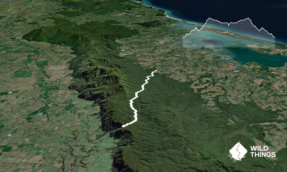
Trail Map
This Topo layer only covers NSW/ACT.
Switch to another map layer when viewing outside this area.
Switch to another map layer when viewing outside this area.


