Wild Things - New Zealand's trail running community
New Zealand's trail running community

Login


don't have an account?

Hunua Heaven, Auckland

Trail Directory proudly supported by Further Faster

Update Your Header Picture

Hunua HeavenBeginner - Intermediate

Submitted by Steve Neary

Info Info
Map Loading

Trail Information

18.90km

870m

870m


Auckland

Clevedon

Front country - easily accessible

Combo

Very hilly

Native bush

Beginner - Intermediate

4:00 (Slow)
3:00 (Moderate)
2:00 (Fast)

-10.7%

+11.9%

CLOSED DUE TO KAURI DIEBACK. You can sign up to e-updates re the track situation in both the Waitakere and Hunua Ranges here.

Download PDF Guide

Fastest Known Times (FKTs)

Please set your gender to see your position on the FKT leaderboards.

Men

There are currently no male FKTs for Hunua Heaven.

Women

There are currently no female FKTs for Hunua Heaven.

Filter FKTs

The more , the harder the FKT will be to beat. Learn about Fastest Known Times.

Missing your time?

Register or login as a VIP and get yourself on the FKT leaderboard!

Register Now

Description

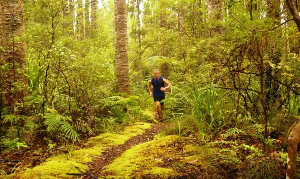
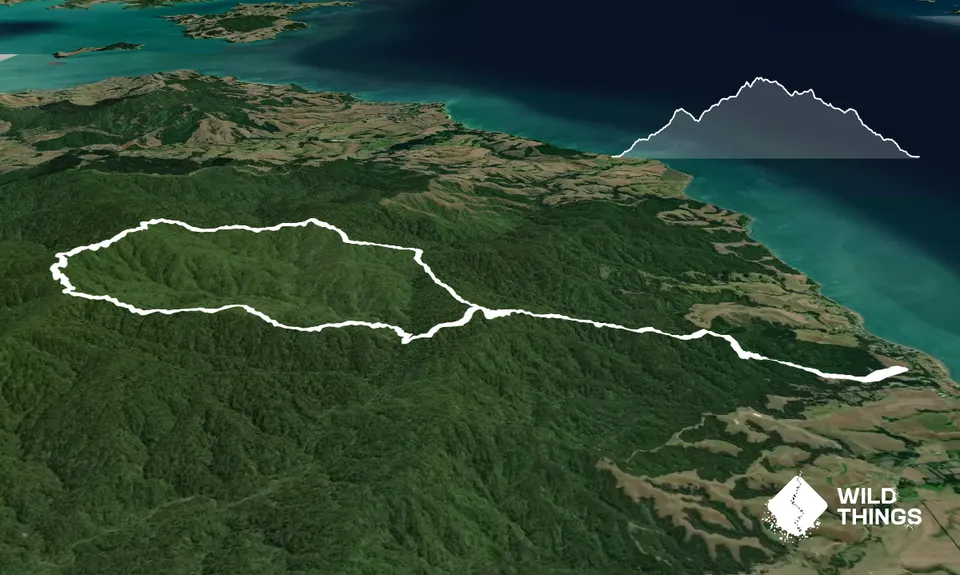
Starting from the car park, run through the picnic area across the cattle stops, following the orange marker poles. Go through a gateway and a short climb across grassy paddocks. Turn right into some native bush, over the stile and follow a wide metal groomed trail.

Follow the trail on a steady upward climb, moving into thicker native bush. Run until you come to a trail maker at a T intersection, take a hard right, continuing along a wide trail for another 300m. At the next fork, take the Mangatangi Ridge Track. After a short climb, you will come to a nice wide muddy downhill, run all the way down to a camp site called Thousand Acre Clearing.

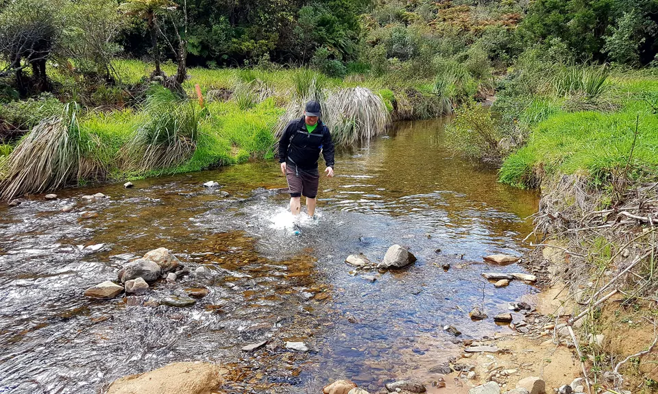
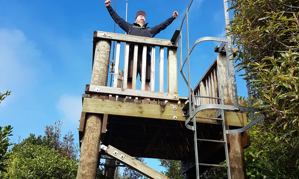
Passing the camp site you will cross a small streamand start another quite difficult climb up to the ridge line. Follow the blaze orange triangular plastic track markers. Continue to climb and run through some nice mature Punga trees, eventually opening out to nice grassy lookout sections. Towards the end of the climb it gets steeper again, take care to follow the markers. After 8.2 km you come to another intersection with the Upper Mangatawhiri track, do not go down the Upper Mangatawhiri track, turn hard right here and start heading down the ridge through a technical muddy, tree root section. After a short climb you will pop out at the highest point of the Hunua ranges at 688m elevation. This is known as K trig, climb up the viewing tower for 360 views.

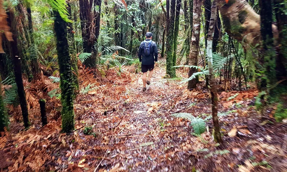
Carry on the track North past the old hut, down a short section of steps, and onto some wooden board walks. After about 450m you will come to a bench seat, turn right onto Kohukohunui Track, where you will start a superb down hill section back to the start of the loop, with a few little ups. There are a few sections further down where you will need to push through bracken and ladder fern, once again beware of the orange trail markers, stick to the trails; there is also the odd post with directional arrows on them. At the 13.5 km mark you will come to another Y intersection, the left track is closed due to Kauri Die Back Prevention, so take the right fork, and get onto some nice smooth flowing downhill sections. At 14.7km you will be back at the end of the loop and from here, its back down the same 4km section, all the way back to the car and enjoy.


Trail Community

Find people who are interested in this run.

You must register or login to view this content.

Features of interest

Beautiful native bush and a trig at the highest point in the Auckland Region


Make Up of Run

Technical Single Track: 35%

Moderate Single Track: 25%

Easy Single Track: 25%

Farm Road / 4WD Track: 15%


Route Data

Reviews:

You must register or login to view this content.


Overlapping Runs

The following trails overlap with this run to some degree. You may wish to combine them but please note that to qualify for FKTs on these runs you should record a separate Strava activity for each

Hunua Crossing

Hunua Crossing

Length: 38.00km


Photos:

You must register or login to view this content.

Your Trail Wishlist

All the runs that are on your To Do list (no limit).

Add to wishlist view wishlist

Your Trail Dreamlist

The runs you most want to do (limited to 10).

Add to dreamlist view dreamlist

Wild Explorers

I did it!
  • Access

    Coming from the south on SH2 head through Mangatahwiri and Mangatangi to Kaiaua. Carry on to the Waharua Park entrance.
    Or go the windy way through Papakura, Clevedon, Kawakawa Bay and East Coast road. It is about the same time but shorter distance by 18 km.
    Parking is by the info center 100 m from the main road.

    Lots of parking available, generally secure.

    38 km

    38 minutes

    No

    No

  • Staying Safe

    Moderate.

    The trails in the area are well signposted but there are plenty of junctions so keep a sharp eye out for turns.

    Very patchy.

    Long-sleeved thermal top, Seam-sealed waterproof jacket, Beanie/thermal headwear, Whistle, First aid kit, Extra food for emergencies, Cellphone, Map.

    No safe drinking water, take your own with you

    Can be very muddy after heavy rain and in winter

  • Sponsor this trail

    If you are interested in learning about sponsorship opportunities, please get in touch below:

    Submit

Got a favourite trail? Tell us about it.

Share the love and add your favourite trail(s) to our growing trail directory.

Submit A Trail

Become a member today

Start enjoying the many benefits to becoming a member of our thriving community.

Become a member

Great brands at great prices with our VIP member's discount

Stay up to date

Sign up to our newsletter for latest offers and trail guides

Share this trail with a friend:

VIP Membership

Please register as a VIP or login to your VIP account to view this content.

Cancel Login Register

Membership Required

You can see up to three trail guides without being logged in but after that we require you to be logged in to your Free or VIP account. If you don’t yet have an account you can register here.

Login Register