Last Updated: 21st Sep 2023

Intermediate - Experienced

Save Trail Save

I've done it Done

Kohukohunui Connection

Clevedon, Auckland

Submitted by John Scott

Last Updated: 21st Sep 2023

Intermediate - Experienced

Save Trail Save

I've done it Done

Closed More info

Track is closed due to storm damage and public access is prohibited. Further information including potential opening dates available at www.hunuatraverse.co.nz

Please notify us if this has changed.

Grunt Factor: 27 ?

Gnarl Factor: 22 ?

25.5km

760m

760m

688m


Login as a VIP to see driving directions, distance and time.

Trail Map

Type of Run

Front country - easily accessible

Out and Back

Undulating, some big hills

Native bush

Plantation/exotic forest

Run Makeup

55%
20%
15%
10%

Gravel Road

Easy Single Track

Moderate Single Track

Technical Single Track

Average Uphill Gradient: +7.8%

Average Downhill Gradient: -7.8%

Trailhead

Login as a VIP to see the trailhead information.

Estimated Times to Run

Not suitable

Slow

4:30

Moderate

3:00

Fast

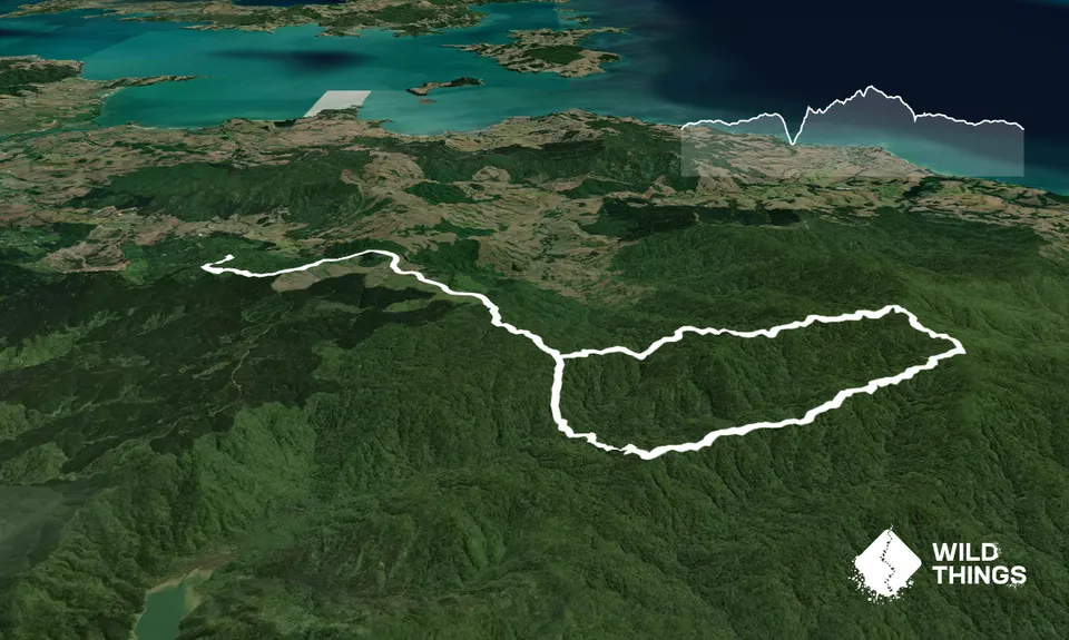
Head up the gravel road from the carpark steeply at first for 3/4 km until you reach Plows Rd. Ignore the "no access, logging" sign, and turn left. For the next 6km it's undulating gravel road, initially past cleared exotic forest (Watercare has bought the exotic forests in the Northern Hunuas and is slowly removing them and replanting with natives), and then at about the 5km mark you're on Mine Rd, which leads through pleasant native bush for another couple of km. Ignore the first turnoff to Kohukohunui (this is the return) and a short way later turn into Mine track.

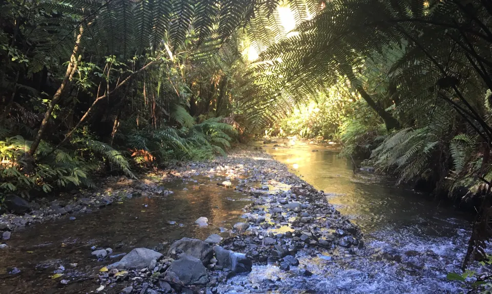
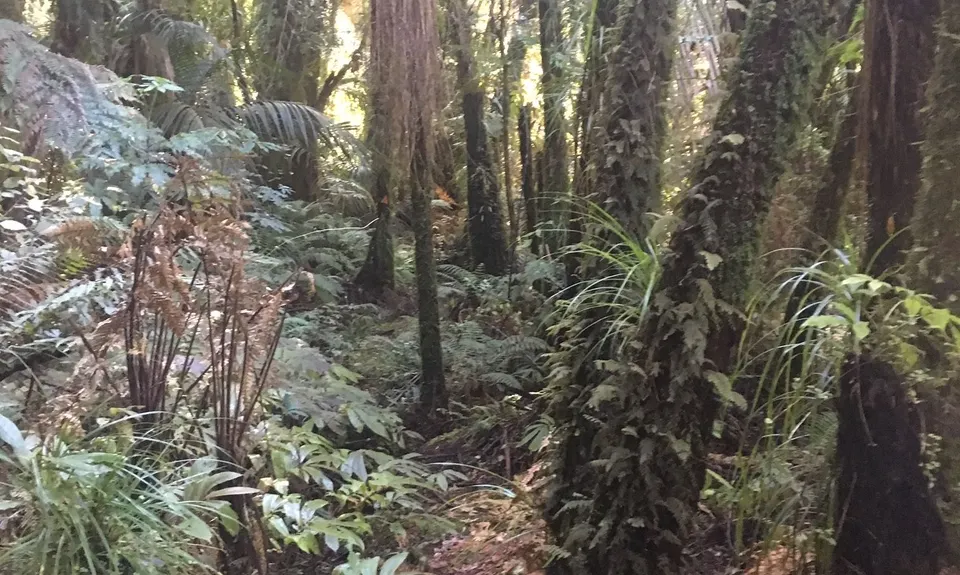
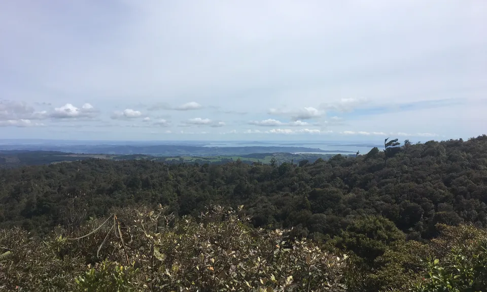
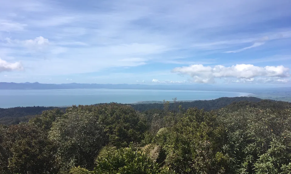
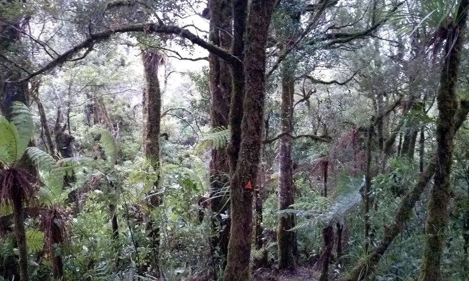
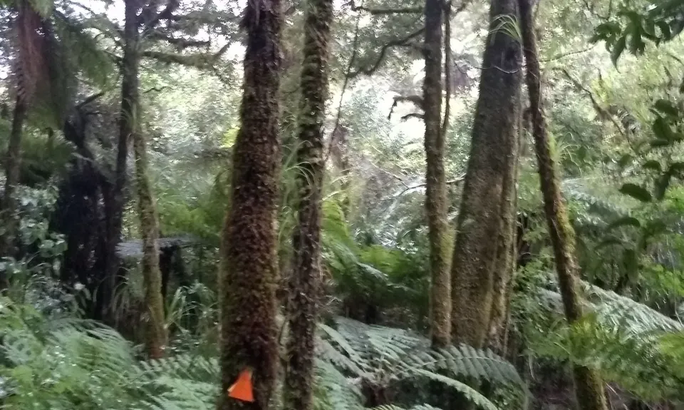
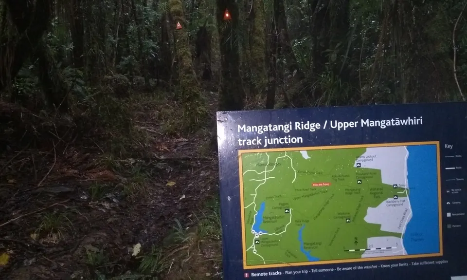
Tighten your laces, this is a steep and rough track downhill to the Mangatawhiri River, and an even steeper uphill on the other side to the Upper Mangatawhiri track. Once on the Upper Mangatawhiri track ridge, you head East for 4 1/2 km, more up than down, and the forest is mostly open and pleasant, fairly technical running however - lots of tree roots. At the 13 km mark you reach the Mangatangi Ridge track coming in from the right - you go left for 200m and at the next junction follow all signs to Kohukohunui. An annoying little downhill and last push up sees you at the summit tower at about the 14km mark. Enjoy the views for a few more years, though the trees will crowd them out before too long.

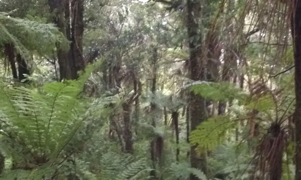
Heading North past the summit tower you pass Trig K Hut, where there is a toilet and a water supply. A few meters further and you turn left, down Kohukohunui track. This you follow all the way back to the road you came along earlier. This track is crazily good - it's all steps, boardwalk, benched, gravelled etc - fantastic trail running in what is basically the middle of nowhere. At about 18.5km you arrive back at Mine Rd. Retrace your steps back to the carpark.

Highest point in the Hunuas/ in the mainland Auckland region. Lots of native birdlife - intensive predator control area. There is an abandoned manganese mine at the end of Mine Rd, a short distance off the route.

From Clevedon, take the Kawkawa Bay Rd for about 5km, then turn right into Ness Valley. Follow Ness Valley Rd for another 5km, then go right up Moumoukai Hill Road. After 4km you reach a locked gate, where there is a carpark, some information, and toilets. Note: there is also a Moumoukai *valley* Rd in the Hunuas, this is miles away so be careful what you enter into Google Maps.

14 km

21 minutes

Unknown

No

Moderate.

Near the start there are numerous secondary forestry roads - but as long as you make the first turn left onto Plows Rd and keep on the main road you'll be fine.
If you find running on forestry roads boring you could mountain bike to the walking track start, hide your bike somewhere, and just run the forest loop. This would make for 14km of cruisy mountain biking and 12 km forest running.

Very patchy.

Long-sleeved thermal top, Seam-sealed waterproof jacket, Personal Locator Beacon (PLB), Whistle, First aid kit, Extra food for emergencies, Cellphone, Map

(1) Mangatawhiri River crossing at 8km mark
(2) Trig K hut near the summit
Rest of the route is on ridges.

None

None

You and Kohukohunui Connection

As a VIP member you can record private notes for this trail, see all of your times and more.

Register Now

Already have an account? Login now

Trail Reviews

"Ran" this beautiful loop on 19th September with my partner, nice rolling start on the gravel road to warm up but don't be fooled as soon as you head down the Mine Track its steep, technical tree roots evrywhere and a very slow pace as many others have noted. Follow the orange triangle markers (plenty of pink ribbons as well along the same path at the moment but its the orange that you want) Gorgeous when you hit the streams at the bottom don't forget to take a minute or two and appreciate it! The climb out is much like the descent, you'll be grabbing tree roots and branches etc to help you along, definitely down to a 20 min per km pace at times, long limbs help! Turn left at the top once you hit the Upper Mangatawhiri Track still technical tree rooty so not much running, then you hit the Mangatangi Ridge Track and go left, obligatory pic at the Trig a short while later and the trail running finally begins, steps, boardwalks and beautiful single track, downhill mostly and fast until youre back on the gravel road, hang a right head back to the carpark. Definitely not a beginners trail, need to be confident on steep ups and downs, happy with tree roots and scrambling at times. Look out for very pretty singing from Kaka if you're lucky! Would give it 5 Stars but i prefer more running on my trails than bush bashing!

Haydon Mace

September 24, 2020

Easy to follow trail, hard to run trail but great training for a fair time on your feet! No views today and a very slow slog up and down the valley to the streams (we tramped this at a slow pace). Rain on the way back on the road was not needed :-( but I loved the bush, birds and bumping into other "mad" things out there walking in the Hunuas

Bethany Cantwell

June 28, 2020

This made for a great afternoon out on a rainy day. The road run at the start becomes nicer and nicer as you run past the plantings and then into the bush.For the Mine track I'd say you won't be running. I walked down and up this. It's a tramping track, very steep. There's two stream crossings at the bottom which are easily manageable. I found finding my way easy, there's plenty of orange triangles, but yes always be on the lookout for them and don't follow the pink ones. And yes turn left at the end. There's a big sign pointing to the left saying Kohukohunui Trig so you'll already be doing the "follow all signs to Kohukohunui" instructions in the description.After that the ground becomes more manageable for running, a bit wider in places and not crazy steep. You're really out in the bush here. After the lookout tower it's fantastic running along the track back down to the road.

Damon Nicholas

June 4, 2020

Great run, thank you for posting it!However we should have read the reviews prior to running it....and we would like to highlight two points for newbies to that area:1. If you go past the old mining hut and start following the pink markers, you are on the wrong track- it is a trapping route only. We turned around after the downhill scrambling got a bit too rough to qualify as a trail. The real "Mining track" is a few hundred meters back up the gravel road. I have no idea how we missed it as its signposted and has a foot washing station... Follow the orange markers.2. When you get to this point in the above description: "Once on the Upper Mangatawhiri track ridge, you head East"... (Yes well, we had no equipment with us to tell us which way East was- our mistake), turn LEFT.The rest was easy to follow as per the above description. And yes, those long forestry roads appear double as long and hot on the way out. Awesome few hours out and bout though.

Angela Ruegger

January 29, 2020

Login to submit a review

Trail Running Community

Find people who are interested in or have completed this trail run.

You must register or login to view this feature.

Register Now

Other trails nearby
Waharau Ridge Gutbuster

Waharau Ridge Gutbuster

Length: 11.3km

Level: Beginner

Xterra Waitawa Super Long

Xterra Waitawa Super Long

Length: 22.6km

Level: Beginner - Intermediate

Hunua Heaven

Hunua Heaven

Length: 18.9km

Level: Beginner - Intermediate

Clevedon Reserve Stairway to Heaven

Clevedon Reserve Stairway to Heaven

Length: 3.0km

Level: Intermediate

Find more trails and peaks nearby