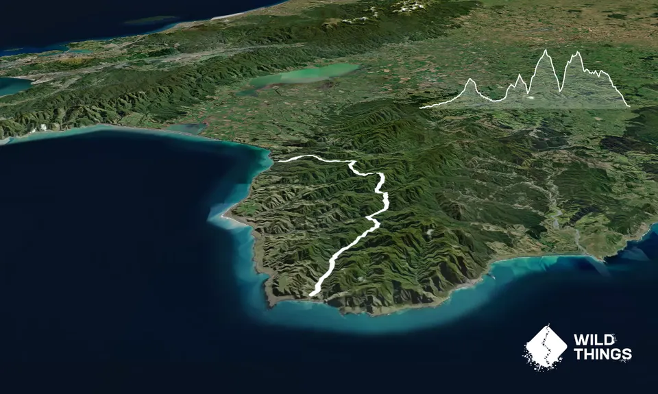
This beautiful but rugged route runs through some of the lesser traveled country in the North Island. Starting from the Mangatoetoe river mouth the route traverses four major undulations before finishing at the Putangirua Pinnacles.
If you're not racing take your time at the end to explore the interesting Pinnacle formations as you come to the finish.
This track should only be attempted by those comfortable in the backcountry. Although most of the route follows marked DoC tracks, there are sections of stream travel where the track is not always obvious. Be sure to turn East at Kawakawa Hut and watch out for the ongaonga!
Mangatoetoe hut is found by following markers off the river bed onto a nice track to the hut. From this hut make sure to follow the markers which will lead you up the correct stream in a North East direction. When approaching Kawakawa Hut cross the stream to river right to pick up the hut and head East from the hut towards Pararaki Hut. There is one well sign posted turn off as you are approaching the end down to the Pinnacles. Take this track down to the finish.
If you know of any public toilets near the trail start or on the route, please login and then let us know so we can update this section.
No public transport
66 km
60 minutes
Yes
No
Hard.
Mangatoetoe hut is found by following markers off the river bed onto a nice track to the hut. From this hut make sure to follow the markers which will lead you up the correct stream in a North East direction. When approaching Kawakawa Hut cross the stream to river right to pick up the hut and head East from the hut towards Pararaki Hut. There is one well sign posted turn off as you are approaching the end down to the Pinnacles. Take this track down to the finish.
Be aware of multiple river and stream crossings. Be very careful after heavy rain as the rivers can come up quickly. Remember they will also drop quickly so best to wait out any crossing which you aren't comfortable with.
Watch out for the Ongaonga (native stinging nettle)!
Do you have a suggestion on where to go afterwards for the best coffee / cake / breakfast / brunch / beer?
These overlap with this trail to some degree. You may wish to combine them but please note that to qualify for FKTs on these runs you should record a separate activity for each.
We don't store or share your location; it's only used for these features. You can continue without it, just without distance sorting and live map features.
Send to your phone
Scan the below QR code to open this trail on your phone.
Tip: position the QR code in your phone camera screen.