Last Updated: 21st Sep 2023

Intermediate - Experienced

Save Trail Save

I've done it Done

Mt. Patriarch (Tasman)

Tapawera, Tasman

Submitted by Ian Gilmour

Last Updated: 21st Sep 2023

Intermediate - Experienced

Save Trail Save

I've done it Done

Open

Grunt Factor: 86 ?

Gnarl Factor: 64 ?

37.9km

2450m

2430m

1701m


Login as a VIP to see driving directions, distance and time.

Trail Map

Type of Run

Back country - remote

Loop

Very hilly

Native bush

Open ridges/tops

Run Makeup

25%
25%
30%
20%

Easy Single Track

Moderate Single Track

Technical Single Track

Untracked / Route only

Average Uphill Gradient: +15.1%

Average Downhill Gradient: -11.8%

Trailhead

Login as a VIP to see the trailhead information.

Estimated Times to Run

Not suitable

Slow

9:00

Moderate

6:00

Fast

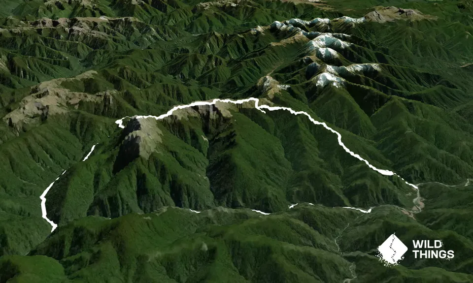
From the marked start of Chummies track on the roadside, immediately start with a crossing of the Wangapeka River. Put yourself in second gear for a long, generally steady climb up a good track up the beautiful wooded ridge to Pt. 1292 (with a few steeper bits, and a few descents to keep things interesting).

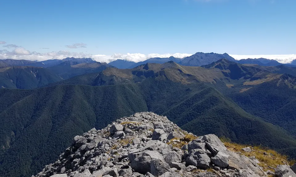
Just past Pt. 1292 the track narrows considerably as you start the traverse along the steep hillside to John Reid Hut. Fill up with water at the hut as this is the last opportunity until Kiwi Saddle. Follow the snow poles straight up the hill from the hut to make the main ridge. From here turn left and generally follow the ridgeline, with a few sections where you'll need to drop down a gully to get over some bluffy bits - notably southwest of Pt. 1507. This is the highlight of the trip, with amazing views distracting you from some technical untracked ridge running.

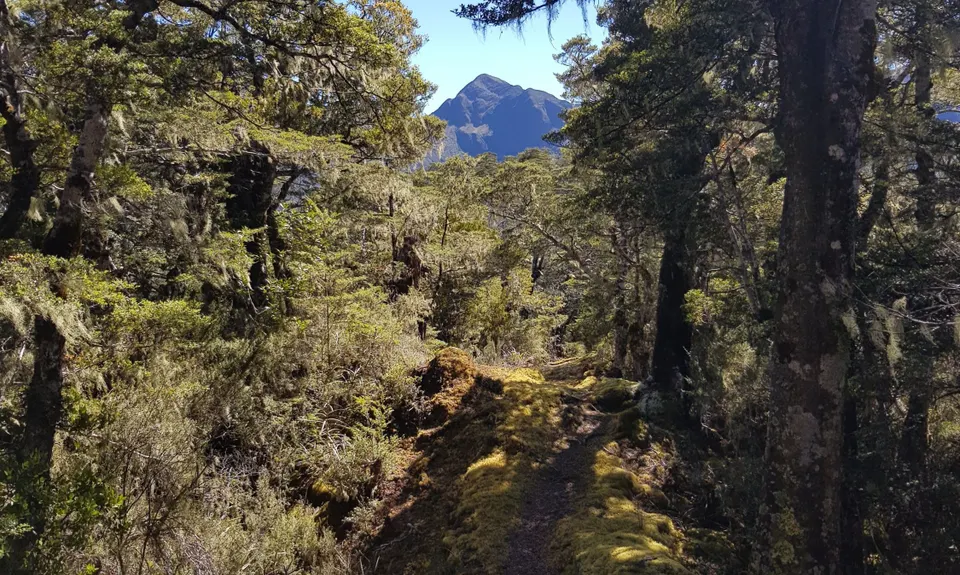
Eventually you reach the start of the track down to Kiwi Saddle where it is decision time. If you have time and are still feeling good, make the steep climb through the spaniards to the summit of Mt Patriarch (lightly cairned) and return the same way. The views are amazing and definitely worth it, but keep in mind that you are not even half way distance-wise and likely time-wise too (depending on confidence on overgrown trails and fatigue during the 'easy trails')

After making the return trip to Patriarch, it's a marked track the rest of the way. Follow the track down to Kiwi Saddle hut, at first steeply down then undulating along and around the ridgeline. From the hut it's a steady descent down to the Wangapeka River/Kiwi Stream confluence. This section would be very runnable if it weren't for the copious amount of hook grass and other foliage covering the track as of writing (March 2021).

After crossing two large swingbridges over Kiwi Stream and the Wangapeka, you're on the Wangapeka Track - turn left to get back to the car. Keep your eyes peeled for Whio as you run through the easiest section of the trail, although the small climbs in the undulations certainly take their toll after 30km! The end point is Rolling River Carpark, where you'll either meet the second car, stashed bike, or have another 5ish km along the gravel road.

This trail includes the peak Mount Patriarch.

360 degree views from Mt Patriarch, beautiful ridgelines to get there. Whio along the Wangapeka on the way out

Limited roadside parking at the start of Chummies Track. There is ample parking at Rolling River Carpark. Either stash a second car or a bike at Rolling River Carpark, or tack on an extra 5km along the gravel road. Be aware of the water level at the concrete ford at the Wangapeka/Dart junction on the drive in, as it can become impassible after heavy rain.

14 km

35 minutes

Unknown

No

Hard.

In clear weather, the general navigation is pretty simple along the unmarked ridgeline. In cloud/clag the navigation will be more difficult unless you know what you are doing. The rest of the track is marked with orange blazes and is generally pretty easy to follow.

Very patchy.

Thermal leggings, Long-sleeved thermal top, Seam-sealed waterproof jacket, Gloves, Beanie/thermal headwear, Personal Locator Beacon (PLB), Whistle, First aid kit, Extra food for emergencies, Survival bag, Cellphone, Map, Headtorch and spare batteries

Water at John Reid Hut (via stream) and Kiwi Saddle Hut (general DOC disclaimers on boil first, routinely ignored). No water between these two points, but plenty of water after Kiwi Saddle Hut.

Care needs to be taken in all seasons in NZ Alpine environments. This track is no different.

Take care in the route selection between John Reid Hut and Mt Patriarch to avoid bluffy bits.

Fastest Known Times (FKTs)

For an FKT you must tag the summit of Mt Patriarch

You and Mt. Patriarch (Tasman)

As a VIP member you can record private notes for this trail, see all of your times and more.

Register Now

Already have an account? Login now

Trail Reviews

Be the first to submit a review for Mt. Patriarch (Tasman)!

Login to submit a review

Trail Running Community

Find people who are interested in or have completed this trail run.

You must register or login to view this feature.

Register Now

Overlapping Trails

These overlap with this trail to some degree. You may wish to combine them but please note that to qualify for FKTs on these runs you should record a separate activity for each.

Blue Ducks & Cecil King's Hut

Blue Ducks & Cecil King's Hut

Length: 23.3km

Level: Beginner - Intermediate

Other trails nearby
Mt Owen via Granity Pass

Mt Owen via Granity Pass

Length: 23.0km

Level: Intermediate - Experienced

Tapawera Taster

Tapawera Taster

Length: 6.3km

Level: Beginner

Find more trails and peaks nearby