Last Updated: 21st Sep 2023
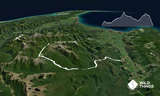
Anatoki-Waingaro-Kill Devil
Last Updated: 21st Sep 2023
Open
Grunt Factor: 104 ?
Gnarl Factor: 64 ?
57.0km
2385m
2345m
1103m
Last Updated: 21st Sep 2023
Last Updated: 21st Sep 2023
Open
Grunt Factor: 104 ?
Gnarl Factor: 64 ?
57.0km
2385m
2345m
1103m
Back country - remote
Point to Point (one way)
Undulating, some big hills
Native bush
Riverside
Lakeside
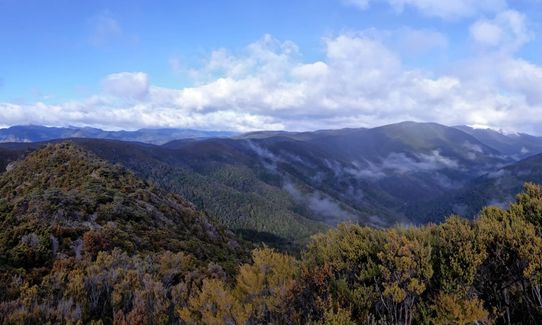
Open ridges/tops
Easy Single Track
Moderate Single Track
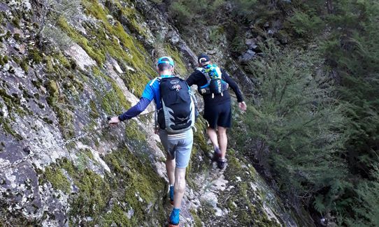
Technical Single Track
Untracked / Route only
Average Uphill Gradient: +11.8%
Average Downhill Gradient: -11.0%
VIP Feature: Send this route to your Garmin account so you can follow the course on your Garmin device.
Login as a VIP to see the trailhead information.
15:00
Slow
12:00
Moderate
8:00
Fast
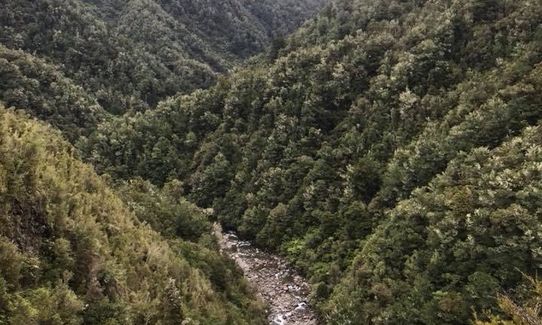
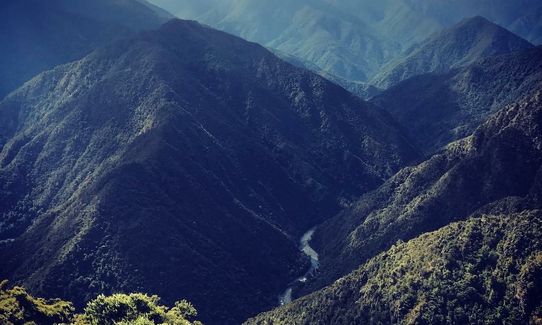
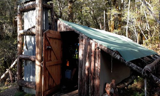
The route is fairly easy to follow but fairly tough and very remote in the middle. It is usually tramped in about 4 days. The first section on the Anatoki Forks track is single track along a river valley with some nice views; the track is in fairly good condition but has lots of small slips to clamber over.
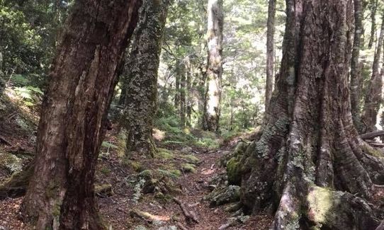
From the Anatoki Forks Hut to Lake Stanley is a route which is very technical and goes over a high saddle - expect to move slowly. This part goes through thick forest and is very remote so move carefully as it's not the place to sprain an ankle!
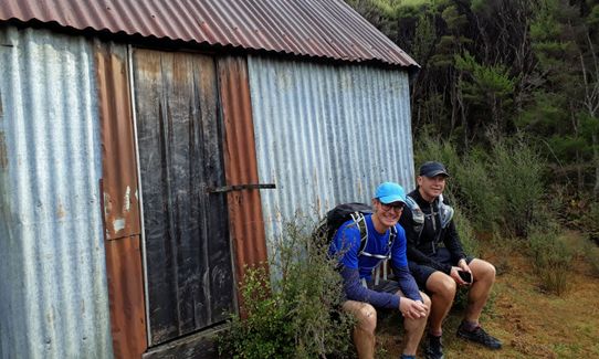
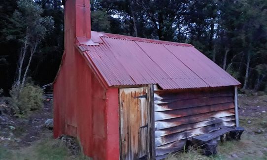
From Lake Stanley the going gets easier (but not easy) on rough single track to Waingaro Forks Hut. The last section from Waingaro Forks Hut to the trail-end at Ururwhenua is a historic pack track that is also used by mountain bikers so is relatively easy but climbs about 500m and has a million switchbacks on the way down.
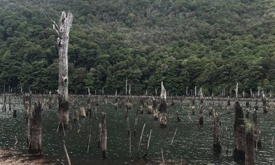
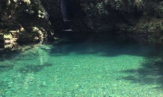
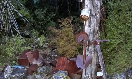
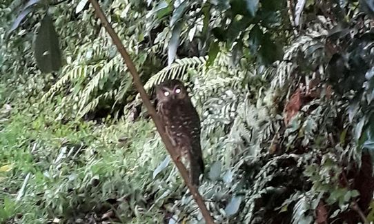
Whio habitat. Lake Stanley was created in the 1929 Murchison Earthquake and the drowned beech forest looks very unearthly. The way out over Kill Devil Track is a historic mining pack track.
If you know of any public toilets near the trail start or on the route, please login and then let us know so we can update this section.
Small area to leave a car but if you're doing this trail as suggested you'll end up in Uruwhenua so better to get someone to drop you if you can manage it. No public transport once you leave the State Highway.
9 km
13 minutes
Unknown
No
Moderate.
The trail is well marked so hard to get lost. However the portion from Anatoki Forks Hut to Lake Stanley is marked as a route with orange arrows only so you need to take some care.
Non-existent.
Waterproof leggings, Thermal leggings, Long-sleeved thermal top, Seam-sealed waterproof jacket, Personal Locator Beacon (PLB), Whistle, First aid kit, Extra food for emergencies, Cellphone, Map, Headtorch and spare batteries
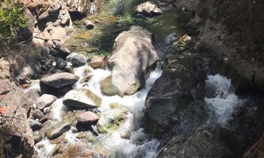
There are several rivers and huts so water is available but may not be safe to drink without treatment. I took a Life Straw which was very helpful.
I did the route in summer. In winter it would definitely be very muddy in places and the tops on the way out on the Kill Devil track would be very exposed.
No particular hazards except weather. However the middle of the route is very remote and self-extraction would take a long time, so you should be prepared to stay overnight no matter how fast you expect to be.
Wholemeal Cafe
Commercial Street, Takaka
https://wholemealcafe.co.nz
Good coffee, yummy food, and the best fresh fruit ice cream in the Bay
Fastest Known Times (FKTs)
You and Anatoki-Waingaro-Kill Devil
As a VIP member you can record private notes for this trail, see all of your times and more.
Already have an account? Login now
What a great track (when dry anyway) and despite lots of tunneling through windfall on Anatoki section- way more runnable than I had feared. Clockwise seems best to avoid afternoon heat- after the Killdevil ascent the trail has good shade.
March 11, 2022
Nice day out. Longer than expected. Lots of windfall and a few slips along Anatoki which really slowed things down.
October 31, 2021
These overlap with this trail to some degree. You may wish to combine them but please note that to qualify for FKTs on these runs you should record a separate activity for each.
Send to your phone
Scan the below QR code to open this trail on your phone.

Tip: position the QR code in your phone camera screen.


