Last Updated: 13th Jan 2025
Arthur & Gordons
Last Updated: 13th Jan 2025
Open
Grunt Factor: 56 ?
Gnarl Factor: 63 ?
25.0km
1360m
1360m
1795m
Last Updated: 13th Jan 2025
Last Updated: 13th Jan 2025
Open
Grunt Factor: 56 ?
Gnarl Factor: 63 ?
25.0km
1360m
1360m
1795m
Back country - remote
Loop
Mountainous
Native bush
Open tussock/grasslands
Open ridges/tops
Easy Single Track
Moderate Single Track
Technical Single Track
Untracked / Route only
Average Uphill Gradient: +13.3%
Average Downhill Gradient: -14.1%
VIP Feature: Send this route to your Garmin account so you can follow the course on your Garmin device.
Login as a VIP to see the trailhead information.
8:00
Slow
6:00
Moderate
4:00
Fast
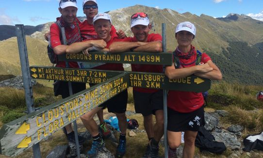
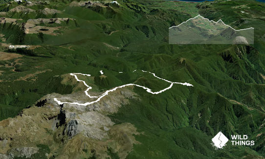
A classic circuit in eastern Kahurangi National Park, taking in two summits - Mt. Arthur and Gordons Pyramid.
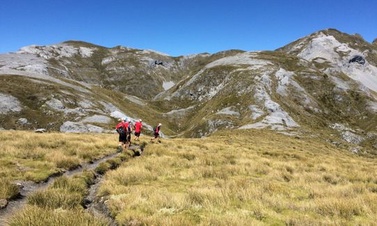
From Flora car park follow the track to Flora Saddle where a well-graded track turns left and follows the ridge towards Mt Arthur, winding through beech forest and groves of candelabra-like mountain neinei (Dracophyllum or 'Dr Zeuss plant!) Mt Arthur Hut is just on the tree line.
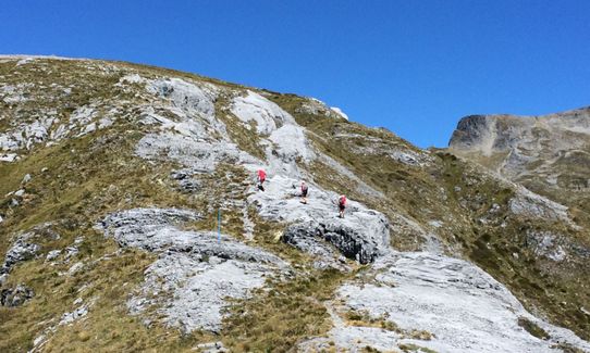
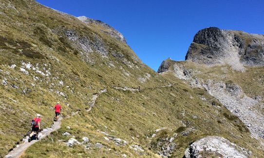
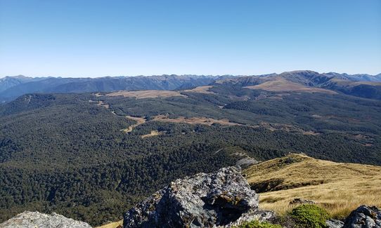
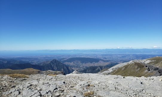
Beyond here you are on open ridges, some parts of which have a lot of loose rock on. The views are superb and from the summit on a clear day it's possible to see Mt. Taranaki!
Start retracing your steps downhill and about 2k later (at around 1500m altitude) hang a left to follow the poled route to Gordons Pyramid. There's an obvious enough trail, quite technical in places and a final steep grunt to your second summit of the day.
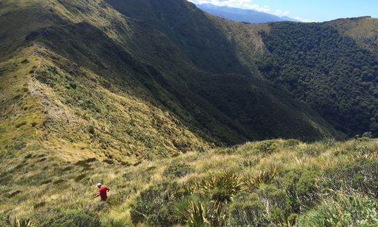
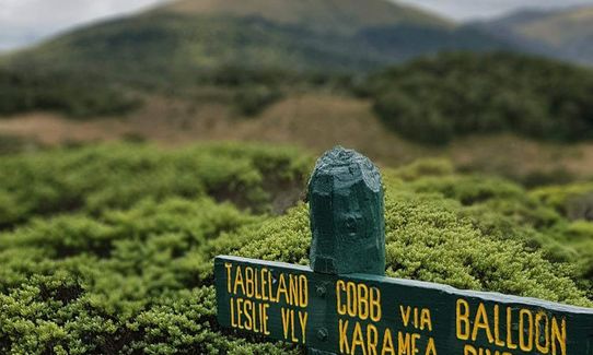
Head NE off the summit of Gordons followed the poled route towards Cloustons Mine, which you'll come across shortly after re-entering the bush.
The trail continues gently downhill to join the trail alongside Flora Stream. Most of your final 5k are a gentle uphill, runnable if you have the energy. Along the way you pass historic Flora Hut, which is well worth a nosey.
This trail includes the peaks Gordons Pyramid and Mount Arthur.
The awesome groves of dracophyllum that you pass through on the way to Mt Arthur Hut & the sensational views from both summits.
Historic Cloustons Mine on the descent from Gordons Pyramid
If you know of any public toilets near the trail start or on the route, please login and then let us know so we can update this section.
Plenty of parking, toilet and information board/shelter at the DoC car park
61 km
65 minutes
Unknown
No
Moderate.
Finding the way is easy enough in good weather but with poor visibility you will need to remain alert on the tops. Take care not to miss the poled route that leads off to your left on the way down from Mt. Arthur towards Gordons Pyramid.
Patchy.
Thermal leggings, Lightweight fleece top, Long-sleeved thermal top, Seam-sealed waterproof jacket, Gloves, Beanie/thermal headwear, Personal Locator Beacon (PLB), Whistle, First aid kit, Extra food for emergencies, Survival bag, Cellphone, Compass, Map, Crampons / microspikes (for winter conditions)
Available at Mt Arthur Hut, Gridiron Creek (just below Cloustons Mine) and Flora Stream. You're a fair while on the tops without any water so make sure you leave Mt Arthur hut with plenty.
This is a great winter route for those with the experience to handle it - be aware of avalanche risk, particularly towards the summit. For others it's best to treat as a summer-only route.
Care is required around the many bluffs, sinkholes and caves.
Trail Legend
Login as a VIP to become a Trail Legend. Learn about Trail Legends.
Fastest Known Times (FKTs)
You and Arthur & Gordons
As a VIP member you can record private notes for this trail, see all of your times and more.
Already have an account? Login now
Amazing terrain and you get to enjoy the soft consistent downhill trail run from Cloustons mine to the Flora track- before the sting in the tail :-)
March 25, 2022
Fantastic views, particularly from the summit of Mt Arthur but quite technical in places. I would suggest running it the other way around as the final 5km uphill was hard work on tired legs, whereas the route straight down from Mt Arthur would have been a great downhill to finish on.
June 1, 2020
These overlap with this trail to some degree. You may wish to combine them but please note that to qualify for FKTs on these runs you should record a separate activity for each.
Send to your phone
Scan the below QR code to open this trail on your phone.

Tip: position the QR code in your phone camera screen.


