Last Updated: 6th May 2024
Mt Shrimpton Track
Last Updated: 6th May 2024
Open
Grunt Factor: 21 ?
Gnarl Factor: 35 ?
8.3km
995m
1000m
1300m
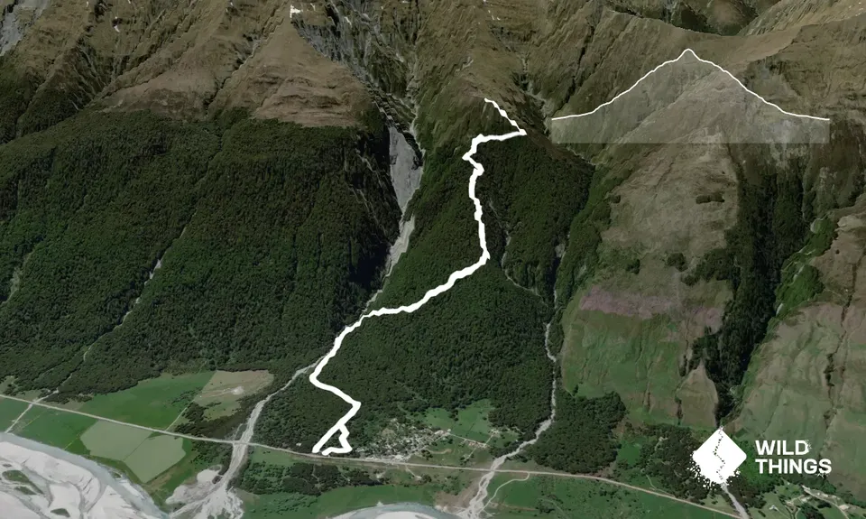
Trail Map
This Topo layer only covers NSW/ACT.
Switch to another map layer when viewing outside this area.
Switch to another map layer when viewing outside this area.


