Last Updated: 29th Nov 2023

Experienced

Save Trail Save

I've done it Done

Gillespie Pass Circuit

Makarora, Otago

Submitted by Wyatt Stevens

Last Updated: 29th Nov 2023

Experienced

Save Trail Save

I've done it Done

Open

Grunt Factor: 89 ?

Gnarl Factor: 54 ?

51.5km

2070m

2080m

1629m


Login as a VIP to see driving directions, distance and time.

Trail Map

Type of Run

Back country - remote

Point to Point (one way)

Mountainous

Native bush

Riverside

Open tussock/grasslands

Open ridges/tops

Run Makeup

2%
20%
38%
30%
10%

Gravel Road

Easy Single Track

Moderate Single Track

Technical Single Track

Untracked / Route only

Average Uphill Gradient: +7.5%

Average Downhill Gradient: -9.2%

Trailhead

Login as a VIP to see the trailhead information.

Estimated Times to Run

12:00

Slow

8:00

Moderate

6:00

Fast

Starting from the carpark, descend to the Makarora and find a suitable place to cross (**read warning below**). If you crossed below the Young River confluence, find your way across the Young and do a short bushwhack to join the Young Valley Track. Follow this beautiful trail as it meanders through beech forests and past waterfalls, all the way to the Young Basin.

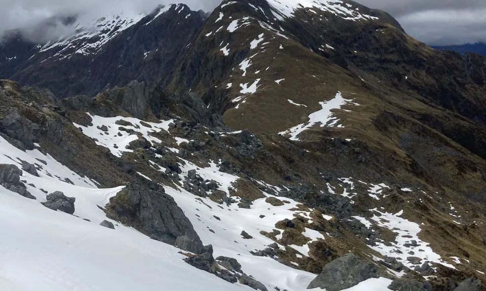
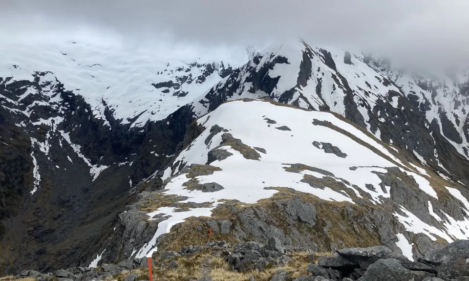
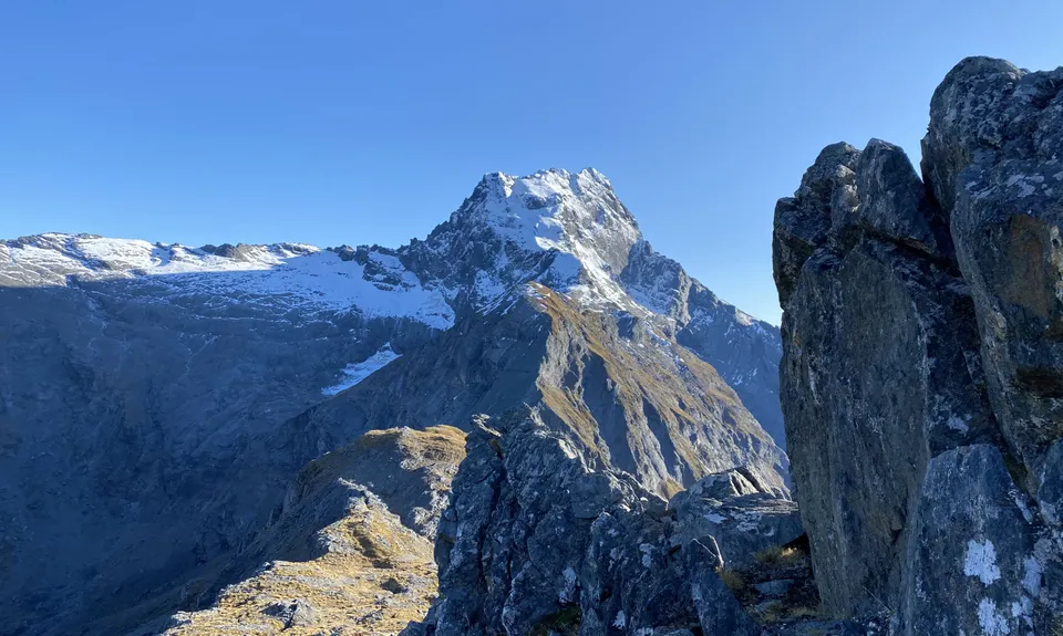
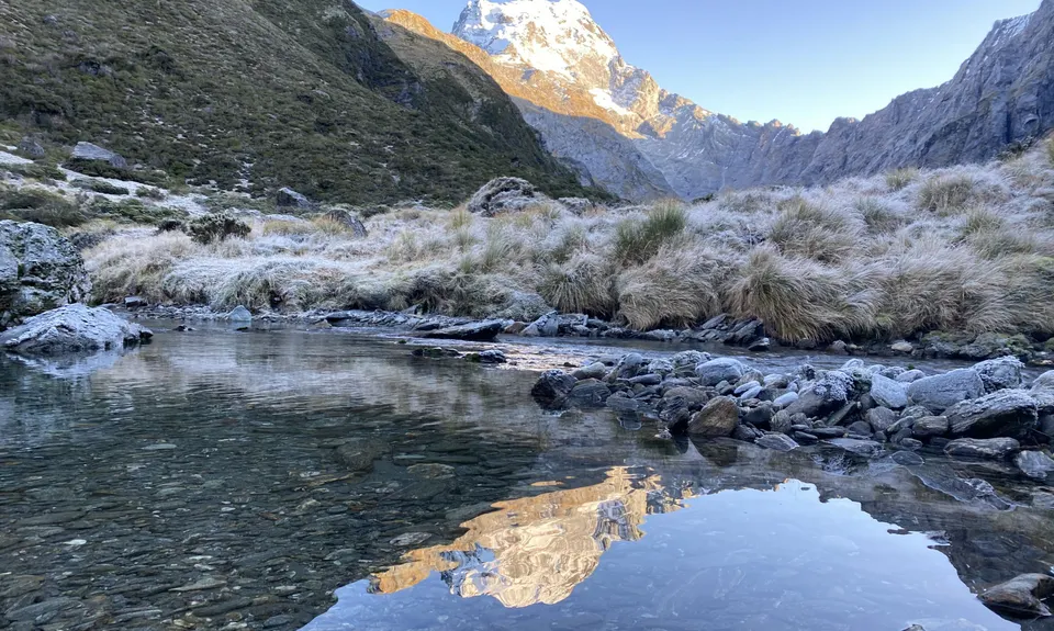
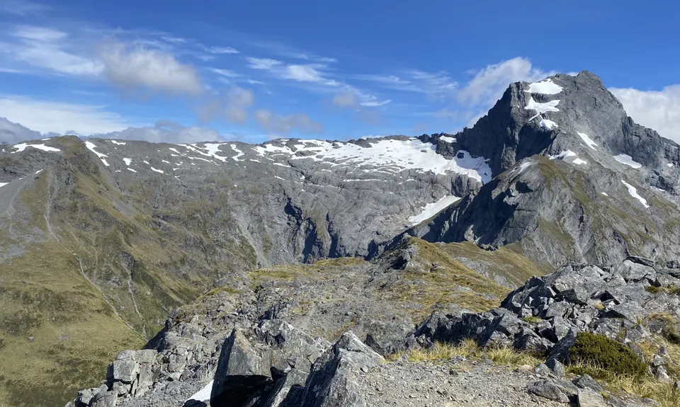
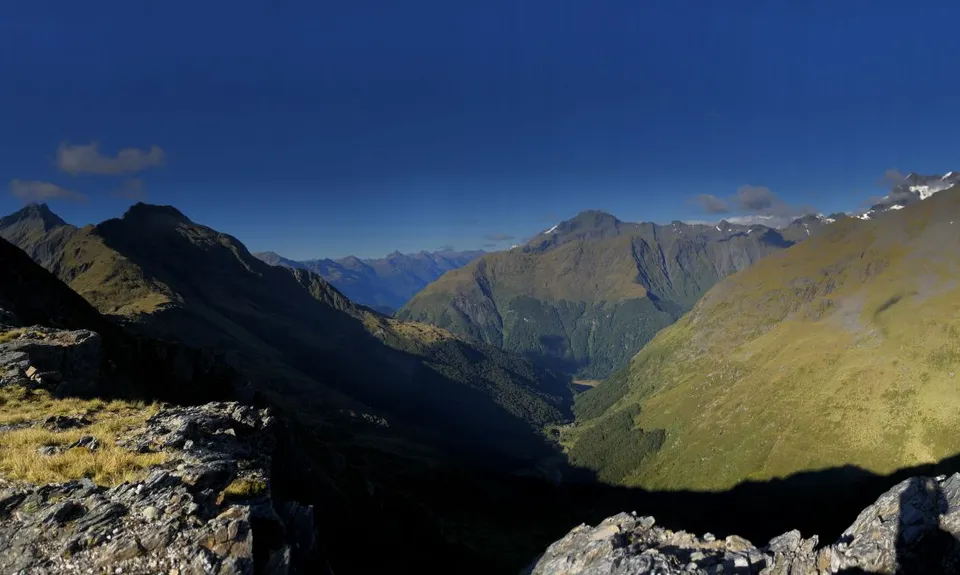
Take a moment to appreciate the cirque of mountains, before climbing steeply up the marked Gillespie Pass Route. The pass is exposed alpine terrain that is not advisable during adverse weather. Be aware that this pass can hold snow for a large part of the year; inquire about conditions with DOC, and be prepared with the necessary skills/equipment.

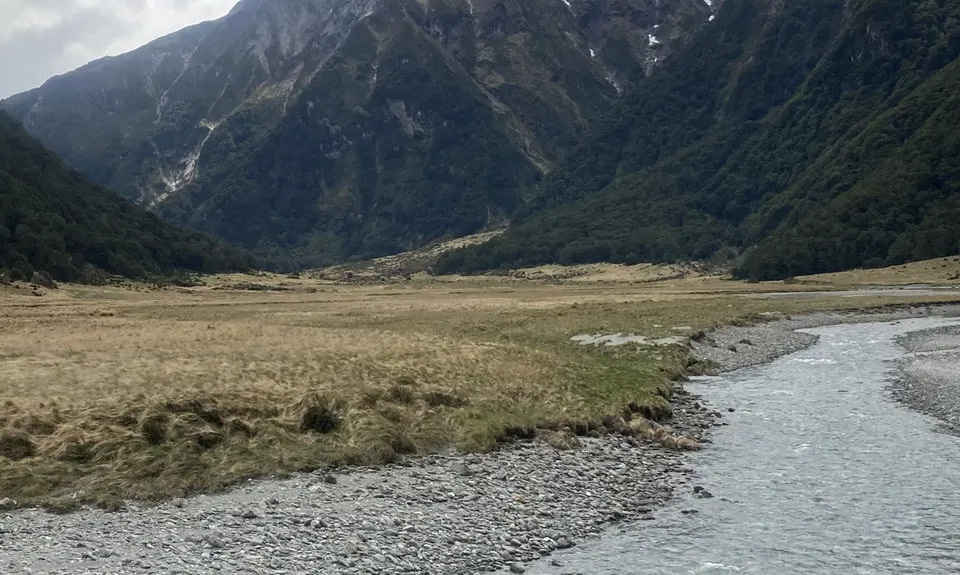
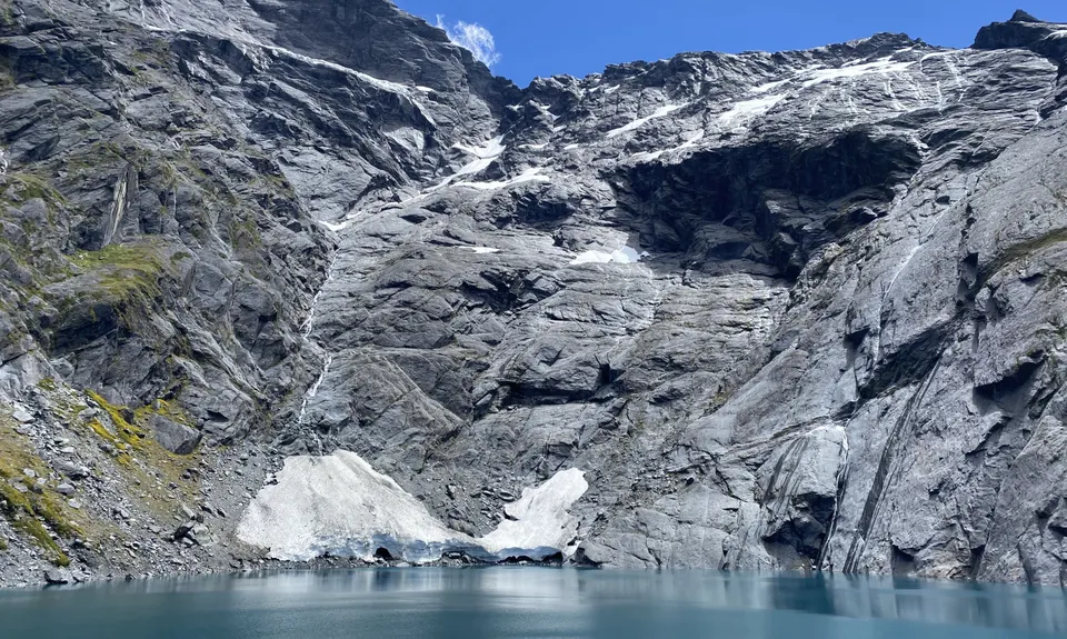
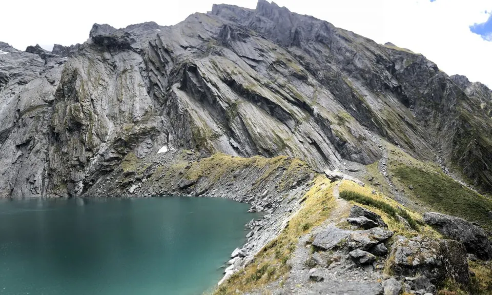
After taking in the stunning views from the pass, descend the steep and at times technical 1000m to Siberia Valley. Here, some parties might choose to add on an extra ~8km by climbing up to Crucible Lake. This is a worthwhile side trip if you have the time/energy. Either way, enjoy some very runnable terrain through Siberia, past the hut, and all the way down to the Wilkin River Valley, on a well-developed trail.

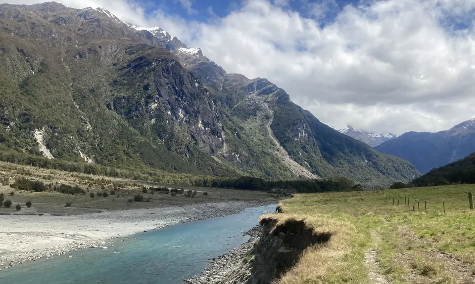
Follow this trail past the marked jetboat pickup, and through the flats and beech forests along the Wilkin River. The track is well marked through the beech forests, and intuitive through the flats. (Note: at one point the gpx track crosses the Wilkin briefly, only to come back across shortly after. This is not a necessary detour, but rather a voluntary swim on a hot day, the track is easily found on the true left bank).

Finally, meet the Makarora River and find a **suitable place to cross**. Take the short dirt road up to Highway 6, or to wherever you left a shuttle vehicle, and you've done it! If you're alone, hopefully you dropped a bike for the shuttle, or are keen to hitchhike or run the extra 8km of road back to your vehicle.

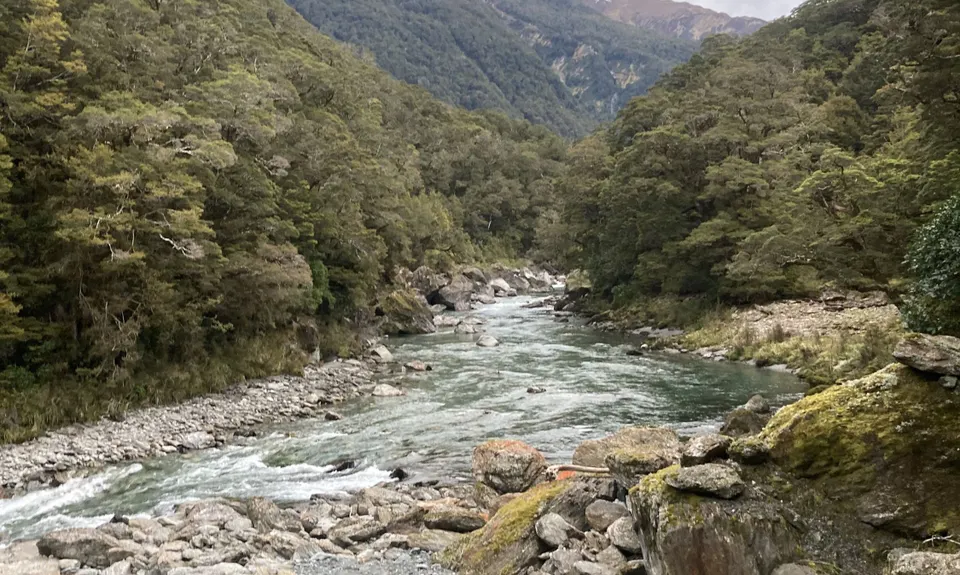
**WARNING: MAKARORA RIVER CROSSING** This is a serious river crossing that requires good conditions and river crossing skills. Even at normal water levels, it is a deep and fast-moving river. Heavy rain or snowmelt can quickly make this river uncrossable. If the Makarora is uncrossable, this route is not possible as described above. Consult DOC for information, and be prepared to scout the river crossing beforehand. It is advisable to scout both Makarora crossings in advance to gauge the conditions and to have a plan of where you will cross. Though relatively small compared to the Makarora, this warning holds for the Young River. There are options to start from the Blue Pools to avoid the first crossing and to take a jetboat out of the Wilkin to avoid the latter, but those fall outside the scope of this route description.


The carpark for the Young is small and might fill up during the summer months when this is a very popular 3-4 day tramping circuit. Best get there early. Alternatives would include starting from the Blue Pools, though this adds on almost 10km. Run your shuttle by dropping a car/bike at the Wilkin Valley access, or be prepared to hitch/run the 8km between the valleys.

3 km

2 minutes

Unknown

No

Hard.


Windfall and some small slips have made the track hard to find at a few spots along the Young and Wilkin valleys, but only for brief stints. Orange markers and poles are consistent throughout the route, look for them.

One might expect the route to hit the lowest point of the pass, but it does not. Follow the orange poles south, ascending along the ridge that forms the pass, before descending towards Siberia Valley.

Non-existent.

Waterproof leggings, Long-sleeved thermal top, Seam-sealed waterproof jacket, Windproof jacket, Gloves, Beanie/thermal headwear, Personal Locator Beacon (PLB), Whistle, First aid kit, Extra food for emergencies, Survival bag, Cellphone, Compass, Map, Headtorch and spare batteries, Crampons / microspikes (for winter conditions), Gaiters.

Water is plentiful throughout the route, except from Young Basin to the far side of Gillespie Pass, take some water with you for the strenuous climb.

Gillespie Pass can hold snow for much of the year, even during summer months; educate yourself on the current conditions, be prepared to assess the risks for yourself, bring the appropriate equipment, and be prepared to turn around if conditions aren't favorable. The pass is also exposed to high winds and cold temperatures throughout the year.

The Makarora/Young River crossings are extremely hazardous at high-water levels; see warning in description. Numerous smaller stream crossings along the can also present hazards during or after periods of heavy rain or snowmelt.


From DOC: "A dam that formed in the Young valley North Branch in 2007 still poses a potential risk to trampers. We recommend you avoid the Young valley during periods of heavy rain. If heavy rain starts during your trip, do not camp in the valley floor and move through the valley as quickly as possible. Watch for any unusual or rapid rises in water levels and move to higher ground if necessary."

Wonderland Lodge
Makarora (between the Young and Wilkin Valley's along highway 6)
https://www.wonderlandlodge.nz/
Great local place to grab a beer and chips while you look across at where you ran!

You and Gillespie Pass Circuit

As a VIP member you can record private notes for this trail, see all of your times and more.

Register Now

Already have an account? Login now

Trail Reviews

My favourite NZ trail so far. Take your time. Do it over a few days and stay in the huts. Make the side trip to crucible lake. Savour every second in this wild, remote, breathtakingly beautiful place 🤩

Lauren Mai Anderson

February 22, 2022

Awesome trail with so many different parts and views. Some of the bush part is slow going but the majority is runnable. I started at the Blue pools car park which adds on 7km but means you skip the first river crossing. Highly recommend :)

Katie Morgan.

February 22, 2022

Stunning day out with plenty of variation and amazing views. There’s a few slower bits (mainly because if tree roots) but mostly runnable. The detour to Crucible is well worth it, although it is was slowest going section of the day for myself (steep and treeroots). Take the Makarora crossing serious!

Mervyn Van Gompel

January 30, 2022

Login to submit a review

Trail Running Community

Find people who are interested in or have completed this trail run.

You must register or login to view this feature.

Register Now

Overlapping Trails

These overlap with this trail to some degree. You may wish to combine them but please note that to qualify for FKTs on these runs you should record a separate activity for each.

Gillespie's Pass Return

Gillespie's Pass Return

Length: 48.0km

Level: Intermediate - Experienced

Other trails nearby
Mt Shrimpton Track

Mt Shrimpton Track

Length: 8.3km

Level: Beginner - Intermediate

Brewster Bimble

Brewster Bimble

Length: 5.4km

Level: Beginner - Intermediate

Find more trails and peaks nearby