Last Updated: 21st Sep 2023

Beginner - Intermediate

Save Trail Save

I've done it Done

Shirt Tail Grunt

Kingston, Otago

Submitted by Fleur Douglas

Last Updated: 21st Sep 2023

Beginner - Intermediate

Save Trail Save

I've done it Done

Open

Grunt Factor: 6 ?

Gnarl Factor: 88 ?

1.8km

200m

200m

517m


Login as a VIP to see driving directions, distance and time.

Trail Map

Type of Run

Urban fringe

Out and Back

Very hilly

Dog Friendly

Native bush

Run Makeup

10%
30%
40%
20%

Easy Single Track

Moderate Single Track

Technical Single Track

Untracked / Route only

Average Uphill Gradient: +24.1%

Average Downhill Gradient: -22.6%

Trailhead

Login as a VIP to see the trailhead information.

Estimated Times to Run

0:45

Slow

0:30

Moderate

0:15

Fast

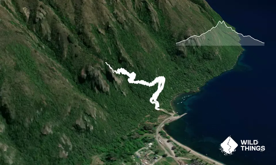
Leave the carpark clearing and head directly up the hill. Don't get distracted by the tempting flat trails to your left or right - you're here for a steep uphill!

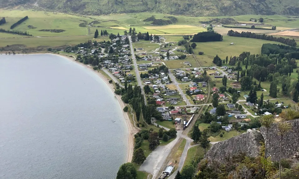
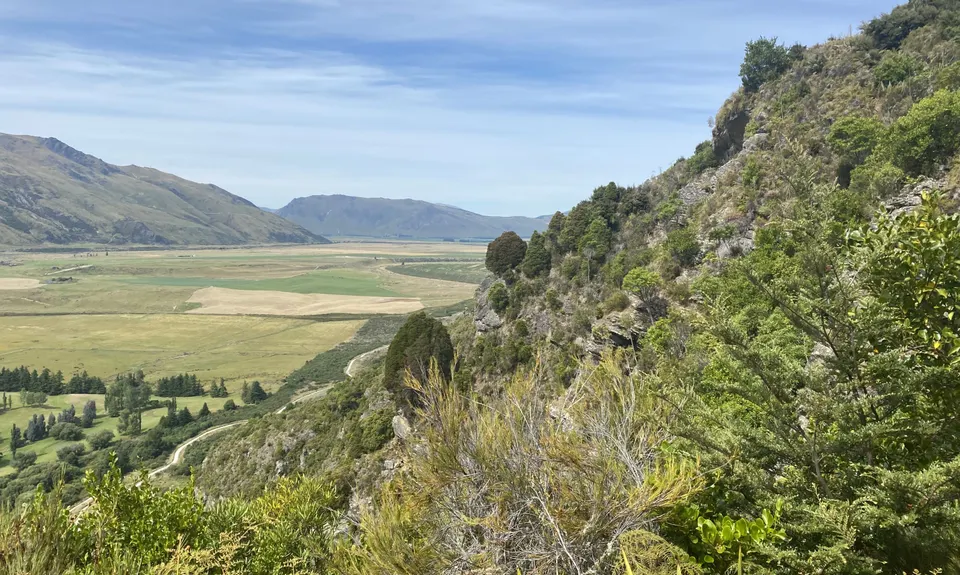
The trail is marked and directly in front of you. The DOC sign estimates 2 hours return - you can beat that! To begin with, you're on a lovely single track, and a relatively easy gradient. Turn the corner and there's a seat to stop, catch your breath, and enjoy the view of Kingston township. From here the trail begins to steepen and become more technical. You'll soon get to a DOC sign warning about slippery rocks - be careful with them in wet weather, because you're clambering up them.

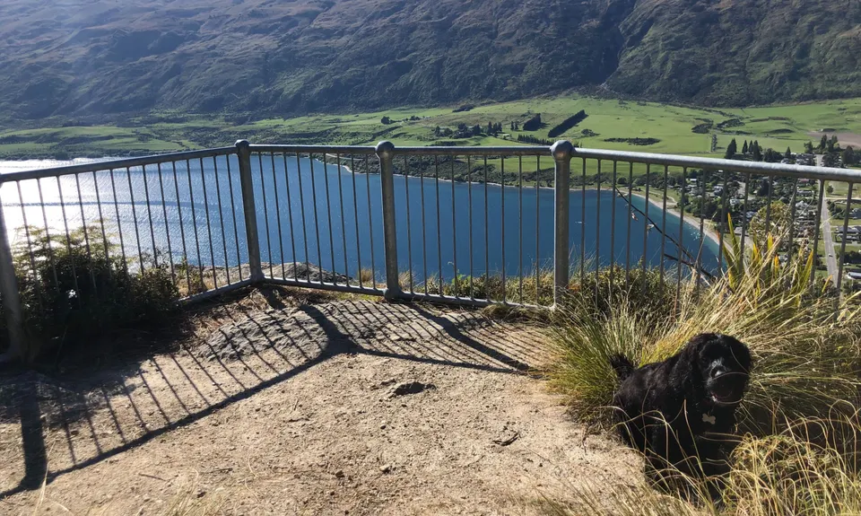
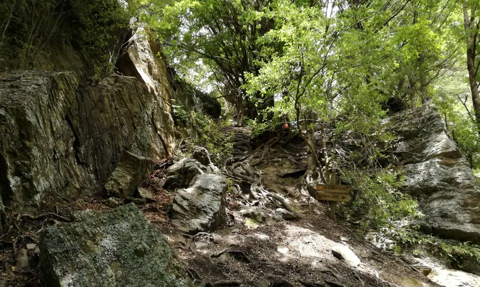
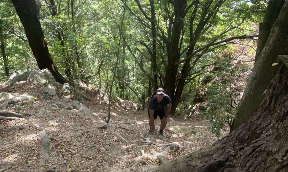
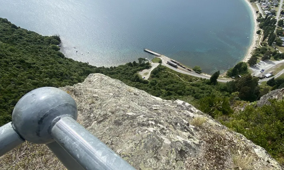
This will take you up to the small stream you need to cross, and that's when it gets really fun. Cross the stream, and that's the end of the marked track. The steep slope in front of you is what you need to go up. Veer as far left as you can - use the tree roots to help you up some of the steeper parts. Soon, you'll come across a sign - Viewpoint (left) / Bushline (right). Head LEFT. It's a very short grunt from here before you head left toward the light, and suddenly come out on a little bluff. Follow the trail again for another 50m to the viewpoint: stop and enjoy the view! And then - head right back down the way you came, enjoying the sweet downhill!

You cross a small stream with a lovely waterfall. There's a natural climbing wall just off the trail. Beautiful views up Lake Wakatipu and down the valley from the top.

Plenty of parking in the clearing at the start of the track, or back at the cafe.

0 km

1 minutes

Yes

No

Moderate.

After the stream crossing, make sure you are heading straight up the slope, to the right of the bluff. Too far left you'll end at the base of the climbing wall, but too far right you'll be heading up Mt Dick. Stick as close to the bluff as possible.

Perfect throughout.

Whistle, First aid kit, Extra food for emergencies, Cellphone, Map

Lake Wakatipu at the start of the track or easy access to the stream most of the way up.

The rock section is very slippery in wet weather and extreme care would need to be taken.

Slippery rocks and steep slopes. The beech trees on the steep section ensure a constant cover of leaves that are very easy to slip on.

Kingston Flyer Cafe & Bar
Kingston
Simply the best place to sit and enjoy a well deserved beer and bowl of chips after you've nipped up the hill, situated in the old station house.

Trail Legend

BH

Brad Harvey

has completed Shirt Tail Grunt 3 times in the last year.

Learn about Trail Legends.

You and Shirt Tail Grunt

As a VIP member you can record private notes for this trail, see all of your times and more.

Register Now

Already have an account? Login now

Trail Reviews

Awesome Short and Sharp Trail... or you also go right and just follow the blue flags and spend almost 2 hours out there.
Highly recommend at least heading up a bit further, awesome trail with some incredible views either way

Brad Geen

December 4, 2022

Second offense here, always gets the heart going!

Tony Sharpe

January 15, 2022

Thought I’d give this a whirl on my way through to Kepler. It was wet and I had my non-grippy road shoes on. Yes it was beautiful at the lookout but the dicey climb up there and down again was not what I should have been attempting the day before a big race 😆

Joe Benbow

December 5, 2020

My favourite little local, I do this on a near daily basis. If you're looking for the best view closest to Kingston, you can't go far wrong with this one.

Fleur Douglas

May 21, 2020

Login to submit a review

Trail Running Community

Find people who are interested in or have completed this trail run.

You must register or login to view this feature.

Register Now

Other trails nearby
Lorn Peak Lunacy

Lorn Peak Lunacy

Length: 12.3km

Level: Intermediate - Experienced

Ridging Ross Spur

Ridging Ross Spur

Length: 36.2km

Level: Experienced

Find more trails and peaks nearby