Wild Things - New Zealand's trail running community
New Zealand's trail running community

Login


don't have an account?

Ridging Ross Spur , Otago

Trail Directory proudly supported by Further Faster

Update Your Header Picture

Ridging Ross Spur Experienced

Submitted by Zak Brown

Info Info
Map Loading

Trail Information

36.20km

2960m

2780m


Otago

Kingston

Back country - remote

Point to Point (one way)

Very hilly

Open tussock/grasslands
Open ridges/tops

Experienced

Not Suitable (Slow)
8:00 (Moderate)
5:00 (Fast)

-15.2%

+16.6%

Download PDF Guide

Fastest Known Times (FKTs)

Please set your gender to see your position on the FKT leaderboards.

Men

There are currently no male FKTs for Ridging Ross Spur .

Women

There are currently no female FKTs for Ridging Ross Spur .

Filter FKTs

The more , the harder the FKT will be to beat. Learn about Fastest Known Times.

Missing your time?

Register or login as a VIP and get yourself on the FKT leaderboard!

Register Now

Description

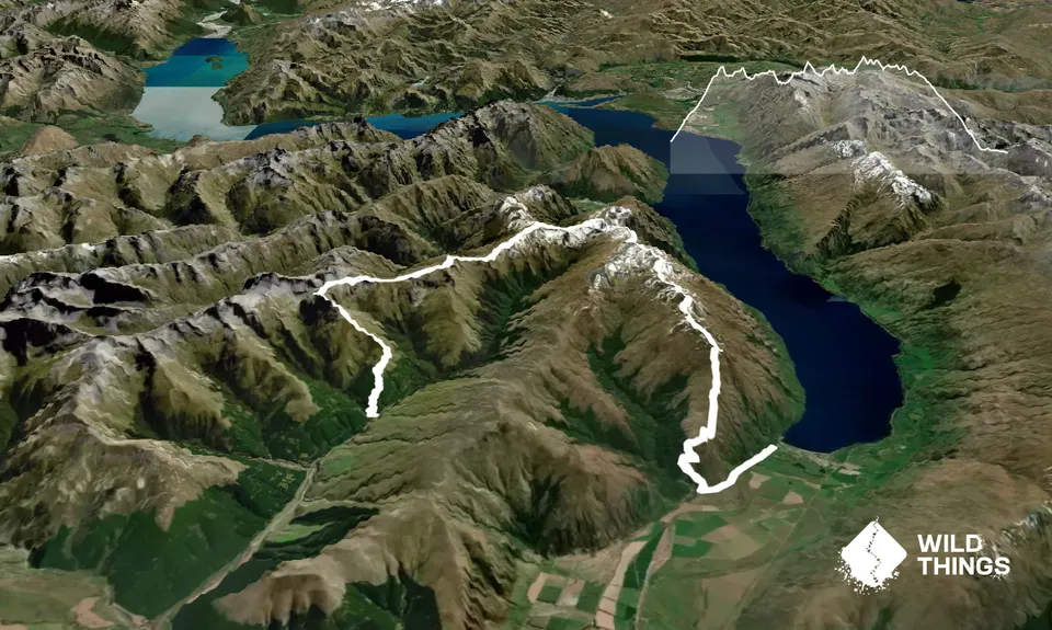
From the drop off point head up the forest track for a couple hundred meters before turning left through the gate to start the incline up Ross Spur. The track meanders through pine forest, eventually opening up and ending at around 1180m at the remnants of a fence line. That's the last of a track or marker you'll see until the end of the decline to Kingston.

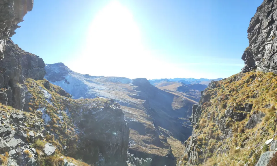
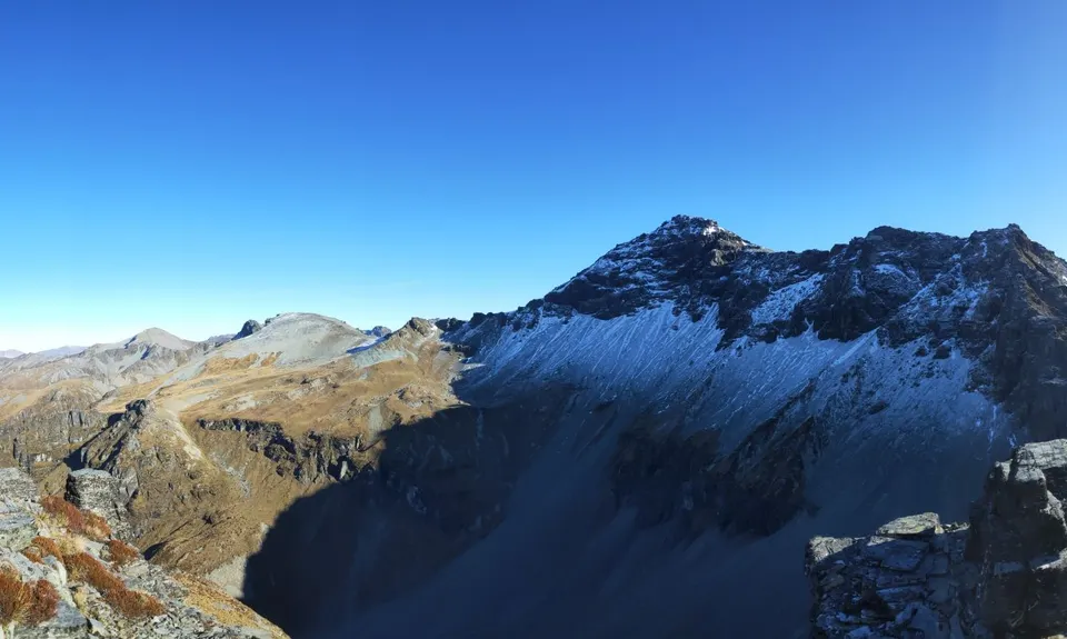
Keep heading up towards the 1400m contour in the general direction of the peaks at Pt1672. At around 1400m you can either continue up and climb through the crags and sidle the NE flank at around 1600m or begin to sidle immediately at around the 1400m contour joining up again directly north of pt 1672 at the creek. If you've gone the higher more technical route, you will descend on the NW side of the outcrop underneath the massive southern face of Symmetry Peaks.

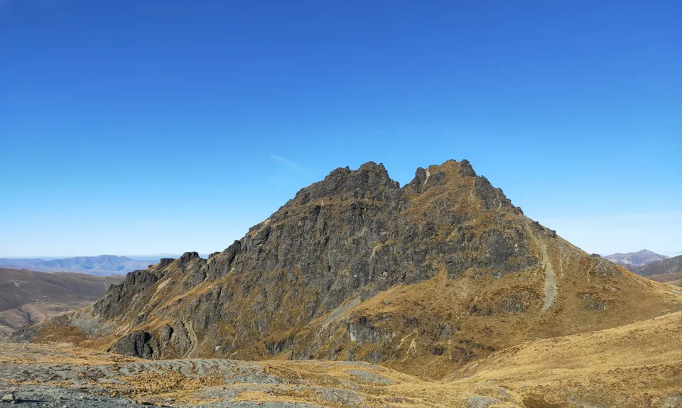
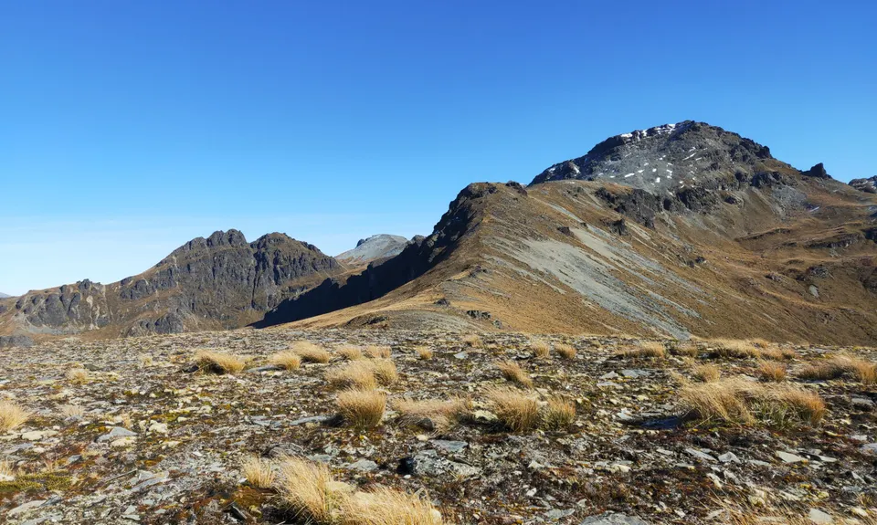
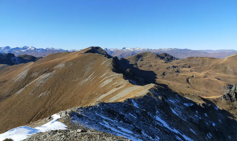
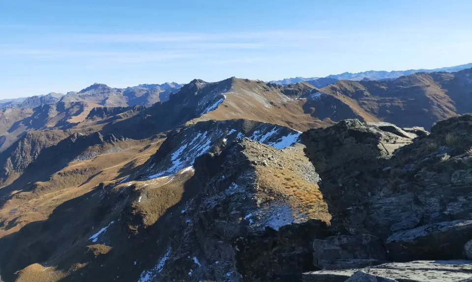
Head NE from here towards Pt1640, either hugging the rocky terrain higher up or descending and ascending down by the creek and skirting the wee cliff up to the Pt. From here you pretty much follow the ridge all the way around to Mt Dick. Don't expect to be going too quick though, there is a lot of undulation and the terrain is pretty tough going. There are also those tricky rock scrambles.

Once at Mt Dick keep following the ridge to the trigs then duck onto to the 4wd track which will take you down to the Glen Allen Track and eventually Kingston. If your nerves haven't already been shaken enough then you can take the alternative descent home from around the 1400m contour linking up with the Shirt Tail track. This is hard to navigate on a descent though so I would leave that for the ascent if you're doing this route in the opposite direction.


Trail Community

Find people who are interested in this run.

You must register or login to view this content.


Make Up of Run

Untracked / Route only: 70%

Farm Road / 4WD Track: 25%

Gravel Road: 5%


Route Data

Reviews:

You must register or login to view this content.

Photos:

You must register or login to view this content.

Your Trail Wishlist

All the runs that are on your To Do list (no limit).

Add to wishlist view wishlist

Your Trail Dreamlist

The runs you most want to do (limited to 10).

Add to dreamlist view dreamlist

Wild Explorers

I did it!
  • Access

    Allow for 30-40 minutes from the turn off SH6 at Fairlight Station. Follow Cainard Road (unsealed) west for 9km then continue due north on the farm track following the DoC poles as far as you can go. Start is just after the creek crossing as the forestry road begins it's incline, approximately where the Derelict Hut is marked on the Topo50 map. You'll need a vehicle with some clearance to get all the way here. 4wd to be safe.

    Get someone to drop you off and meet you at the other end. This one is great for keeping your designated driver occupied as there is good out and back running either end around Ross Spur or Kingston to keep them busy.

    27 km

    45 minutes

    No

    No

  • Staying Safe

    Hard.

    There are no markers or tracks for the majority of this route. Study the GPX and the topo maps and know your ability.

    Patchy.

    Waterproof leggings, Thermal leggings, Lightweight fleece top, Short-sleeved thermal top, Long-sleeved thermal top, Seam-sealed waterproof jacket, Windproof jacket, Gloves, Beanie/thermal headwear, Personal Locator Beacon (PLB), Whistle, First aid kit, Extra food for emergencies, Survival bag, Cellphone, Compass, Map, Headtorch and spare batteries, Crampons / microspikes (for winter conditions), Gaiters.

    Running water at the creek just north of pt 1672. That's it. Take as much as you can.

    Not for winter. Exposed to cold winds on tops at any time of year. Could be icey on cusp seasons. Summer recommended. Creek could be dry in Summer.

    There is some significant rock scrambling requiring - all 4s and a lot of concentration, both near the start (Pt 1672) and at the furthest point in the route (Pts 1715, 1682 and 1636) so if you haven't got the experience to get through these areas DO NOT attempt this at all as there are no alternative ways through these points (other than the first one as described).

  • Post run indulgence

    Kingston Flyer Cafe and Bar
    221 Kent Street, Kingston 9373
    Had some good hearty meals here post runs. Very friendly staff and nice comfortable dining area.

  • Blog Posts and Articles
  • Sponsor this trail

    If you are interested in learning about sponsorship opportunities, please get in touch below:

    Submit

See other runs nearby:

Shirt Tail Grunt
Lorn Peak Lunacy

Show all

Got a favourite trail? Tell us about it.

Share the love and add your favourite trail(s) to our growing trail directory.

Submit A Trail

Become a member today

Start enjoying the many benefits to becoming a member of our thriving community.

Become a member

Great brands at great prices with our VIP member's discount

Stay up to date

Sign up to our newsletter for latest offers and trail guides

Share this trail with a friend:

VIP Membership

Please register as a VIP or login to your VIP account to view this content.

Cancel Login Register

Membership Required

You can see up to three trail guides without being logged in but after that we require you to be logged in to your Free or VIP account. If you don’t yet have an account you can register here.

Login Register