Last Updated: 21st Sep 2023

Beginner

Save Trail Save

I've done it Done

Pretty Papatowai

Balclutha, Otago

Submitted by Kieran Philip

Last Updated: 21st Sep 2023

Beginner

Save Trail Save

I've done it Done

Open

Grunt Factor: 14 ?

Gnarl Factor: 23 ?

13.2km

215m

215m

61m


Login as a VIP to see driving directions, distance and time.

Trail Map

Type of Run

Front country - easily accessible

Combo

Undulating, small hills only

Native bush

Beach

Coastal

Run Makeup

5%
15%
65%
15%

Sealed Road

Gravel Road

Easy Single Track

Untracked / Route only

Average Uphill Gradient: +4.0%

Average Downhill Gradient: -3.8%

Trailhead

Login as a VIP to see the trailhead information.

Estimated Times to Run

2:00

Slow

1:30

Moderate

1:00

Fast

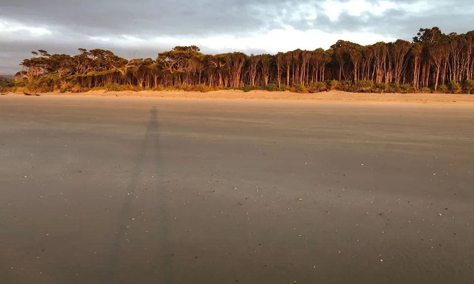
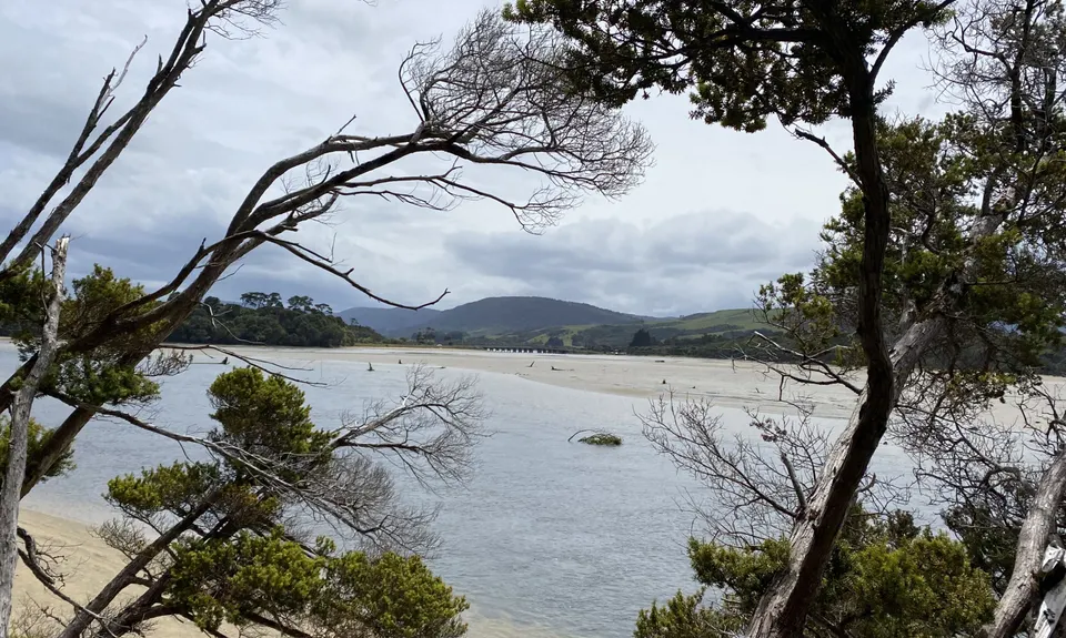
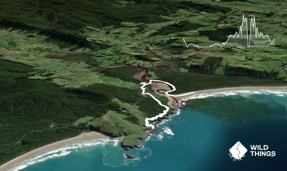
Starting in the middle of Papatowai at the DOC Campsite, head to the main road and take a right. No need to run on the road as there is a nice wee track that winds its way beside the road. Head over the bridge, and just after coming off the bridge take a right in to the Old Coach Road area, follow this track along and out on to the beach at the head of the estuary.

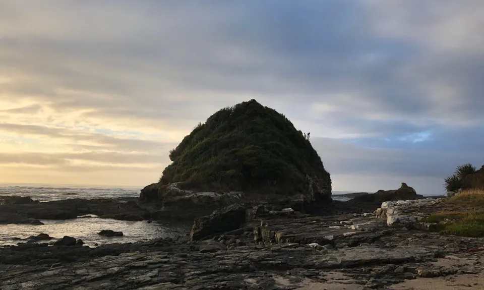
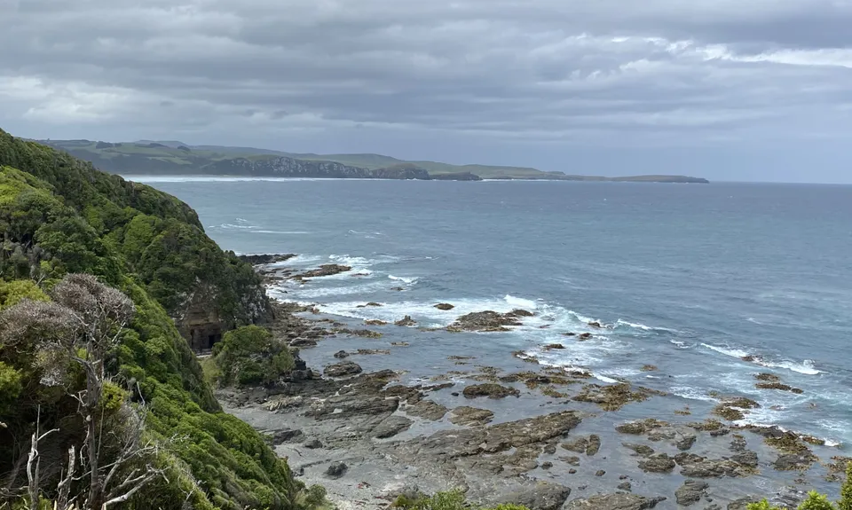
Head along the beach for as long as your heart desires. This guide went out 800m or so and then back. Follow the same track back to the bridge. On the return, there is the cool wee option of the local bush walk which is a wee loop on the right hand side of the main road with the entrance located on the corner of it and Tahakopa Valley Rd. This is a wee loop with some fun wee signposts etc to look at on your way round (would also be good for a stroll around with kids if you were so inclined). Once back at the store you could cut it off there (6.5km) or can continue up the road. Take a left into Alexandra Rd (opposite Gyspy caravan) and then a right in to Cross St. At the end of Cross St you'll reach the Picnic Point walkway, which you follow through the forest until you reach an intersection with the Kings Rock track. Take a right here and follow this up through the bush, follow some poles across a paddock and then down to the beach. A good wee rock to scale if you're keen. Track back the way you came, back to the store.

Beach views, native forest, cute wee local bush track.

Parking off the road, fairly public, keep the valuables out of sight.

56 km

47 minutes

Unknown

No

Easy.

Generally good.

Windproof jacket, Gloves, Beanie/thermal headwear, Whistle, First aid kit, Extra food for emergencies, Cellphone, Map

No drinkable water around

Can be very wet and wild when the weather is rough, not too bad in the bush cover though, could get pretty muddy.

You and Pretty Papatowai

As a VIP member you can record private notes for this trail, see all of your times and more.

Register Now

Already have an account? Login now

Trail Reviews

Beautiful, and good to have lots of options to make your run longer or shorter. You can also run up the estuary from the bridge all the way to picnic point (2-3 hours either side of low tide) and you can access this direct from the doc campground, if you want to cut out the road section.

Maggie Davies

January 28, 2020

Login to submit a review

Trail Running Community

Find people who are interested in or have completed this trail run.

You must register or login to view this feature.

Register Now

Other trails nearby
Sandhills, Cannibals & Sea-Lions

Sandhills, Cannibals & Sea-Lions

Length: 9.0km

Level: Beginner

Jack's Bay Beach & Blowhole

Jack's Bay Beach & Blowhole

Length: 4.5km

Level: Beginner

The Tautuku Tiptoe

The Tautuku Tiptoe

Length: 7.7km

Level: Beginner - Intermediate

A Little Bit of Clutha

A Little Bit of Clutha

Length: 6.3km

Level: Beginner

Find more trails and peaks nearby