Wild Things - New Zealand's trail running community
New Zealand's trail running community

Login


don't have an account?

Coleridge to Bealey Beer Run , Canterbury

Trail Directory proudly supported by Further Faster

Update Your Header Picture

Coleridge to Bealey Beer Run Intermediate - Experienced

Submitted by Tony Sharpe

Info Info
Map Loading

Trail Information

41.60km

1100m

1000m


Canterbury

Lake Coleridge Village

Back country - remote

Point to Point (one way)

Undulating, some big hills

Native bush
Plantation/exotic forest
Riverside
Open farmlands
Open tussock/grasslands
Open ridges/tops

Intermediate - Experienced

8:00 (Slow)
6:00 (Moderate)
4:00 (Fast)

-6.2%

+4.9%

Download PDF Guide

Fastest Known Times (FKTs)

Please set your gender to see your position on the FKT leaderboards.

Men

There are currently no male FKTs for Coleridge to Bealey Beer Run .

Women

There are currently no female FKTs for Coleridge to Bealey Beer Run .

Filter FKTs

The more , the harder the FKT will be to beat. Learn about Fastest Known Times.

Missing your time?

Register or login as a VIP and get yourself on the FKT leaderboard!

Register Now

Description

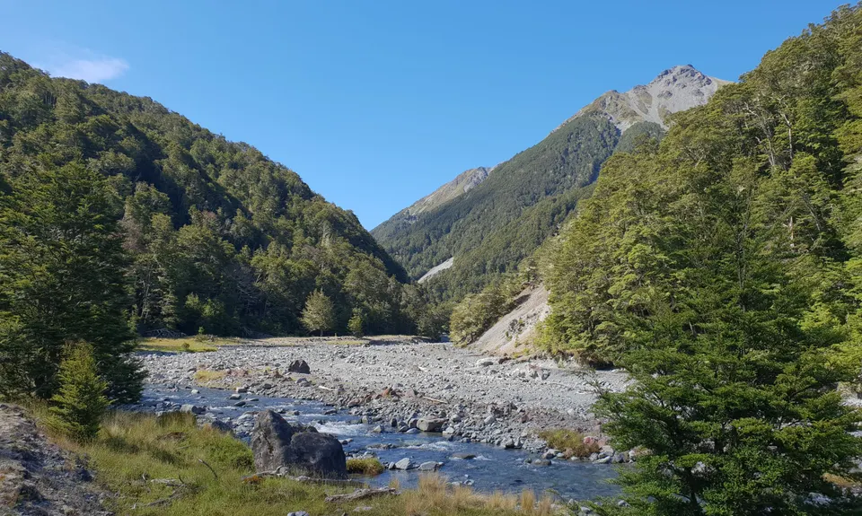
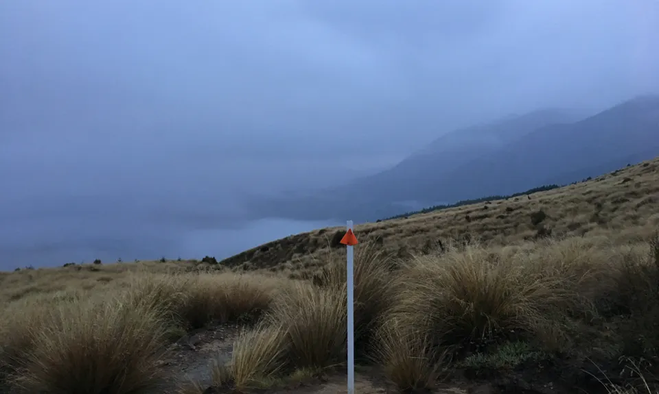
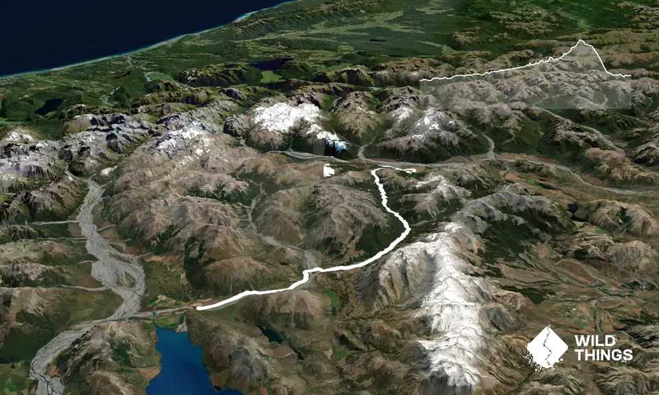
Description is north bound on Te Araroa Trail from the head of Lake Coleridge to the Pub, taking in the Harper Valley Track and the Lagoon Saddle Track. Begin by picking up the trail markers and poles beside the Harper River. The first 6-7 km are easy trails and farm tracks up the north bank (True Right) of the Harper, until you reach the confluence with the Avoca River. The best ford for the Avoca is a bit upstream but in low flows you should be able to find multiple crossing points without too much drama. If its flooding you shouldn't be there at all, so check river levels/ rainfalls first.

Once across the Avoca head out back towards the marked farm tracks beside the Harper, still on the true right bank. Take care to avoid the large swampy area which is well marked on the topomap. The author failed and lost half an hour of grovelling instead! A few more km's upstream you'll be ushered across the Harper River by marker poles and onto the true left. Shortly up from here you'll be treated to the amazing views up to the Harper River Pinnacles. Beyond the pinnacles the trail weaves back and forth across the river, with numerous crossings.

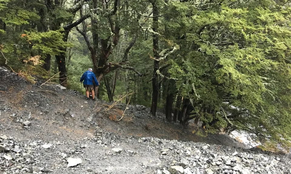
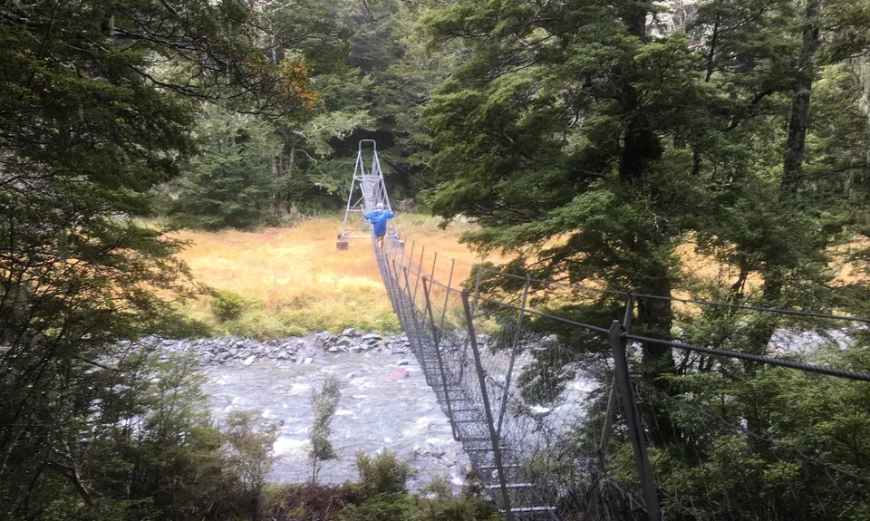
Eventually the valley begins to narrow and you near the signposted turnoff to Hamilton Hut. Ignore the sign unless you want to bag the hut, instead stay in the river to streambash another few hundred meters until you notice a swingbridge overhead. Hop out of the river and pick up the track now on the true right heading upstream. Running becomes more technical and undulating from here, as the trail winds its way over a few spurs and up valley. After several forested lumps and bumps you'll reach the character hut known as West Harper Hut, a true gem, a piece of NZ backcountry history.Beyond here the going gets rougher as the upper Harper valley begins to close in.

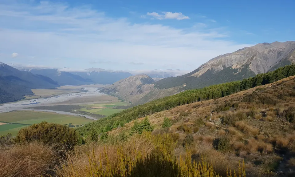
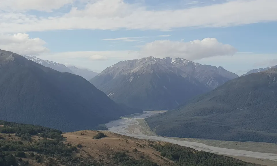
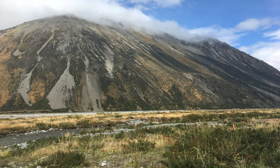
Make sure you pay attention at river forks- take car to find cairns and markers in the river bed as it would be possible to take a wrong turn. Eventually the river section closes in further and the trail heads up into the bush on a steep section of spur. From here its a mix of steady climbing and small stream crossings until you reach a junction to Lagoon Shelter near the Lagoon Saddle bushline. One last burst of uphill and your hit the high point and round the corner to stunning sweeping views of the upper Waimakariri Basin and Arthurs Pass National Park Descending to Cora Lynn can be a bit muddy at times for the first couple of km's but this settles down when you eventually pick up the forest and complete the descent. Look out for stunning displays of native mistletoe in the lower sections around Xmas. Unless your pick up is the trailhead you now have 4-km of road bashing down to the main highway and round to the Bealey Pub to grab a well earned beer. Watch out for traffice on the main road though.


Trail Community

Find people who are interested in this run.

You must register or login to view this content.

Features of interest

Te Araroa Trail, Harper River, Pinnacles, Lagoon Saddle


Make Up of Run

Untracked / Route only: 5%

Technical Single Track: 40%

Moderate Single Track: 25%

Farm Road / 4WD Track: 20%

Sealed Road: 10%


Route Data

Reviews:

You must register or login to view this content.


Overlapping Runs

The following trails overlap with this run to some degree. You may wish to combine them but please note that to qualify for FKTs on these runs you should record a separate Strava activity for each

Lake Lilian Track

Lake Lilian Track

Length: 20.90km


Photos:

You must register or login to view this content.

Your Trail Wishlist

All the runs that are on your To Do list (no limit).

Add to wishlist view wishlist

Your Trail Dreamlist

The runs you most want to do (limited to 10).

Add to dreamlist view dreamlist

Wild Explorers

I did it!
  • Access

    From the inland highway turn off at Windwhistle up past Terrace Downs. Keep heading up valley on the main road until you reach Harper Road, which you follow up past a series of small lakes until you reach the settlement at the head of Lake Coleridge around Glenthorne Station. This trail commences shortly after the bridge over the Harper River, look of the DOC sign.

    If coming from the other end the Bealey Pub is the start finish

    You'll need a drop off and pick up for this one, support drivers allow about 1 to 1.5 hours for the drive round from end to end

    33 km

    103 minutes

    No

    No

  • Staying Safe

    Moderate.

    There are several places where there isn't really a trail in the Harper, but it is pretty well marked. Take care to pick up marked when passing river confluences

    Non-existent.

    Waterproof leggings, Thermal leggings, Lightweight fleece top, Long-sleeved thermal top, Seam-sealed waterproof jacket, Windproof jacket, Gloves, Beanie/thermal headwear, Personal Locator Beacon (PLB), Whistle, First aid kit, Extra food for emergencies, Survival bag, Cellphone, Compass, Map, Headtorch and spare batteries, Gaiters.

    Lots of river crossings, plenty of water

    Winter/ spring can be snowy. Take care to check river conditions and forecasts before setting out and tell someone (probably your driver) when and where you are heading

    Multiple river crossings
    Adverse weather has potential to make areas impassable when flooding or heavy snow
    Avalanche risk in Winter/ early spring in some area
    Navigation needed to be good in some areas

  • Post run indulgence

    Beer and chips at the Bealey pub will taste pretty good

  • Blog Posts and Articles
  • Sponsor this trail

    If you are interested in learning about sponsorship opportunities, please get in touch below:

    Submit

See other runs nearby:

Peaking Out

Show all

Got a favourite trail? Tell us about it.

Share the love and add your favourite trail(s) to our growing trail directory.

Submit A Trail

Become a member today

Start enjoying the many benefits to becoming a member of our thriving community.

Become a member

Great brands at great prices with our VIP member's discount

Stay up to date

Sign up to our newsletter for latest offers and trail guides

Share this trail with a friend:

VIP Membership

Please register as a VIP or login to your VIP account to view this content.

Cancel Login Register

Membership Required

You can see up to three trail guides without being logged in but after that we require you to be logged in to your Free or VIP account. If you don’t yet have an account you can register here.

Login Register