Last Updated: 21st Sep 2023

Intermediate - Experienced

Save Trail Save

I've done it Done

Roadworks on the A1

Darfield, Canterbury

Submitted by Billy Powell

Last Updated: 21st Sep 2023

Intermediate - Experienced

Save Trail Save

I've done it Done

Open

Grunt Factor: 71 ?

Gnarl Factor: 82 ?

30.0km

1600m

2000m

1661m


Login as a VIP to see driving directions, distance and time.

Trail Map

Type of Run

Back country - remote

Point to Point (one way)

Very hilly

Native bush

Riverside

Open tussock/grasslands

Open ridges/tops

Run Makeup

20%
50%
30%

Moderate Single Track

Technical Single Track

Untracked / Route only

Average Uphill Gradient: +12.1%

Average Downhill Gradient: -12.3%

Trailhead

Login as a VIP to see the trailhead information.

Estimated Times to Run

Not suitable

Slow

6:30

Moderate

4:00

Fast

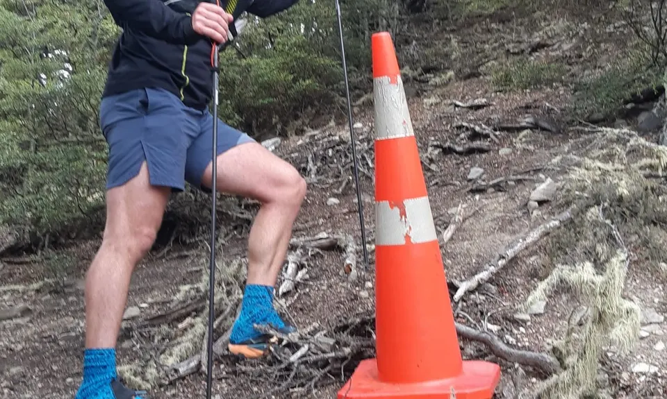
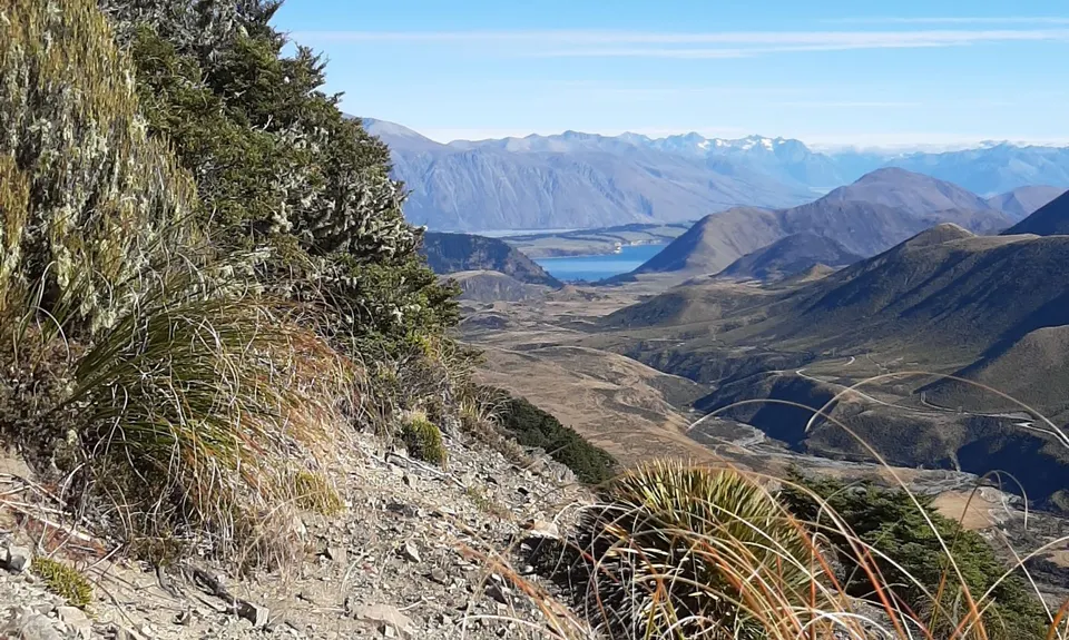
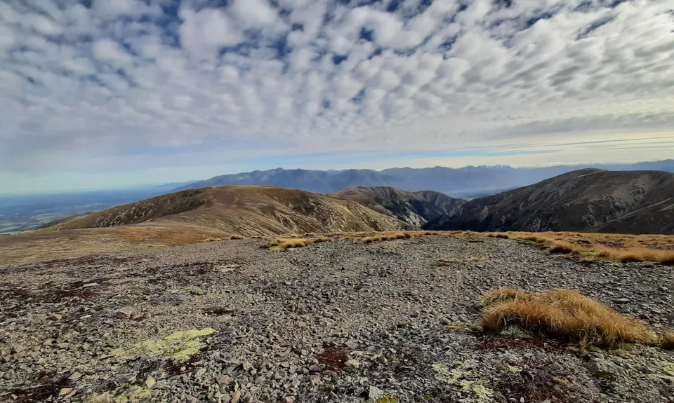
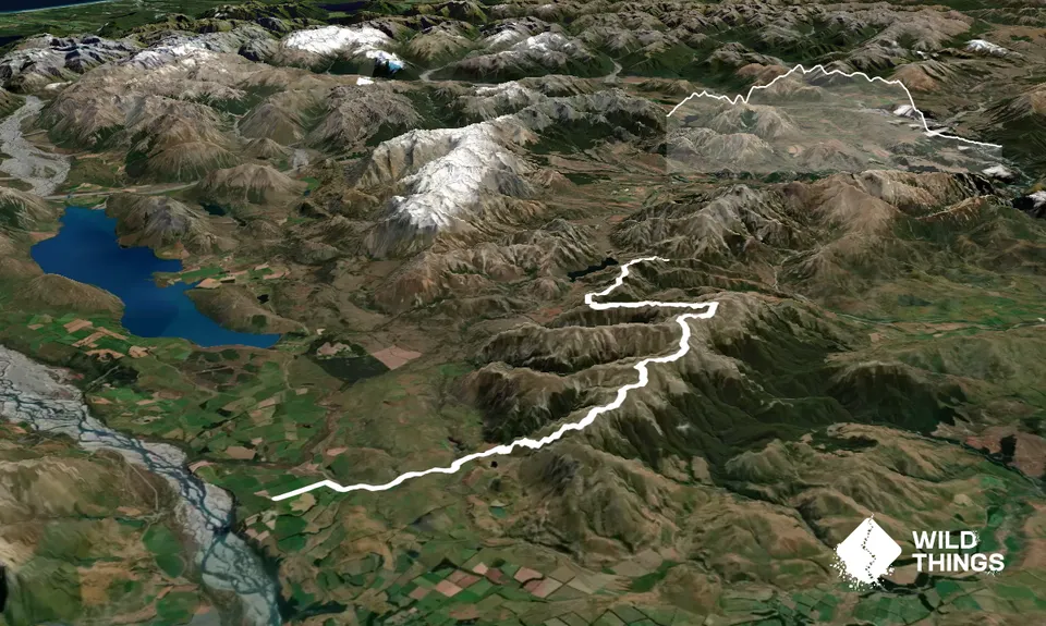
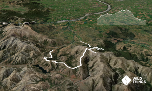
There's a reasonably well established trail to Trig-M and onward to Rabbit Hill (there is a bit of a bog in wetter weather). From Rabbit Hill ensure you cross on the South West side of the saddle to gain the next ridge (spot height 1327m), as there is a lot of undergrowth otherwise (don't be tempted to sidle on the East side). Look out for the traffic cone in the beach trees on the way up to the ridge, there's always road works on this route!...

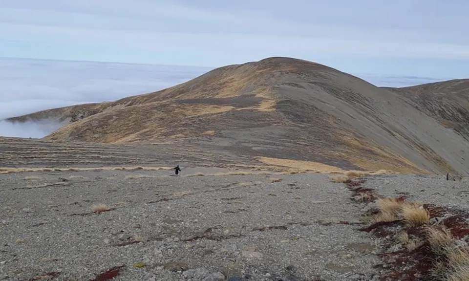
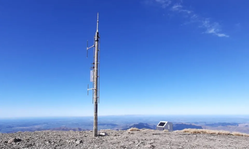
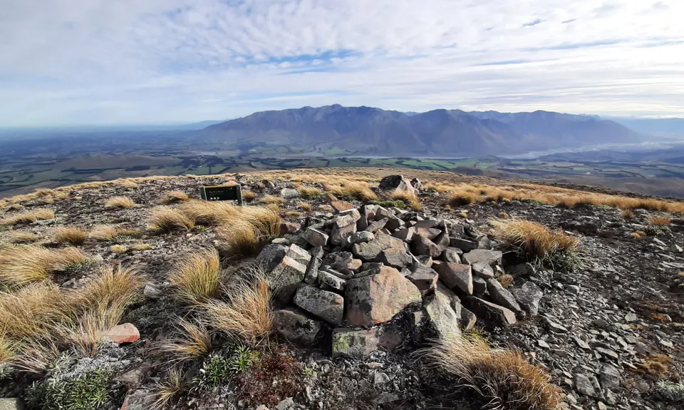
Follow the open ridge due East, following a vague track that appears to wind more than necessary trending upwards until you reach the weather station at 1660m on the wide open summit. Fantastic views here across to the Torlesse Range and down across Canterbury Plains. Take the steep scree slope directly South into a saddle, heading up through the rock formation the other side to gain the next ridge. This takes you up to Ben More (at 1655m, Pt 1402), now only marked by a jumble of old metalwork.

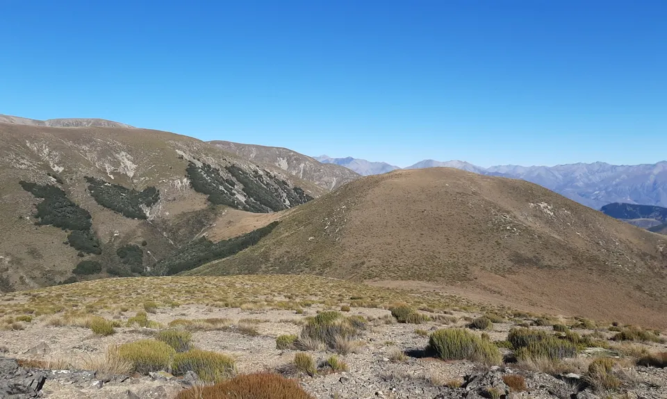
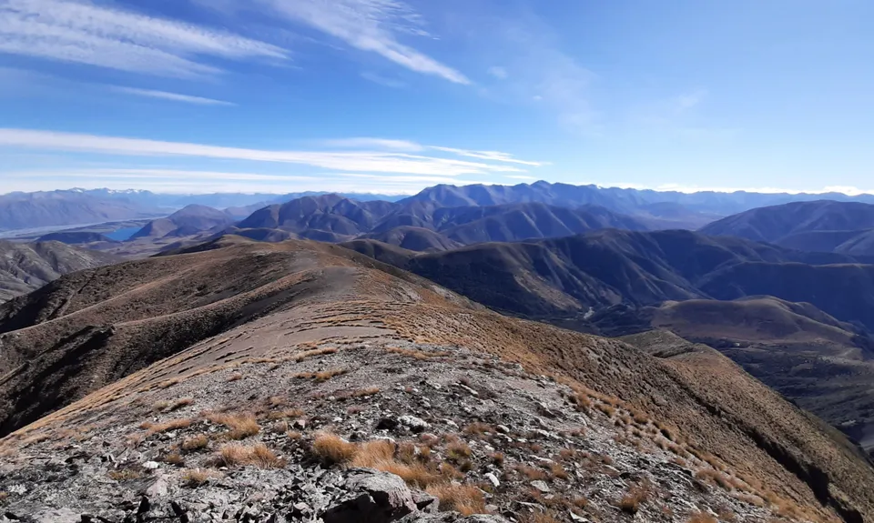
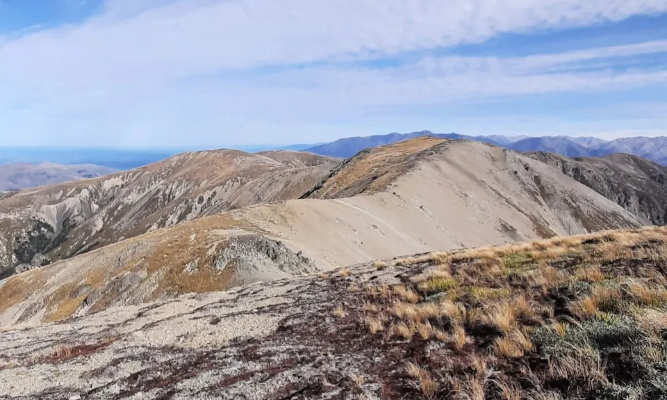
From Ben More you are on untracked terrain. This is where route finding becomes a bit harder as the ridge junctions are wide open and more numerous. Take the small saddle directly South of the main summit heading over spot height 1593m and follow this ridge South-West. Hold this line all the way to Big Ben, ensuring you don't head West at spot height 1549m. The ground underfoot is surprisingly runnable, with small scree terraces interspersed with very low lying vegetation. It does require attention though, as there are numerous larger rocks and small drop-offs to catch you out.

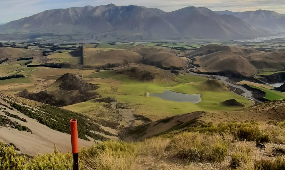
After taking in the DOC marked summit of Big Ben and lack of bell birds (geddit?!), it's time to descend. This is easier said than done, especially considering you're technically back on a marked route. Find the orange markers South West of the summit that steadily curl further West as you descend, passing over a short ridge, and following an old fence for most of the way (watch out for broken fence wire). This is where you begin to get intimate with your quads, matagouri and spear-grass.

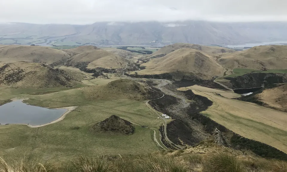
This is a harsh descent, but weirdly amusing picking the least painful options, and you get a fantastic view of the run out along the Dry Acheron Track. Once you hit the bottom, turn right (North) for roughly 50 metres to get onto the Dry Acheron Track - this is signposted towards the carpark, but on the side facing away from Big Ben, so it's easy to head straight towards the farm track/silos (don't).

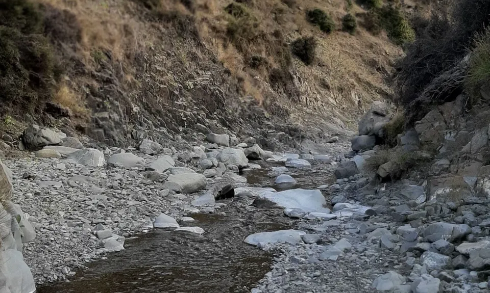
The Dry Acheron is a fantastic run out to finish off, with the matagouri keeping you awake nipping at your shins and calfs as you wind your way besides and across the stream. A strange mini-gorge to get lost in for the final few kms. In general, stick as close to the river as possible, with orange DOC posts situated ready to pull you back on route when you start to deviate (usually in the luckless pursuit of a less spikey path which invariably turn out to be sheep trails as matagouri closes in at head height!)

This is a lot more fun than my description, with a gentle downhill gradient, I swear. When you hit an impassable barrier across the stream in a mini gorge (not a passable one like the previous ones...), head out left where a DOC marker confirms where you should be. Here the running eases as the mini gorge opens out, and soon you follow a tree line alongside a paddock back to your waiting car.

This trail includes the peaks Rabbit Hill (Acheron), Ben More , Big Ben and Trig M.

The Dry Acheron Track is a strange mini-gorge with interesting rock features, and the Tussocklands scenic reserve really is special.

There is limited parking off the side of the SH73. Be aware that this is an alpine section of road with bends in the road reasonably nearby, ensure the road is clear before pulling out, and take time to slow and stop when pulling in. This is a one-way track, so you will need to leave a car at the Dry Acheron Track start on the Coleridge Road and do a shuttle. This car park is only small - do not block the gate, there is plenty of space to pull off beside the road elsewhere, but this is rarely busy. There is no public transport option, and the quickest shuttle is using the Lake Lyndon gravel road - be aware this is regular back country gravel road, not suitable for campervans, but fine for most other vehicles unless there has been significant snowfall.

43 km

32 minutes

Unknown

No

Hard.

These are covered in the route description, but care must be taken from Ben More to Big Ben to gain the correct ridges. This could be very difficult in foggy conditions and I would recommend advanced map reading skills and compass, or having a decent GPS. A good cell phone with NZTopoMaps loaded worked great for us, but we had back up options just in case. The descent from Big Ben is marked, but very rough and steep - in general, if it is too full of matagouri above ankle level, you are probably off route.

Patchy.

Waterproof leggings, Thermal leggings, Lightweight fleece top, Long-sleeved thermal top, Seam-sealed waterproof jacket, Gloves, Beanie/thermal headwear, Personal Locator Beacon (PLB), Whistle, First aid kit, Extra food for emergencies, Survival bag, Cellphone, Compass, Map, Headtorch and spare batteries, Gaiters

No potable water on the route. Stream is through a cattle farm at the end... otherwise there's a couple of bogs... maybe some snow at the right time of year?!

This is a very exposed ridge run, so unprotected for 80% of the time on the route from all weather conditions. Lots of drinking water would be required on a hot day, and plenty of sun protection. Wind protection a must, and prepare for changing conditions, this is an alpine route.

Low cloud can make navigation very difficult, as the run consists of a series of connecting open ridges and saddles to navigate - ending up on the wrong ridge could become serious as you would have to double back, or battle heavy bush growth (matagouri etc.) at lower elevations. In winter the ridges will be wind scoured snow/ice/rock that may make for easier running, but the saddles could become treacherous / impassable without spikes.

Watch out for the broken fence hidden in the bush on the descent of Big Ben.
Incredibly exposed for much of the run. Lots of broken rock / scree.

Willows Cafe
Glentunnel - Hororata Golf Club
https://www.hororatagolf.co.nz/cafe?ComeFromCat=1261
Incredible food, coffee and owners. This is where the Butcher's Pies are made. Nom nom.

Sheffield Pie Shop
Sheffield
Famous for a reason.

Terrace Downs
Coleridge Road
Only food and coffee in Coleridge, but it's good...

You and Roadworks on the A1

As a VIP member you can record private notes for this trail, see all of your times and more.

Register Now

Already have an account? Login now

Trail Reviews

There’s something very satisfying about a point-to-point mountain range traverse and this delivers! You’ll need a day with good visibility, the Big Ben tops are so broad it could be easy to take a wrong turn at some of the junctions. Really enjoyed spending so much time up high with great views all round. Funnily enough the DOC route from Big Ben to the dry Acheron stream is the most difficult part of the route with plenty of matagouri and spaniards and steep slopes to keep you on your toes.

Tom Brennan

February 20, 2023

Absolutely loved running along the tops, amazing route & day out! Looks like they've finished the roadworks, no roadcone here anymore 😄. Take care not to take the wrong ridge off Mt Benmore like I did! Was so happy to see the Big Ben track sign towards the end of the range but as mentioned in the description, the Big Ben 'track' is very average/non existant in places and very steep. A lot of matagouri, speargrass and bush lawyer so a pair of gaiters might be useful. Highly recommend despite this little bit! Enjoy!!

Laura Richards

May 1, 2022

Great trail. Amazing views, was a temperature inversion most of the day. Great variety of terraine.

Christine Borland

May 28, 2020

Login to submit a review

Trail Running Community

Find people who are interested in or have completed this trail run.

You must register or login to view this feature.

Register Now

Overlapping Trails

These overlap with this trail to some degree. You may wish to combine them but please note that to qualify for FKTs on these runs you should record a separate activity for each.

Rabbiting around Benmore

Rabbiting around Benmore

Length: 32.0km

Level: Intermediate - Experienced

Other trails nearby
Ben More Loop

Ben More Loop

Length: 17.1km

Level: Intermediate - Experienced

Coalgate Crusher

Coalgate Crusher

Length: 4.2km

Level: Beginner

Torlesse Traverse

Torlesse Traverse

Length: 20.0km

Level: Intermediate - Experienced

Darfield Dash

Darfield Dash

Length: 5.0km

Level: Beginner

Find more trails and peaks nearby