Last Updated: 22nd May 2025
Eskdale Outer Loopypop
Last Updated: 22nd May 2025
Open
Grunt Factor: 5 ?
Gnarl Factor: 26 ?
5.0km
100m
100m
92m
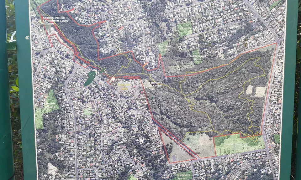
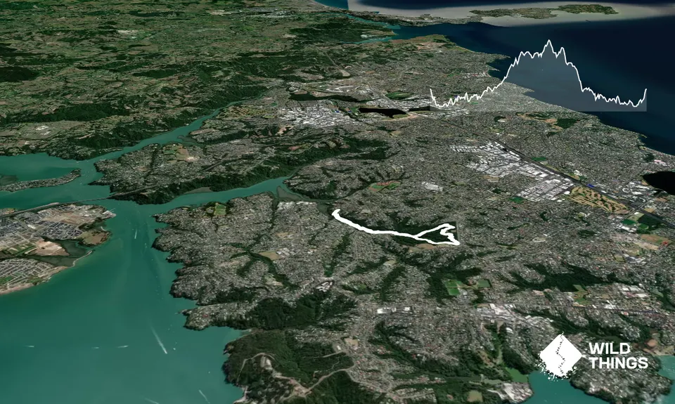
Trail Map
This Topo layer only covers NSW/ACT.
Switch to another map layer when viewing outside this area.
Switch to another map layer when viewing outside this area.


