Last Updated: 22nd Jan 2024

Beginner - Intermediate

Save Trail Save

I've done it Done

My Achilles Wheel

Mount Wellington, Auckland

Submitted by Jonathan Drake

Last Updated: 22nd Jan 2024

Beginner - Intermediate

Save Trail Save

I've done it Done

Grunt Factor: 14 ?

Gnarl Factor: 81 ?

9.2km

326m

326m

52m


Login as a VIP to see driving directions, distance and time.

Trail Map

Type of Run

Urban fringe

Loop

Undulating, small hills only

Dog Friendly

Beach

Coastal

Open farmlands

Run Makeup

22%
30%
48%

Sealed Road

Easy Single Track

Untracked / Route only

Trailhead

Login as a VIP to see the trailhead information.

Estimated Times to Run

1:45

Slow

1:15

Moderate

1:00

Fast

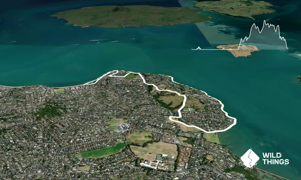
From St Heliers Beach head east directly towards the cliffs in front of you.

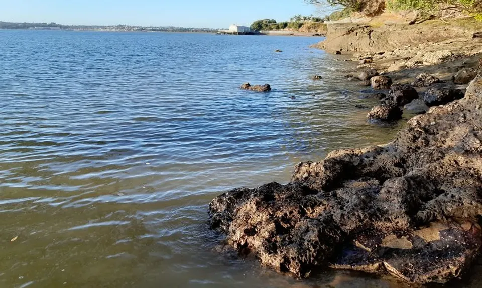
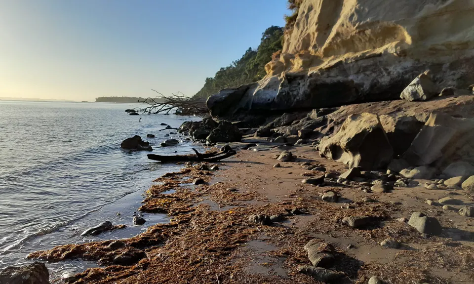
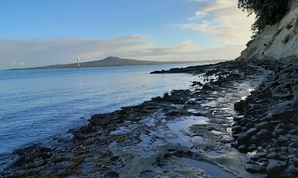
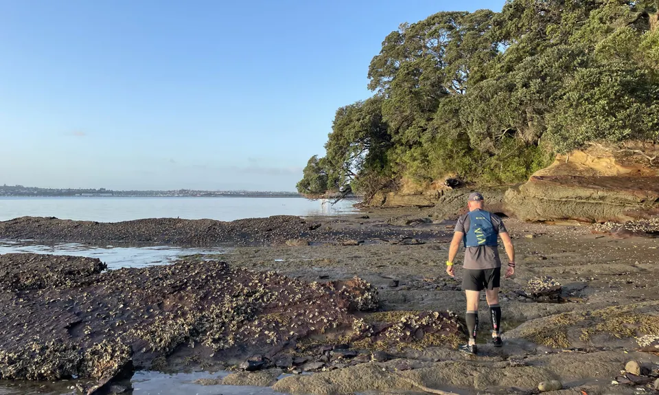
You will skirt the base of these for a few kilometers. The more difficult sections of the route come early on, with some edging along a ledge above the sea and below the cliff face, but eventually, you come to an open beach and can move more freely, skirting around the occasional fallen tree and rocky point.

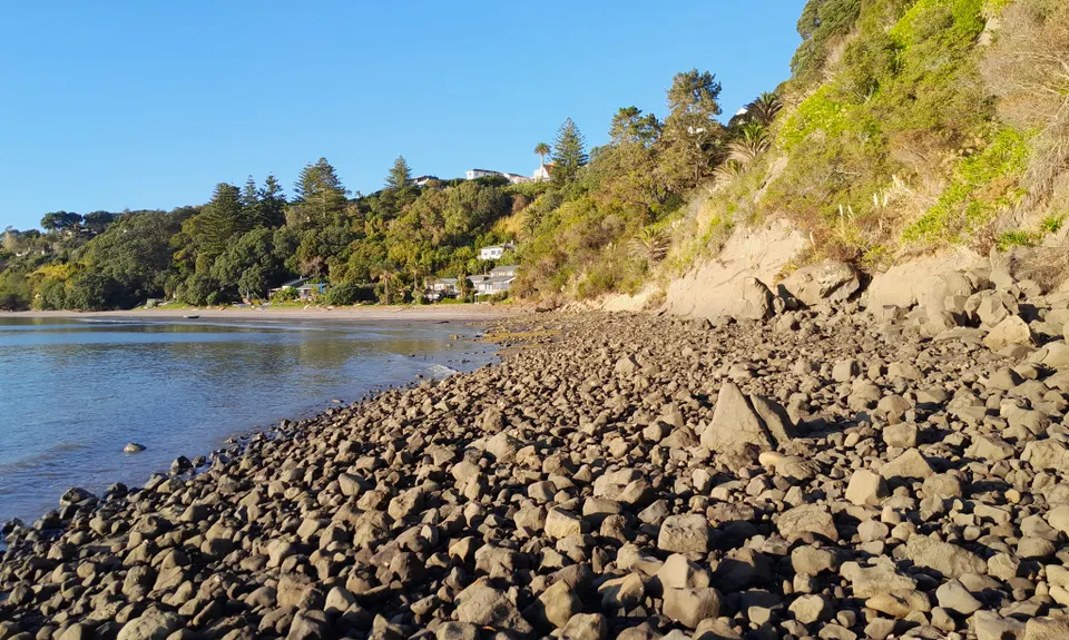
Eventually you will come to the long open Karaka Bay with houses above the beach and mostly free running in front of you. Beyond that, there is a little more rock clambering around the coastline, and eventually a section that requires some wading at about mid-calf to knee height. It is not too far though and makes for a very unique outing!

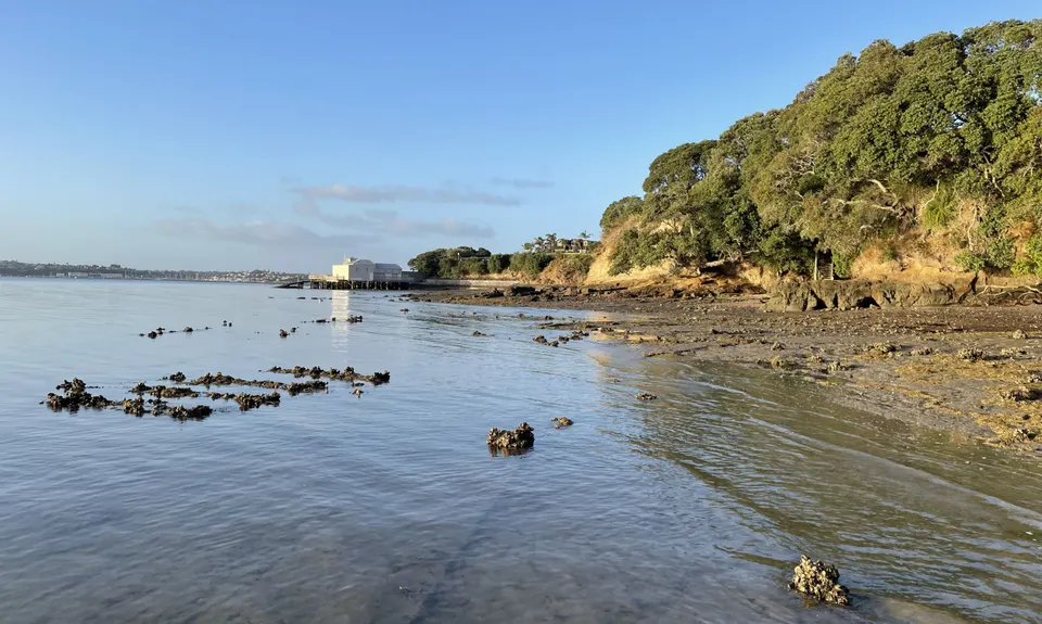
Coming out of the water you will see a raised boatshed ahead. Head directly underneath it and continue along the coast to the beach at Roberta Reserve.

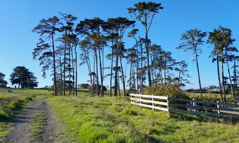
Take a sharp right off the beach onto the grass and in the direction of Glendowie Park across the road and angling up the hill in front and to the right.

Make your way through Glendowie Park then angle right to Westhaven Road. Here is a short road section – turn right onto Whitehaven, then left into Forfar which will lead you to Churchill Park. Follow the path to the right of the gate and through the centre of Churchill Park then onto the footpath alongside the school.

From here the path drops down some steps and into a wooded area, there are one or two little spur tracks to the right but follow the arc of the trail to the left and up a series of steps.

Take a right along the residential access road and up the steps to cross Riddell Road and to Glover Park.

Follow Waitara Rd alongside the park to the end of the road then angle left to follow the footpath along the clifftop around the outside of the park.

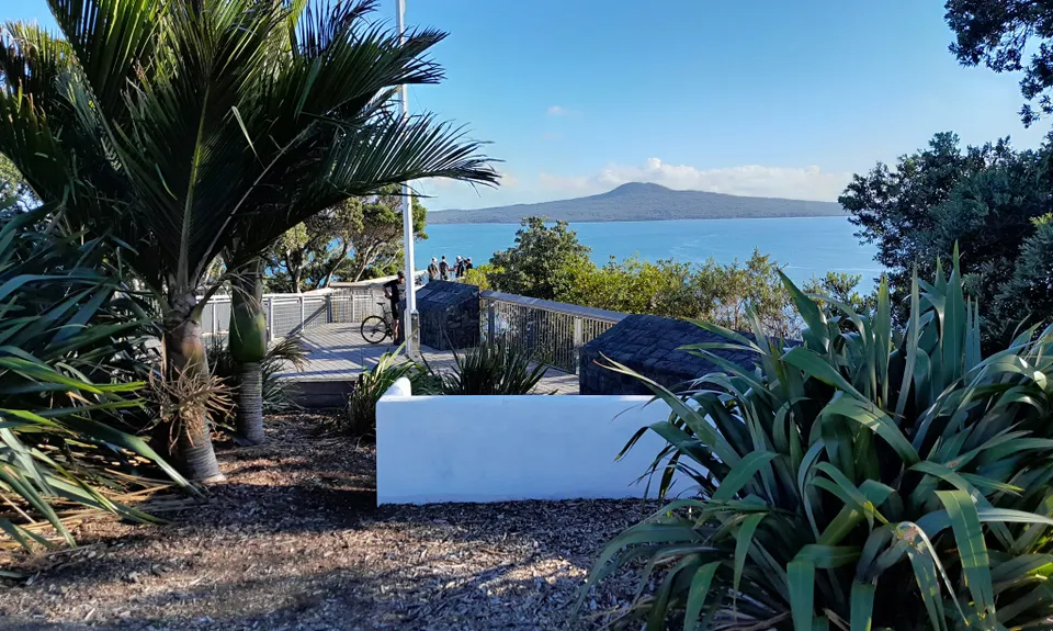
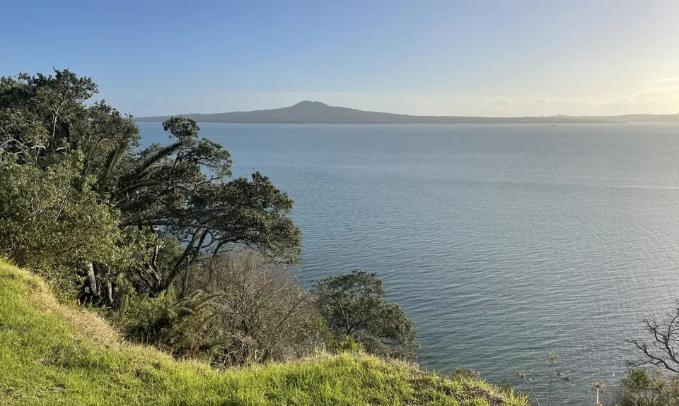
Before the changing sheds take a right onto a short section of Glover Road, then at the top of the rise a right onto Springcombe. This will arc around to bring you to Achilles Point.

Touch the rail at the end of the viewing platform, take in the views, then follow the clifftop back in the direction of St Heliers Beach along Cliff Road and arrive back at the boat ramp.

The route provides outstanding views of Rangitoto, Motutapu, Motukorea (Browns Island) and Musick Point, with Motuihe and the Coromandel behind them. Returning through Glover Park you skirt the crater of Whakamuhu, the ancient volcano that created these cliffs and then visit Achilles Point, dedicated to the NZ naval vessel of that name.

There is street parking available on Tamaki Drive or the side roads in the vicinity.

9 km

17 minutes

Yes

No

Moderate.

The route is generally easy to follow but given it is tidal have a look at a map in advance and consider where your ‘outs’ from the designated route might be if needed. These are places like the Ladies Bay steps, Karaka Bay road, and Clouston Road. You may take the odd wrong fork through the parks but cannot get too lost, if you have a GPX trace then that should be easy to follow.

Generally good.

Whistle, First aid kit, Cellphone, Map

There is a drinking fountain adjacent to the Roberta Reserve toilets, slighly off the route.

None.

Be conscious of your safety below the cliffs where you are exposed to rockfall, and on the rocky ledges. Of course, the primary requirement is to plan with the tide.

You and My Achilles Wheel

As a VIP member you can record private notes for this trail, see all of your times and more.

Register Now

Already have an account? Login now

Trail Reviews

I'd recommend reversing the direction - the view running north along the estuary is spectacular.

Nic Brooke

June 28, 2022

Definitely a low tide trail!

Matt Rowbotham

May 22, 2022

Login to submit a review

Trail Running Community

Find people who are interested in or have completed this trail run.

You must register or login to view this feature.

Register Now

Overlapping Trails

These overlap with this trail to some degree. You may wish to combine them but please note that to qualify for FKTs on these runs you should record a separate activity for each.

Partial Lunacy Mission

Partial Lunacy Mission

Length: 24.7km

Level: Beginner

Other trails nearby
Maungarei / Mt Wellington Climb

Maungarei / Mt Wellington Climb

Length: 3.8km

Level: Beginner

Find more trails and peaks nearby