Last Updated: 2nd Oct 2026

Intermediate

Save Trail Save

I've done it Done

Mt Fuji (Yoshida Trail)

A classic route to the highest and most iconic summit in Japan

Submitted by Sarah Coxon

Last Updated: 2nd Oct 2026

Intermediate

Save Trail Save

I've done it Done

Notice More info

Grunt Factor: 60 ?

Gnarl Factor: 65 ?

22.8km

2460m

2455m


Become a VIP to see driving directions, distance and time.

Trail Map

This Topo layer only covers NSW/ACT.
Switch to another map layer when viewing outside this area.

Type of Run

Front country - easily accessible

Out and Back

Mountainous

Native bush

Open ridges/tops

Volcanic

Run Makeup

80%
20%

Moderate Single Track

Technical Single Track

Average Uphill Gradient: +21.50%

Average Downhill Gradient: -21.50%

Garmin Course

VIP Feature: Send this route to your Garmin account so you can follow the course on your Garmin device.

Send to Garmin

Learn about sending to Garmin.

Trailhead

Become a VIP Member to see the trailhead information.

Estimated Times to Run

10:00

Slow

7:00

Moderate

5

Fast

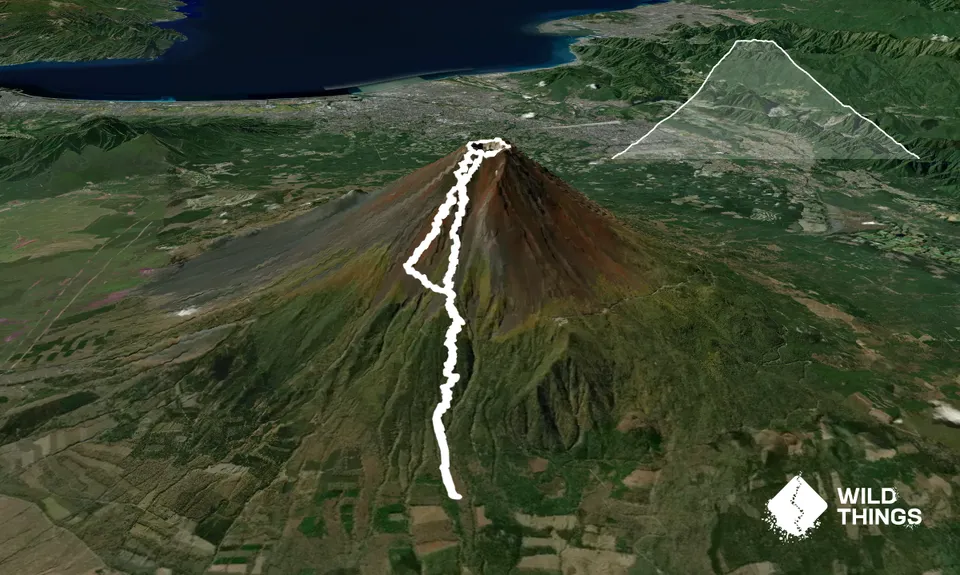
This route starts at Umagaeshi, the 1st station on the Yoshida trail and original trailhead before the Fuji Subaru Line opened in the 1960s to provide road access further up the mountain. The trailhead is marked with a torii gate, stone lanterns and a pair of monkey statues, placed as guardians to this sacred land.

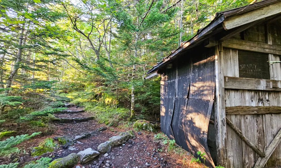
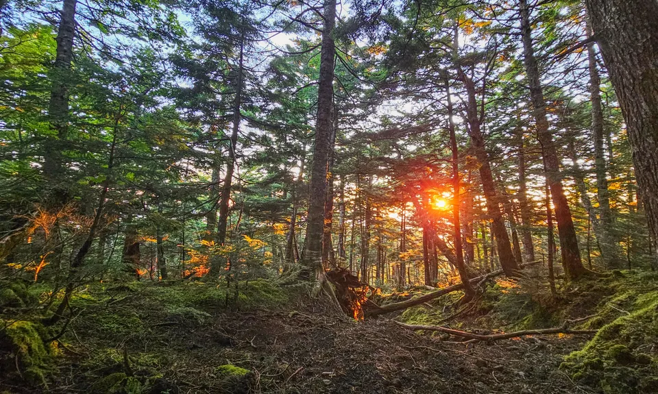
The trail is easy to follow, climbing up through beautiful forest and passing moss-covered stone monuments, the remnants of historic rest-stops and several small shrines. If you’ve started early (and you should), there are some incredible glimpses of dawn light to be had through the trees. The few junctions are sign-posted. About 4.7km, you’ll reach a sealed road – follow it around the first hairpin then regain the trail beside a small shrine, before almost immediately crossing the road again, after which you’ll arrive at Satomidaira Seikanso hut – a nice spot for a bite to eat or to use the bathroom (200¥). It’s also your first real chance to (clouds permitting!) glimpse the peak that awaits you.

About 1km further on, you’ll reach the 6th Station/Mt Fuji Safety Guidance Centre and the main junction with the trail from the Fuji-Subaru Line 5th station, where the vast majority of hikers start their day after catching a bus up. The Safety Guidance Centre is where you’ll need to grab your tickets/passes for the rest of the climb (see below).

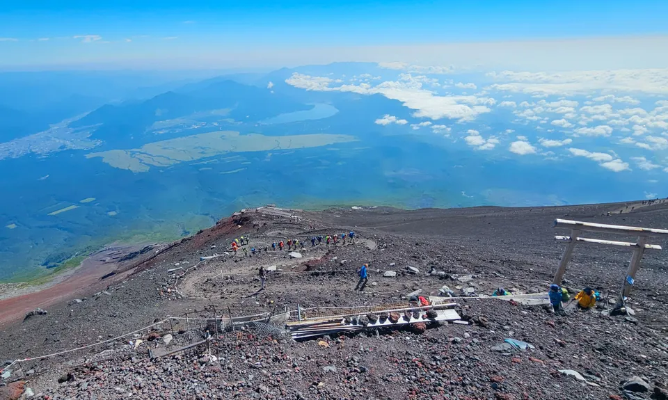
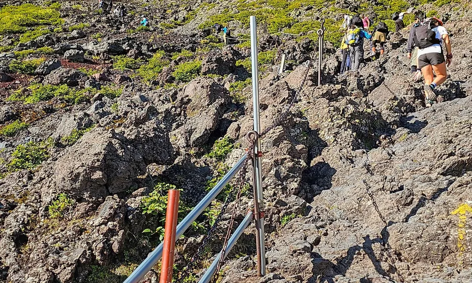
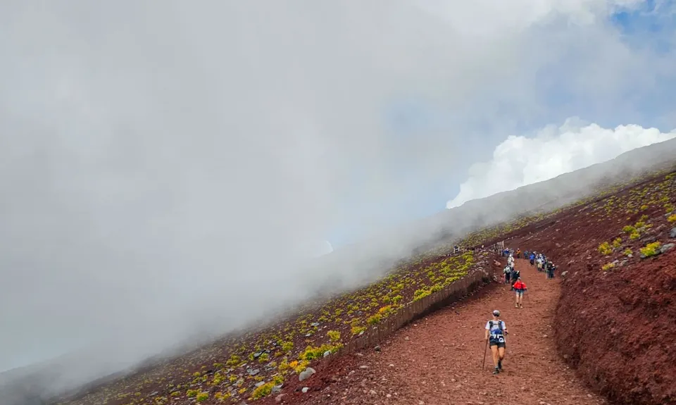
From here, the trail gets both noticeably busier and steeper. There are stretches of wide, gravel/scree zig-zags, and stretches of clambering over jumbled volcanic rock - nothing difficult, but enough to make you consider stashing poles if you’re using them. Follow the crowd, and keep grinding up. You’ll pass several further huts along the way that offer opportunities to purchase water or use the bathroom, so have some change handy if this sounds like you (allow 500-700¥ for water, 200-300¥ for bathroom – costs increase as you climb).

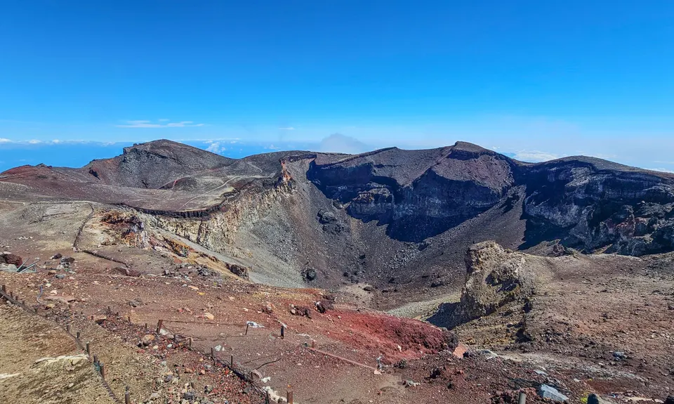
Eventually, as the altitude starts to bite, you reach the torii gates of the Kusushi Shrine, Yamaguchiya Hut (drinks, snacks, bathroom, souvenirs) and the crater rim. Follow the trail around the crater rim loop, bagging the true summit (Kengamine Peak) as you go.

The descent initially follows a separate trail from the one you climbed up. Starting from the southern end of the Yamaguchiya Hut, it opens with a few long switchbacks on loose volcanic scoria that get gradually shorter and tighter as you descend. Enjoy bashing down the mountain, weaving in and out of the hikers for as long as your knees and quads hold up (losing 1200 m altitude in <5km). Note that the trail splits at a sign-posted junction at the 8th station – be sure to stay left on the Yoshida trail!

The trail rejoins the ascending route at the Safety Guidance Centre. From here, simply retrace your steps back down through the forest to Umagaeshi. If it’s a hot day, consider a brief stop for icecream at Satomidaira Seikanso to fuel those last few kilometres.

****

There are several things to note about this route that may differ to trail prep/planning in elsewhere:

  • A ticket is required to access the Yoshida trail above the 6th station. Tickets are capped at 4,000 hikers per day, and can be purchased online in advance or on the day (1,000 tickets are reserved for on-the-day purchase). Online ticket/QR code is shown at the Safety Centre and exchanged for a wristband or token. The current fee is 4,000¥ per person.
  • To prevent overnight ‘bullet climbs,’ access to the trail above the 6th station is restricted between 2pm and 3am. You will not be able to climb past here unless you have a reservation for that evening in one of the mountain huts. Ensure you start your adventure early enough to ensure you’re through 6th station before 2pm.
  • Gear checks may be undertaken at 6th station to ensure hikers are properly equipped, and passage denied if they are not. Ensure your footwear is appropriate and you have sufficient cold and wet weather gear.
  • The trails on Mt Fuji have an official season (early July to mid-September), access outside of this is restricted.
  • For up to date information, check www.fujisan-climb.jp/en/
Mt Fuji is Japan's highest peak. The sacred mountain and its surrounds are a UNESCO World Heritage Site.

Umagaeshi trailhead (free), nothing until Satomidaira Seikanso, then at each huts/station above it (200-300¥ fee).

Large carpark (~30 cars), free. A seasonal bus service operates between Fujisan Station and Umagaeshi for a small number of trips per day, check online to confirm services/timetable.

No

Yes
Name: Tickets must be purchased online
Telephone: https://www.fujisan-climb.jp/en/yamanashi-notice/

Moderate.

The trails themselves are easy to follow (and above 6th station, so too the crowds). There are few junctions, usually signposted, but if not its pretty intuitive which way to go; take the GPX if you're the type who likes the reassurance. Just make sure to take the Yoshida trail down from the 8th station - if you end up at the bottom of Subashiri, it will complicate the logistics at the end of your day!

Patchy.

Waterproof leggings, Thermal leggings, Lightweight fleece top, Long-sleeved thermal top, Seam-sealed waterproof jacket, Gloves, Beanie/thermal headwear, Personal Locator Beacon (PLB), Whistle, First aid kit, Extra food for emergencies, Survival bag, Cellphone, Compass, Map, Headtorch and spare batteries, Crampons / microspikes (for winter conditions), Gaiters

No running water on course, but bottled water is available for purchase at the various huts. Take cash/change.

This is a serious alpine environment. Conditions may change at any time - carry appropriate cold and wet weather gear. The Mt Fuji trails are only open for a short summer season (early July-mid Sept); outside of this, the conditions become increasingly dangerous (snow, ice, high winds, sub-zero temperatures, avalanche risk), all mountain huts and facilities close, and rescue becomes increasingly difficult. Winter climbs should only be attempted by those with appropriate winter mountaineering experience, who are well equipped and who have submitted trip plans.

Altitude, exposure (to heat/sun in hot conditions, and wind/cold/rain in poor conditions).

The information provided is a guide only. Conditions, access and hazards can change, so use your own judgement and check current local information before heading out. Make sure the route or location is suitable for your experience, fitness and equipment, and check any access restrictions or permissions that may apply.

Do you have a suggestion on where to go afterwards for the best coffee / cake / breakfast / brunch / beer?

Trail Legend

Sarah Coxon

Sarah Coxon

has completed Mt Fuji (Yoshida Trail) once in the last year.

Login as a VIP to become a Trail Legend. Learn about Trail Legends.

You and Mt Fuji (Yoshida Trail)

As a VIP member you can record private notes for this trail, see all of your times and more.

Become a Member

Already have an account? Login now

Trail Reviews

Be the first to submit a review for Mt Fuji (Yoshida Trail)!

Login to submit a review

Trail Running Community

Find people who are interested in or have completed this trail run.

You must register or login to view this feature.

Register Now

Other trails nearby
Mt Archer Loop

Mt Archer Loop

Length: 18.2km

Level: Intermediate

Distance Away: 6,649.4km

Rockhampton Botanic Gardens Loop

Rockhampton Botanic Gardens Loop

Length: 5.3km

Level: Beginner

Distance Away: 6,655.4km

Mt Boulder Circuit

Mt Boulder Circuit

Length: 11.7km

Level: Beginner - Intermediate

Distance Away: 7,014.9km

Surf Clubs - Hell's Gate Triangle

Surf Clubs - Hell's Gate Triangle

Length: 11.6km

Level: Beginner - Intermediate

Distance Away: 7,037.6km

Find more trails and peaks nearby

Wild Things
Wild Things
Explore more

Plan smarter, stay motivated, track your progress, and unlock the full Wild Things experience — while saving along the way.