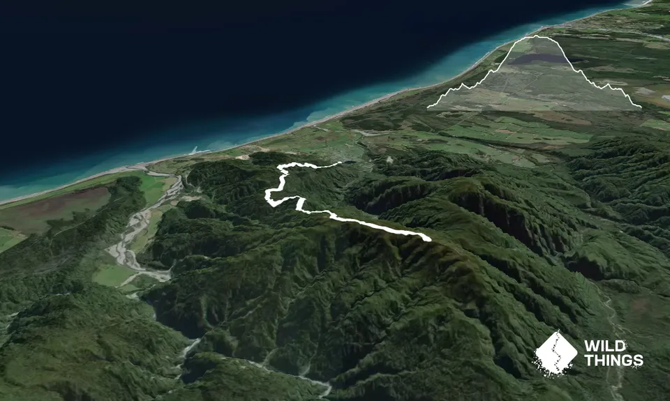
Starting from the Ross goldfields carpark, either head along the DoC track leading out from the lefthand corner, or head up the left-hand sealed road - they join up after about 200m onto the Mt Greenland 4wd road. Initially you run along Jones Creek, where you can fossick for nuggets if you like! Ignore the DoC signs for gold panning or the gold walk that goes off to the right, and start the steady climb up the 4wd road. This is initially well-formed, but it gets increasingly rough the further you go, to the extent it is more like technical singletrack for a third of the run.
There are no turnoffs apart from one early on that is marked "no access". The 4wd track climbs through native bush and podocarp forest, with a few short downhills just when you think you're getting some vertical under your belt. The first 4-5km is mostly well-graded and runnable, before becoming steeper, and for the last 2-3km you are basically running up a loose streambed. From this point you start getting tantalising views back to the coastline, and of the Southern Alps inland.
The gradient eases from the 8km mark, and you pass a mast on your right hand side. Continue on as it undulates along the top, and you will see a large trig on the summit off to the right of the track. Go about 100m beyond this and keep a look out for an unmarked track through the manuka scrub on the right that heads back and up to the trig. From here there are stunning views right down the coast to Mt Cook, back up to Hokitika, and the Alps are spread out inland.
Turn around and head back the way you came. The main track does continue on for about another 1.5km towards a disused quartz mine if you want to extend it slightly.