Last Updated: 22nd Apr 2024

Intermediate

Save Trail Save

I've done it Done

Moonlighting

Blackball, West Coast

Submitted by Katie Smith

Last Updated: 22nd Apr 2024

Intermediate

Save Trail Save

I've done it Done

Grunt Factor: 42 ?

Gnarl Factor: 81 ?

20.7km

1050m

1050m

1147m


Login as a VIP to see driving directions, distance and time.

Trail Map

Type of Run

Front country - easily accessible

Out and Back

Mountainous

Native bush

Riverside

Open tussock/grasslands

Open ridges/tops

Run Makeup

20%
60%
20%

Moderate Single Track

Technical Single Track

Untracked / Route only

Average Uphill Gradient: +12.6%

Average Downhill Gradient: -12.7%

Trailhead

Login as a VIP to see the trailhead information.

Estimated Times to Run

Not suitable

Slow

4:00

Moderate

2:30

Fast

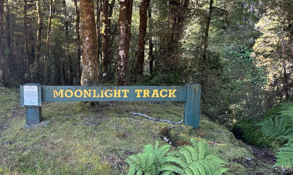
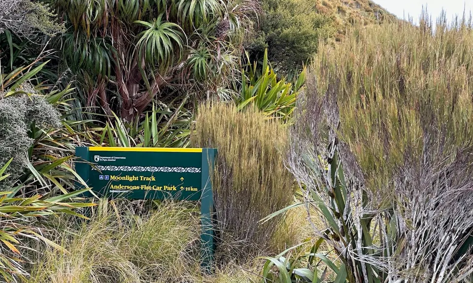
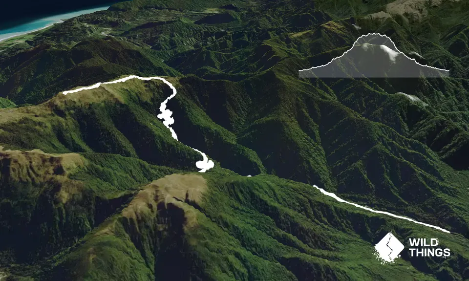
This run follows the Moonlight track up onto the tops. This description is of an out-and-back run, but with a car shuttle it would be possible to continue along the tops and either descend to Blackball or Barrytown along the Croesus track (or via Mt Watson).

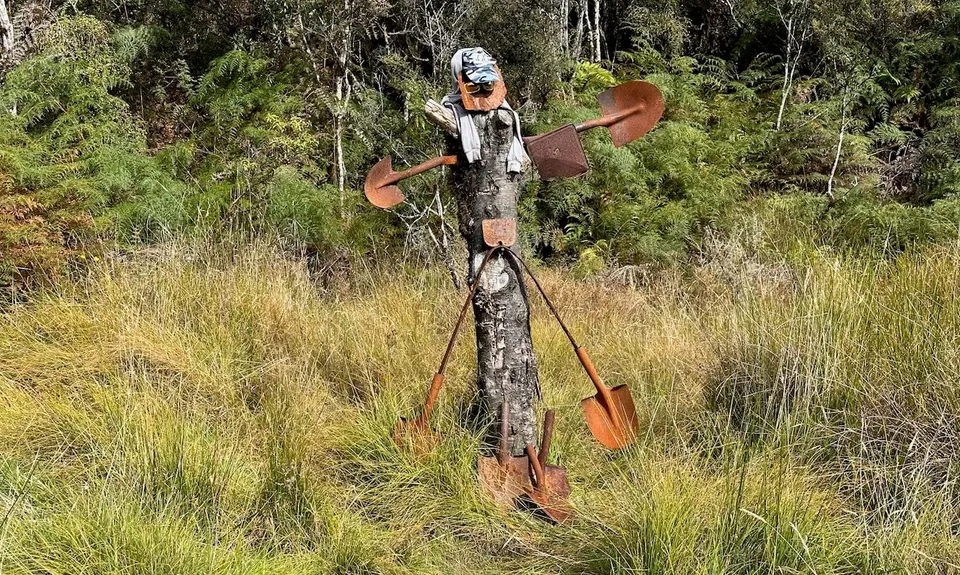
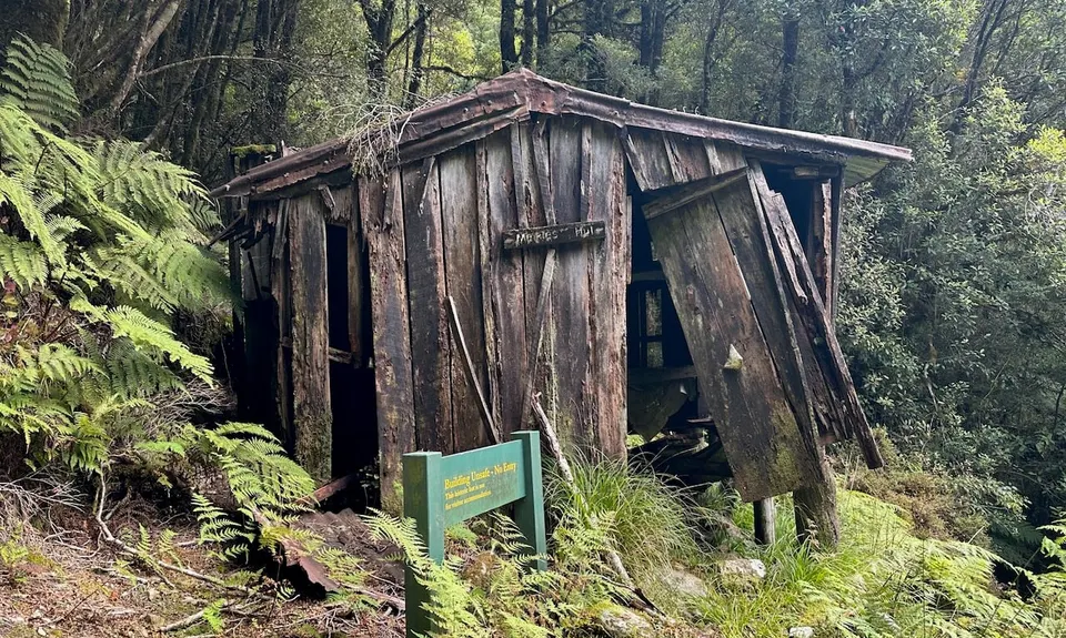
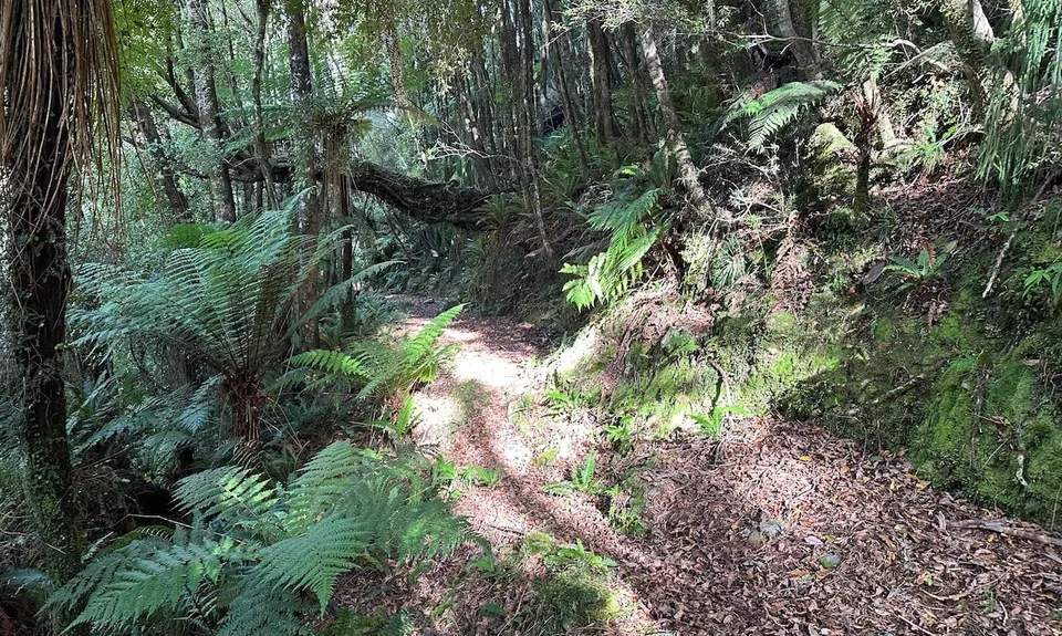
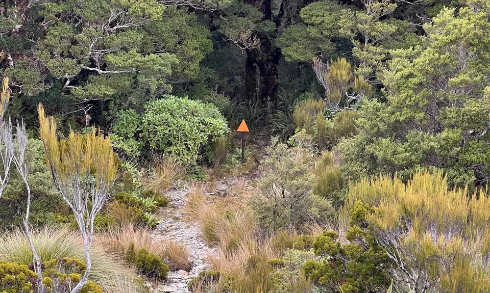
Park at Andersons Flat at the road end. The track starts off gently alongside the creek, passing old mine tailings and relics. For the first 6km it climbs gradually through stunning pristine bush, following the Moonlight Creek, which it crosses several times on swing bridges. For this section any climbs are switchbacked and stay on a nice runnable gradient. However, after passing the derelict Meikle's Hut and crossing the right branch of the Moonlight the gradient increases significantly, climbing steeply through huge old trees before breaking out into subalpine scrub, full of dracophyllum trees.

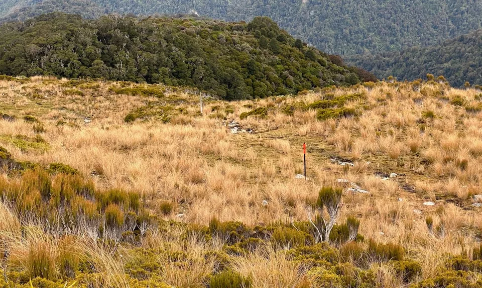
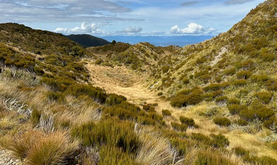
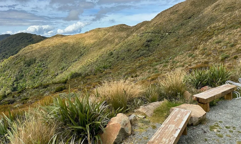
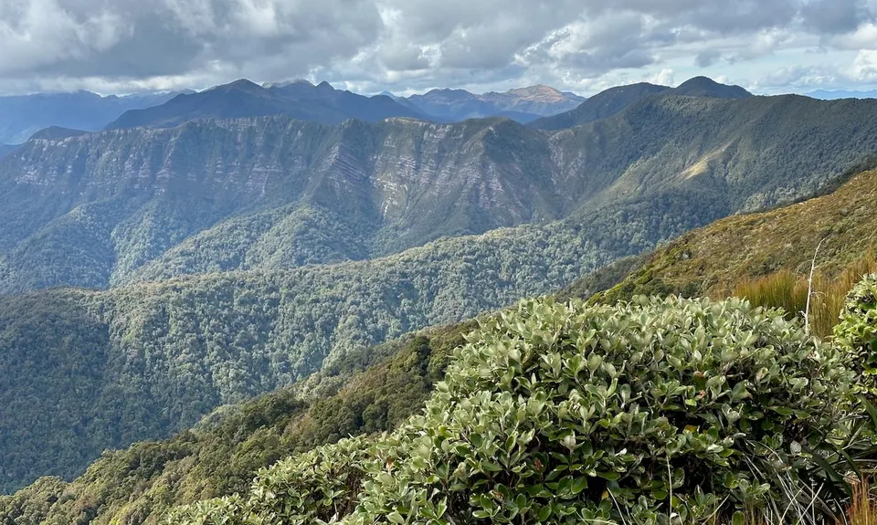
This gradually gives way to open tussock, swampy at first. Follow the poles to the signposted tops junction. From here head left towards the Croesus track along the tops. There are plenty of short steep ups and downs and views for miles, both out to the Tasman and inland to the Southern Alps from Nelson Lakes to Mt Cook. You will also see the new Moonlight hut, built for the new Paparoa Great Walk that will join the tops to the Croesus once it is open.

Once you've had your fill, turn around and enjoy the long downhill back through the bush. A great extension would be arranging a car shuttle so that you could start at the Croesus car park and run up the Mt Watson route along the tops to Mt Ryall, then continue down the Moonlight.

Lots of old mine workings including a historic (dilapidated) hut. This area has kiwi and whio programmes and whio are often seen.

Plenty of parking, no public transport.

The gravel road from Atarau to Anderson's Flat is pretty rough in places and folk with a low clearance 2wd car might choose to run or bike in. There is space for a few cars to park at the Moonlight info panels beside the Moonlight Rd turn off.

20 km

29 minutes

Unknown

No

Moderate.

Avoid the tops in poor visibility as although there is the odd marker pole they are few and far between, and the ridgeline isn't totally straightforward.

Very patchy.

Thermal leggings, Lightweight fleece top, Long-sleeved thermal top, Seam-sealed waterproof jacket, Gloves, Beanie/thermal headwear, Personal Locator Beacon (PLB), Whistle, First aid kit, Extra food for emergencies, Survival bag, Cellphone, Map, Headtorch and spare batteries

Plenty of creeks on the way up through the bush, no easily-accessible water on the tops.

Exposed and gets very cold on the tops at any time of year and can snow almost year-round. Muddy after rain, and the Moonlight Creek right branch would be uncrossable after any significant rain, possibly one unnamed side creek before this too.

You and Moonlighting

As a VIP member you can record private notes for this trail, see all of your times and more.

Register Now

Already have an account? Login now

Trail Reviews

A great run! The road to Anderson's is currently very good. The first 4 km of track next to the river have seen a lot of erosion and are a bit rough, then there's a surprisingly good old pack track for another 4.5km to the 750m contour, then it's standard tramping track up to the tops. Moonlight Hut is the obvious destination/ turnaround point which makes for about a 20 k run. Lots of variety - a lovely river valley, old mine ruins, a derelict hut, alpine tops, views from the main track once you're there. Combining with the new Pike trail would be fun.

John Scott

April 19

This track has recently had a maintenance run done, and vegetation has been cut along the entire track, making it much easier to run. :)

hadyn butler

July 12, 2019

The first 6km is great: mostly runnable track, wonderful mossy forest, abundant birdlife (including whio!!), lots of fascinating gold mining relics (tunnels, walls of stacked stones, old stamping battery remains), beautiful river with a few good swimming pools and frequent views up to the tops. However, the latter half is currently quite overgrown and a bit boggy in places. Also, if your car hasn't much ground clearance, I recommend parking at the start of Moonlight Rd and running or biking to Anderson's Flat.

Catriona McWhirter

February 24, 2019

Login to submit a review

Trail Running Community

Find people who are interested in or have completed this trail run.

You must register or login to view this feature.

Register Now

Other trails nearby
Croesus Crossing

Croesus Crossing

Length: 28.0km

Level: Intermediate

Mt Watson Croesus Loop

Mt Watson Croesus Loop

Length: 21.6km

Level: Intermediate

Find more trails and peaks nearby