Last Updated: 9th May 2025
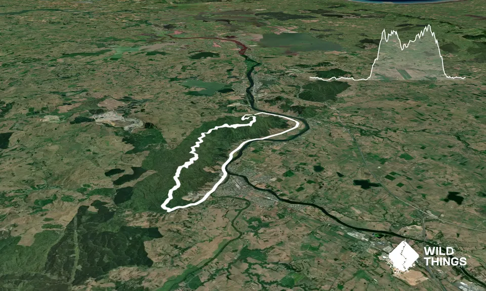
Hakarimata N-S Full Trail Loop
Last Updated: 9th May 2025
Open
Grunt Factor: 34 ?
Gnarl Factor: 40 ?
26.0km
980m
980m
342m
Trail Map
This Topo layer only covers NSW/ACT.
Switch to another map layer when viewing outside this area.
Switch to another map layer when viewing outside this area.