Last Updated: 12th Apr 2025
Wots Up DOC
Submitted by Stu Houston
Last Updated: 12th Apr 2025
Grunt Factor: 35 ?
Gnarl Factor: 31 ?
24.1km
1100m
1100m
1322m
Last Updated: 12th Apr 2025
Submitted by Stu Houston
Last Updated: 12th Apr 2025
Grunt Factor: 35 ?
Gnarl Factor: 31 ?
24.1km
1100m
1100m
1322m
Front country - easily accessible
Loop
Undulating, some big hills
Dog Friendly
Native bush
Open tussock/grasslands
Open ridges/tops
Farm Road / 4WD Track
Easy Single Track
Moderate Single Track
Technical Single Track
Average Uphill Gradient: +9.1%
Average Downhill Gradient: -10.2%
VIP Feature: Send this route to your Garmin account so you can follow the course on your Garmin device.
Login as a VIP to see the trailhead information.
5:00
Slow
3:30
Moderate
2:00
Fast
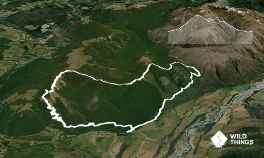
This is a fantastic scenic loop that can be done in either direction but is best done clockwise.
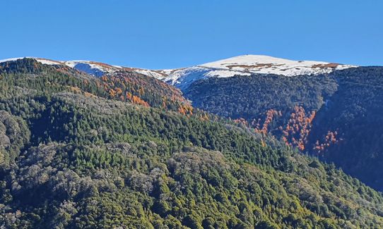
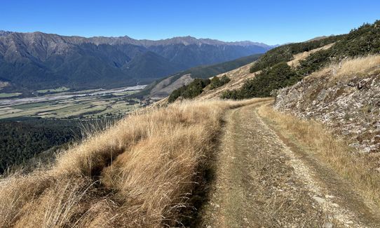
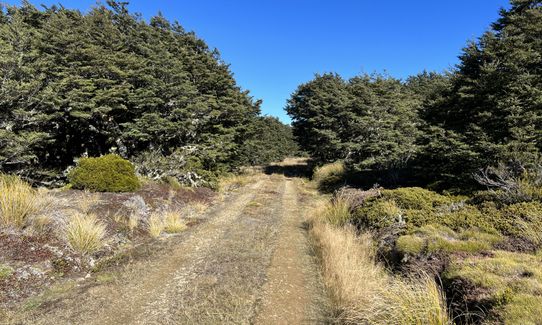
Starting in the Red Hills carpark follow the well signposted track to the start of the Wots Up DOC Mountain Bike track. This well built (by the Nelson Mountain Bike club) well graded track climbs and zig zags its way through beech forest up and onto the open tops of Beebys Knob, where there are beautiful views in all directions.
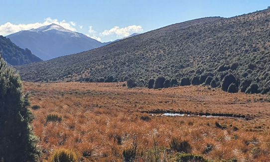
Carry on until you arrive at the Junction with the Maitland Ridge track. Turn right (East) onto the Maitland Ridge track and run along this narrow undulating single track through mountain beech forest interspersed with open clearings keep an ear open for mountain bikes coming behind you. Eventually the open mass of the Red Hills comes into view and you drop down to the sweet little Red Hills Hut - this area is stunning and unique as the ultramafic red rock of the Red Hills means forest doesn't grow on them in stark contrast to the beech forest you've just run through.
From the hut the track follows an old 4x4 road back down to the carpark.
You can add to this run with a side trip visit to Beebys Hut from the Maitland Junction - carry on North along the 4x4 road for 3 km the views along this side trip are well worth the extra effort.
This is a very runnable circuit the beautifully graded trail means there's very few places the track is over 7% in grade but only if you do it Clockwise ! Take plenty of water with you as for 14 kms there is none available.
Stunning views of Nelson Lakes National Park and Raglan Ranges plus the Wairau Valley and the magical Red Hills.
If you know of any public toilets near the trail start or on the route, please login and then let us know so we can update this section.
Nice shady DOC carpark but beware carparks in this area are routinely broken into.
10 km
9 minutes
Yes
No
Moderate.
This is a well marked trail follow orange markers.
Very patchy.
Lightweight fleece top, Long-sleeved thermal top, Seam-sealed waterproof jacket, Windproof jacket, Beanie/thermal headwear, Whistle, First aid kit, Extra food for emergencies, Cellphone, Map
Only first 5 km and last 5 km is there any water.
Hot in summer and freezing in winter and very exposed on open tops.
Do this trip in fine weather - you are on tops up high for a long time plus you need to see the views.
Trail Legend
Login as a VIP to become a Trail Legend. Learn about Trail Legends.
Fastest Known Times (FKTs)
Can be run in either direction
You and Wots Up DOC
As a VIP member you can record private notes for this trail, see all of your times and more.
Already have an account? Login now
What a cracking loop. Despite doing it in mid-winter & spending most of the time inside a freezing cloud, I loved the mix of trail, and the fairytale stunted bush dripping with lichen. Some beaut single track, especially the Maitland section which would be 'interesting' on a MTB in some parts! I'd also suggest an out & back to Beeby's Knob (adds about 3k) not so much 'cos it's a spectacular peak (it's not!) but because it'll earn you valuable Peak Bagging Points (1442 of them) and there MAY be great views if it's not inside a cloud ?
July 14, 2024
This is a great loop, superb on a fine day and would also be good if the weather wasn't perfect as most of the time you're fairly sheltered. Thanks to our mountain biking friends who built both the bottom (Wot's up Doc) and the top (Maitland ridge) trails!
May 10, 2022
This is a great route to run and has wonderful views. Red Hills Hut is very cute and a nice place to stop before the final descent.
The climb up is long but mostly runnable. The 8km technical section on Maitland Ridge Track is really fun and there’s an easy 6km descent to finish. Route finding is easy although note that the 4x4 track does not end at the car park. It leads back into the beech forest for another 2km or so of bush tracks to complete the circuit.
December 25, 2021

Length: 38.3km
Level: Intermediate - Experienced
Send to your phone
Scan the below QR code to open this trail on your phone.

Tip: position the QR code in your phone camera screen.


