Last Updated: 21st Apr 2024
Mt Robert Loop
Submitted by Mal Law
Last Updated: 21st Apr 2024
Open
Grunt Factor: 17 ?
Gnarl Factor: 31 ?
9.4km
650m
650m
1420m
.jpg?tr=w-542,h-325)


Last Updated: 21st Apr 2024
Submitted by Mal Law
Last Updated: 21st Apr 2024
Open
Grunt Factor: 17 ?
Gnarl Factor: 31 ?
9.4km
650m
650m
1420m
Front country - easily accessible
Loop
Very hilly
Native bush
Open ridges/tops
Gravel Road
Easy Single Track
Moderate Single Track
Average Uphill Gradient: +17.6%
Average Downhill Gradient: -15.4%
VIP Feature: Send this route to your Garmin account so you can follow the course on your Garmin device.
Login as a VIP to see the trailhead information.
2:20
Slow
1:40
Moderate
1:10
Fast
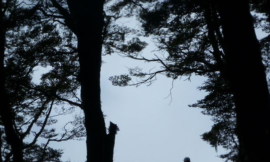
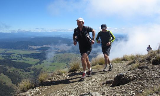
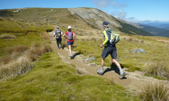
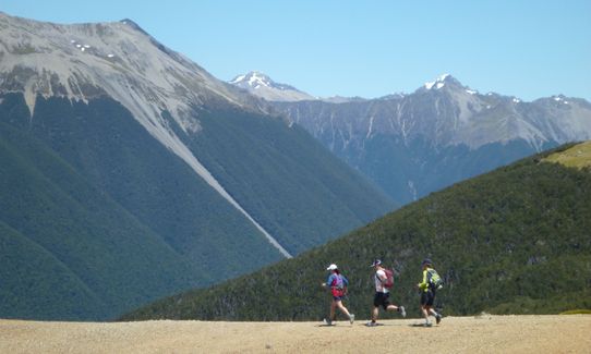
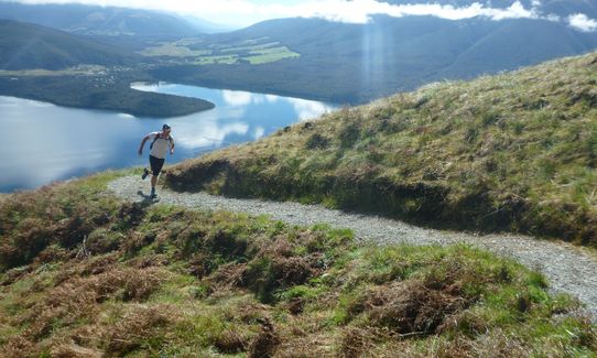
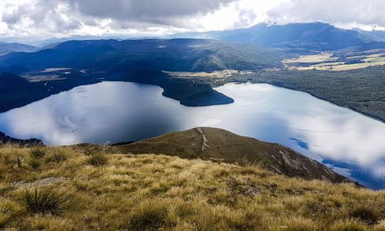
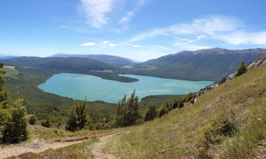
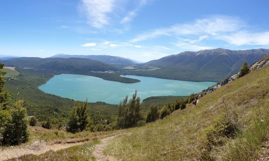
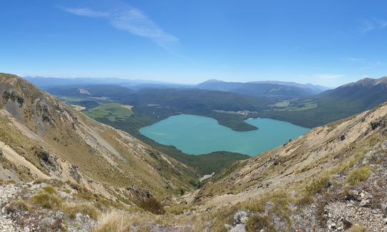
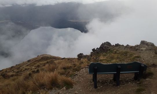
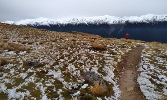
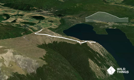
From the car park pick up the Pinchgut Track. This well made trail winds its way uphill through a series of zigzags to climb some 550m over just 3 kms. Initially it is all in bush but shortly before reaching Mt. Robert (a fairly indisticnct summit off the track to the left) it breaks into the open revealing stunning 360 deg views.
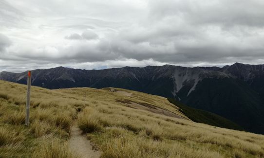
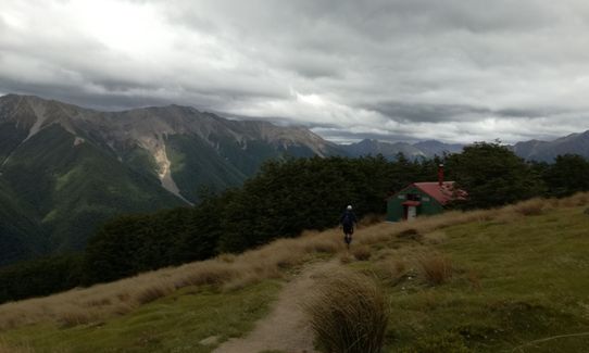
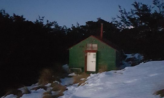
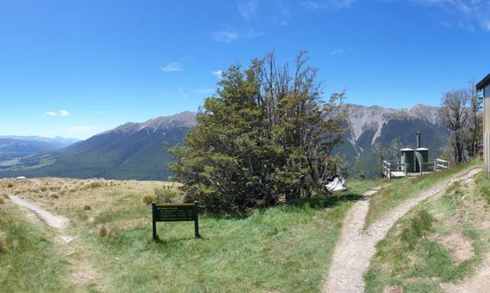
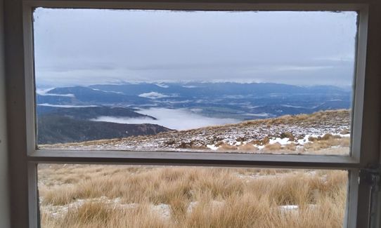
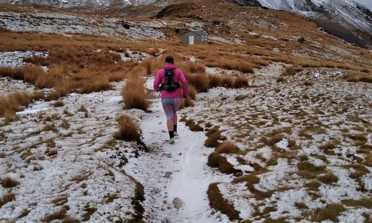
Just beyond Relax Shelter hang a left on to Paddys Track and follow this over a gentle downhill with stunning views, past the disused historic hut, through a small stand of beech forest, to the newer Bushline Hut.
Beyond the hut the trail has been gravelled and starts to drop quite steeply, eventually entering regenerating bush and crossing a couple of slips. There is one junction lower down where you bear left and follow the trail out to the gravel road. turn left again and finish with a short sharp uphill on the road to return to the car park.
This trail includes the peak Mount Robert.
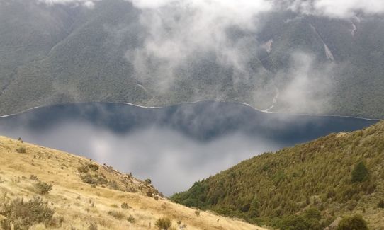
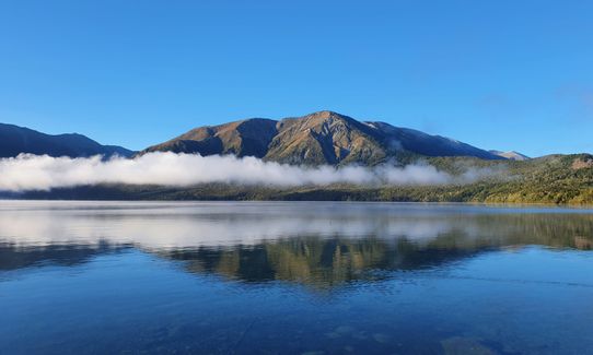
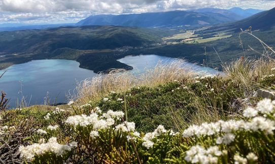
Stunning mountain and lake views, historic hut.
If you know of any public toilets near the trail start or on the route, please login and then let us know so we can update this section.
Plenty of parking, toilet, information board & map
7 km
12 minutes
No
No
Easy.
Well signposted but if the cloud is down keep a sharp eye out for the left turn on to Paddys Track.
Generally good.
Long-sleeved thermal top, Seam-sealed waterproof jacket, Gloves, Beanie/thermal headwear, Personal Locator Beacon (PLB), Whistle, First aid kit, Extra food for emergencies, Survival blanket, Cellphone, Map, Headtorch and spare batteries, Crampons / microspikes (for winter conditions)
The only water on the route is at Bushline Hut.
This is an alpine environment and conditions can be treacherous at any time of the year in bad weather. Expect snow in winter but don't be put off by it - this is a great route for those that go prepared with micro-spikes and/or snowshoes!
Be prepared for extreme weather at any time of year.
Alpine Lodge
St. Arnaud
http://www.alpinelodge.co.nz
Great hospitality, great food and convivial atmosphere in their restaurant/bar
Trail Legend
Login as a VIP to become a Trail Legend. Learn about Trail Legends.
Fastest Known Times (FKTs)
You and Mt Robert Loop
As a VIP member you can record private notes for this trail, see all of your times and more.
Already have an account? Login now
Hard up to start with but rewarded with spectacular views. Be prepared for weather at the top. It is a very exposed ridge line. We got a bluebird day and it was amazing!
December 29, 2023
W
Easy well maintained track, so not technical. The reward for slog up is great views & opportunity to hammer the down hill till your quads scream.
October 9, 2023
Lovely shade on Pinchgut and gorgeous views from the top and along Paddy's track.
January 26, 2022
Grunty start but rewarded with epic views the whole way. Top notch short run
January 30, 2021
These overlap with this trail to some degree. You may wish to combine them but please note that to qualify for FKTs on these runs you should record a separate activity for each.

Length: 38.3km
Level: Intermediate - Experienced
Send to your phone
Scan the below QR code to open this trail on your phone.

Tip: position the QR code in your phone camera screen.


