Last Updated: 21st Sep 2023
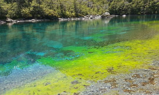
Blue Lake - clearest water on earth
Submitted by Sarah Biss
Last Updated: 21st Sep 2023
Open
Grunt Factor: 72 ?
Gnarl Factor: 65 ?
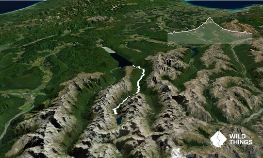
44.3km
1100m
1100m
1209m
.jpg?tr=w-542,h-325)
Last Updated: 21st Sep 2023
Submitted by Sarah Biss
Last Updated: 21st Sep 2023
Open
Grunt Factor: 72 ?
Gnarl Factor: 65 ?
44.3km
1100m
1100m
1209m
Back country - remote
Out and Back
Undulating, small hills only
Native bush
Riverside
Lakeside
Open ridges/tops
Easy Single Track
Moderate Single Track
Technical Single Track
Untracked / Route only
Average Uphill Gradient: +5.9%
Average Downhill Gradient: -6.1%
VIP Feature: Send this route to your Garmin account so you can follow the course on your Garmin device.
Login as a VIP to see the trailhead information.
11:00
Slow
8:00
Moderate
6:00
Fast
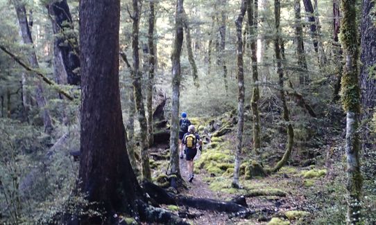
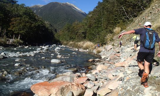
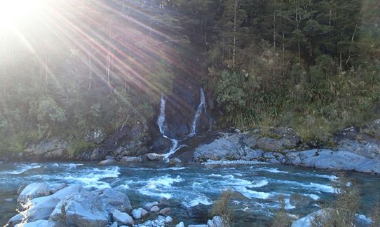
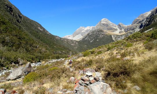
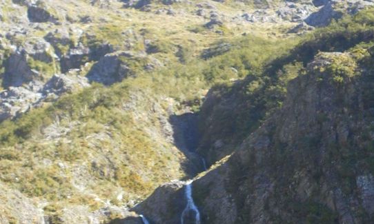
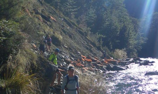
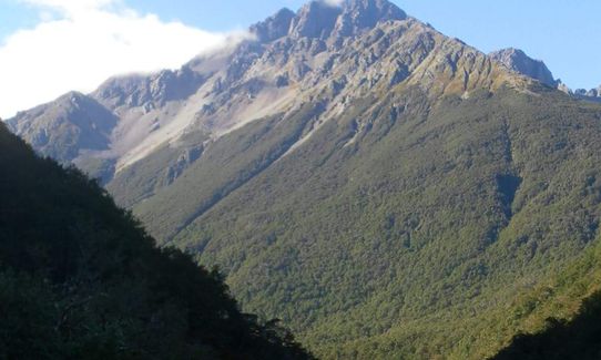
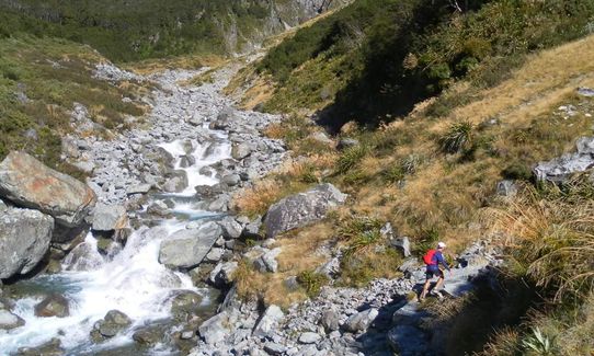
Although the Blue Lake is the destination, the scenery to and from is also superb. The track departs from the lake edge fairly quickly and tracks the Sabine River. The single track terrain alternates between native bush, tussock, rocky areas and some stream crossings. There are some areas of scree and some short sections signposted as avalanche prone.
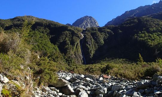
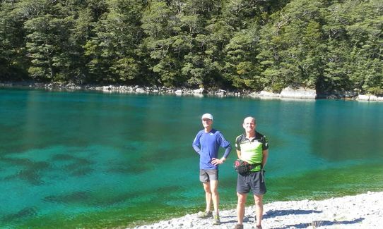
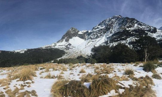
You gradually gain altitude, with some short steep climbs and descents on route. West Sabine Hut is signposted across a swing bridge, approximately 2 hours in (for intermediate level runners). From here the climbing is a little steeper, until you arrive at the Blue Lake Hut. The hut is a decent stone throw from the amazing clear waters of the Blue Lake, situated in a large natural clearing, surrounded by mountainous peaks and native bush. Some may wish to carry on a bit further to look down on Lake Constance (signposted). Otherwise, once you have enjoyed the Blue Lake (no swimming or touching the water is permitted - let's help keep it pristine), turn around and head back exactly the way you came- this time enjoying a net downhill and the challenge of knocking off an unoffical ultra-marathon of technical running.
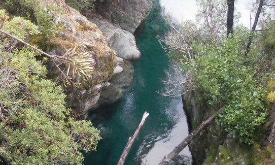
"Blue Lake, known to Ngati Apa iwi as Rotomairewhenua (the land of peaceful waters) is thought to be the clearest fresh water in the world. While only seven metres deep the clarity of the lake water can exceed 80m which is close to the theortically calculated clarity of distilled water"
From www.doc.govt.nz/parks-and-recreation/places-to-go/nelson-tasman/places/nelson-lakes-national-park/things-to-do/huts/blue-lake-hut/
If you know of any public toilets near the trail start or on the route, please login and then let us know so we can update this section.
Drive to the road end and jetty at the northern end of Lake Rotoroa, approximately 35 mins from St Arnuad - to catch your pre-arranged water taxi or launch your own boat. There is plenty of room for parking.
42 km
36 minutes
Unknown
No
Hard.
Keep a careful eye out for markers in the areas where the track is not obvious.
If on the way to the Blue Lake you take the detour across the swing bridge to have a brief rest at West Sabine Hut, make sure you come back over the bridge again and keep going straight on towards the Blue Lake (at this point the track you have been on changes from being called the "Sabine Track", to the "Blue Lake Track"). Do NOT stay on the West Sabine Hut side of the river and take the Travers Saddle Track which heads south east, away from the river.
Take NZTopo50 map sheet: BS24 and the DOC brochure on the Travers-Sabine Circuit is very useful to get a general overview of the area:
http://www.doc.govt.nz/Documents/parks-and-recreation/tracks-and-walks/nelson-marlborough/travers-sabine-circuit-brochure.pdf
Blue Lake hit is situated: Grid/NZTM2000 coordinates: E1571514, N5343732
Very patchy.
Waterproof leggings, Thermal leggings, Short-sleeved thermal top, Long-sleeved thermal top, Seam-sealed waterproof jacket, Gloves, Beanie/thermal headwear, Personal Locator Beacon (PLB), Whistle, First aid kit, Extra food for emergencies, Survival bag, Cellphone, Compass, Map, Headtorch and spare batteries
In 2016 a group of us drank from the Sabine River and did not get ill.
It is a very remote area, and can get very cold in winter. Take care with avalanche prone sections. It is a long day, even for very experienced runners, so make sure that you start early and allow yourself plenty of daylight to get the run done, best done at a time of year when there is plenty of daylight available- not winter. It would be a very difficult track to navigate in the dark with a head torch.
See above.
Alpine Lodge
St Arnaud
http://www.alpinelodge.co.nz/
You'll be starving and this place serves a good variety of food, plus a bar.
Fastest Known Times (FKTs)
You and Blue Lake - clearest water on earth
As a VIP member you can record private notes for this trail, see all of your times and more.
Already have an account? Login now
Way more runnable than I thought! Protection from the sun (forest cover) all along and when it does open up, lovely views. Not sure why the GPX doesn't go to the lake though. I did, and walked along it to take it all in.
January 4, 2023
Classic nz trail. Worth taking poles but about half was runnable. Piccadilly circus on new years day though..wow.
January 2, 2023
Anticlimactic if I am to be honest. A long slog from
Sabine and a very tricky, tree fallen, slip laden route out to the blue pool. The pool itself was not as good as expected, however there were a few lovely views on the way of the surrounding mountains.
March 16, 2022
AB
One of the best day trips in the nelson lakes. Definitely plenty of roots and rocks to slow you down but with views this good who cares!
June 15, 2018

Length: 38.3km
Level: Intermediate - Experienced
Send to your phone
Scan the below QR code to open this trail on your phone.

Tip: position the QR code in your phone camera screen.


