An awesome and challenging alpine circuit that takes you around the western side of Lake Rotoiti, up the spectacular and remote east ridge of Mt Angelus, past tarns and a lake to Angelus hut, then back out via the fantastic Robert Ridge track. It's a run-climb-run.
The route described is feasible only in summer months, with clear, settled weather. It requires some careful route finding and confidence on exposed rock (the east ridge climb is grade 2+ in the NZAC guidebook, and gets a star for quality. Trail running shoes are fine).
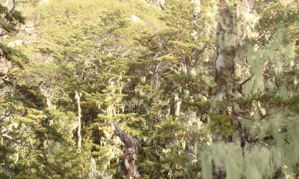
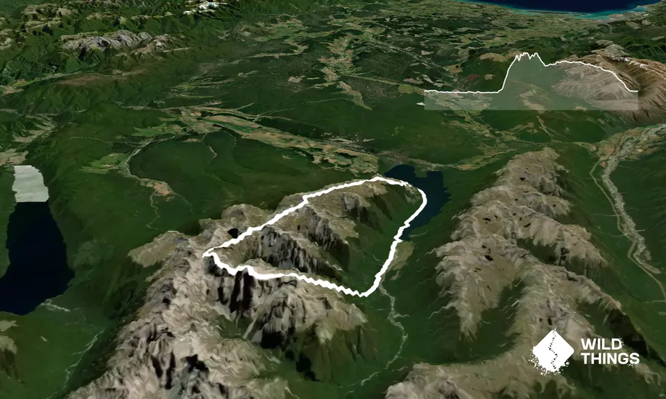
Start from the carpark half-way up the Mt Robert Road where the Lakeside track starts. Follow this around the lake to Coldwater Hut and on to Hukere Stream (1-1.5 hrs from the car). Cross the bridge over this stream, fill up with water, and strike out into the forest heading for the prominent ridge that rises up to separate the Travers river and Hukere stream.
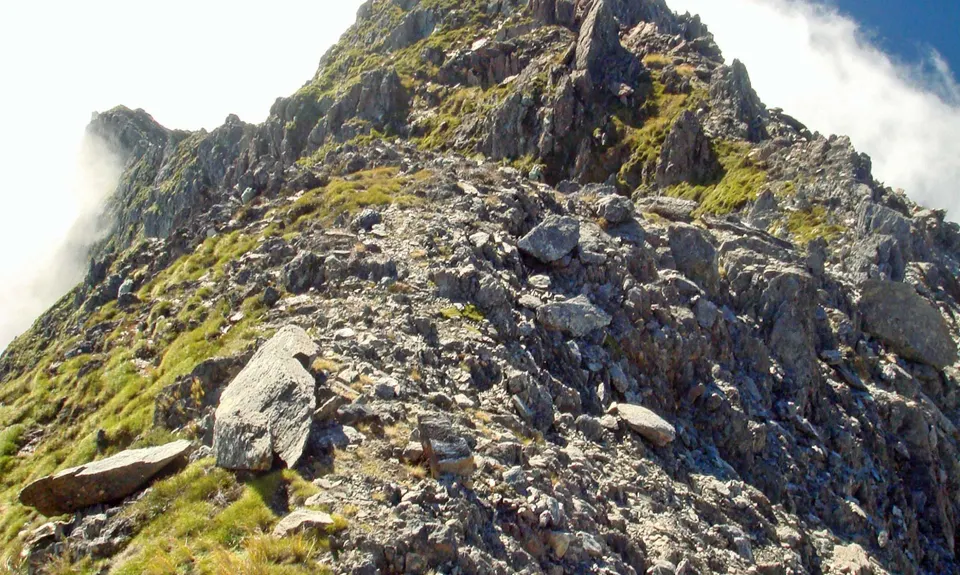
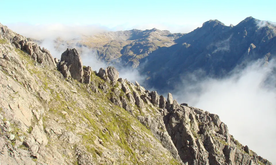
The steepening ridge is easily followed through the bush (no track or cairns - you're on your own here) and climbs to a rock band at the bushline which requires some care to ascend. Beyond this, the ridge has pleasant and varied travel (see pic) until pt 2015 is reached. Drop into the scree between here and pt 2037 and regain the ridge to bypass a difficult section that would require a rope.
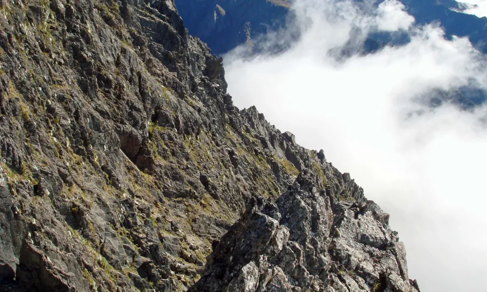
Carry on over pt 2093 and descend carefully (tend right near the bottom) to the major col that overlooks screes into the Hukere and Hopeless headwaters. The section from here to the summit of Angelus Peak has the most 'interesting' and at times airy rock scrambling; take care on this section - it takes much longer than it looks on the map!
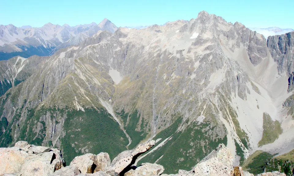
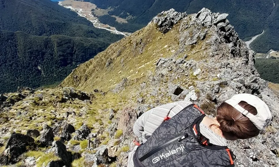
From Angelus Peak, you can start running again - first down to the attractive alpine basins picking up faint trails, and make your way past tarns to the spacious hut by Lake Angelus. Fill up with water here, then it's an exhilarating 2 hour+ run along a well-marked track over the undulating tops (great views) with a turn-off right onto Paddy's track for the final descent sections back to Lakeside Track and carpark.
Lakes, tarns, bush, peaks, huts, alpine rock. The east ridge of Mt Angelus is an impressive feature, rising from the valley floor to the summit of Mt Angelus over subsidiary summits (one of which is higher than Mt Angelus).
If you know of any public toilets near the trail start or on the route, please login and then let us know so we can update this section.
The main carpark is higher up, however the car park by Lakeside track is still well-off the main road.
5 km
7 minutes
Unknown
No
Hard.
Take care navigating in the forest climb, and also in the route from Mt Angelus back to Angelus Hut if cloud comes in. Also sight and be aware of two possible exit options from the east ridge if the weather should change (one is down a scree slope above Hopeless hut, the other is the major col described in the route - with fairly easy access to the Hukere stream [and Cascade track] or less easy, but still do-able, access to Hopeless hut.)
If the weather is not ideal an alternative to this trip is to head up the Cascade track directly to Mt Angelus hut directly (shorter and tracked all the way).
Plenty of water in the valleys and at Angelus Hut. No water on the east ridge. Some water in streams between Angelus Peak and the hut; no water on the main descent ridge below Angelus Hut.
Best in summer, and out of the question as a run if the ridge/peak has snow on it.
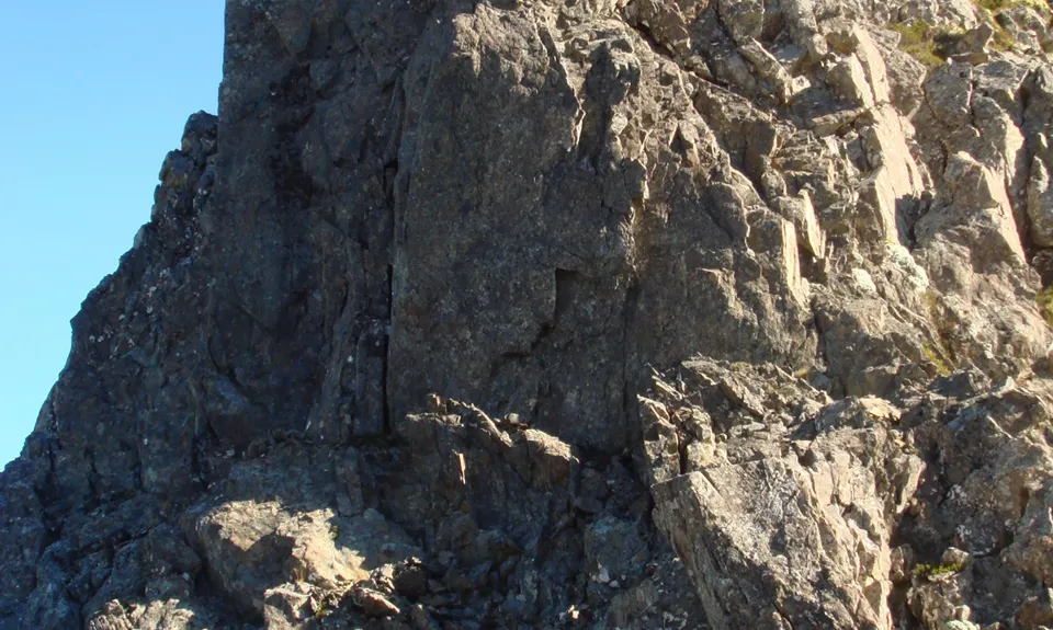
On the exposed and pinnacled upper section of Angelus east ridge, test hand-holds for loose rock.
Do you have a suggestion on where to go afterwards for the best coffee / cake / breakfast / brunch / beer?
Omg- this route has awesome potential but sadly we underestimated the difficulty. The run to Hukere steam was pure fun. While navigating the steep ridgeline (not guessing that this gpx was created manually after the fact) more like type2 :-) . But we had to retreat around 6 hr/1900m due to severe lack of water. So next time we will equip for a 12 hr+ day- ie depending on how easy navigation along the rest of the ridge turns out to be? The unknown is an adventure!
These overlap with this trail to some degree. You may wish to combine them but please note that to qualify for FKTs on these runs you should record a separate activity for each.
We don't store or share your location; it's only used for these features. You can continue without it, just without distance sorting and live map features.
Send to your phone
Scan the below QR code to open this trail on your phone.
Tip: position the QR code in your phone camera screen.