Last Updated: 12th Jan 2025
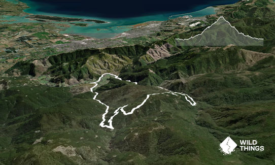
Serpentine Hackett Loop
Last Updated: 12th Jan 2025
Grunt Factor: 23 ?
Gnarl Factor: 25 ?
20.0km
500m
500m
511m

Last Updated: 12th Jan 2025
Last Updated: 12th Jan 2025
Grunt Factor: 23 ?
Gnarl Factor: 25 ?
20.0km
500m
500m
511m
Front country - easily accessible
Loop
Undulating, some big hills
Dog Friendly
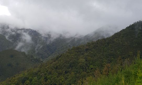
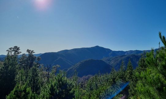
Native bush
Plantation/exotic forest
Riverside
Farm Road / 4WD Track
Moderate Single Track
Average Uphill Gradient: +6.7%
Average Downhill Gradient: -6.9%
VIP Feature: Send this route to your Garmin account so you can follow the course on your Garmin device.
Login as a VIP to see the trailhead information.
3:15
Slow
2:30
Moderate
1:40
Fast
Starting at the Hackett carpark, run out and turn left (back the way you drove in). Follow the road back until you reach Serpentine River Road on your left (it's also a very obvious bridge). Cross the bridge and keep left, you're now on Serpentine River Road. Stay to this 4x4 road and you'll have a couple of small streams to cross before an undulating climb through mostly pine forest. Near the top, you'll come to two signs. Left is Clover Road, right is Serpentine Road. TURN LEFT onto Clover Road and continue uphill for the final push.
Now you're at the top, they'll be a skid site. Just follow the 4x4 road down, down and down some more - if in doubt, yes, go down! You'll exit the pine forest onto the Hackett Track. Turning right takes you south towards the Hackett Hut, left will take you back to your car (about 5km).
The loop run can incorporate the Chromite Mines, accessed off of the Hackett Track on the way back, or via the 4x4 road on the uphill section. However, this is quite steep and becomes more of a tramping track in places.
If you know of any public toilets near the trail start or on the route, please login and then let us know so we can update this section.
Parking is free and there are always spaces. It's safe, but still, lock your car. There is also changing rooms, long-drop toilets and a swimming hole at the carpark for when you finish your run! :)
16 km
23 minutes
Yes
No
Moderate.
Patchy.
Seam-sealed waterproof jacket, Personal Locator Beacon (PLB), Whistle, First aid kit, Extra food for emergencies, Cellphone, Map
There are streams on the uphill, however, due to it being a logging forest, I wouldn't drink it.
On the Hackett side, however, I have happily drunk from the river - just be careful as it's powerful in places.
Forestry work. Check here for track closures: http://www.nelson.govt.nz/recreation/recreation/parks-and-reserves/track-closures/
Carpark Swimming Hole
Where you parked up
Fresh, clean water to swim in, a bridge or rocks to jump off and just bloody good fun!
Trail Legend
Login as a VIP to become a Trail Legend. Learn about Trail Legends.
Fastest Known Times (FKTs)
You and Serpentine Hackett Loop
As a VIP member you can record private notes for this trail, see all of your times and more.
Already have an account? Login now
A good wee loop - mostly forestry road, some nice trail back from Hacket. Great runnable gradient. Glad I had the gpx as there were a few junctions up there! Had hoped for more views, but nice all the same.
May 27, 2022
These overlap with this trail to some degree. You may wish to combine them but please note that to qualify for FKTs on these runs you should record a separate activity for each.
Send to your phone
Scan the below QR code to open this trail on your phone.

Tip: position the QR code in your phone camera screen.


