Last Updated: 21st Sep 2023
Six Mile - Matakitaki Walk, Murchison
Last Updated: 21st Sep 2023
Open
Grunt Factor: 9 ?
Gnarl Factor: 39 ?
5.5km
170m
170m
293m


.jpg?tr=w-542,h-325)
Last Updated: 21st Sep 2023
Last Updated: 21st Sep 2023
Open
Grunt Factor: 9 ?
Gnarl Factor: 39 ?
5.5km
170m
170m
293m
Front country - easily accessible
Out and Back
Undulating, some big hills
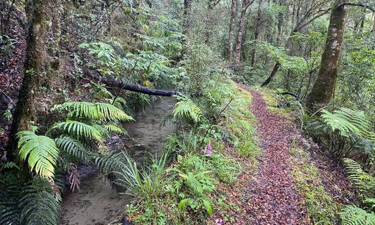
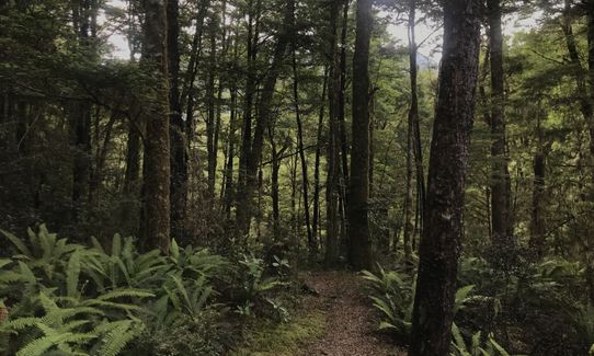
Native bush
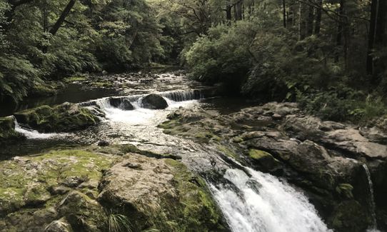
Riverside
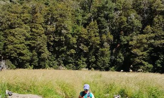
Open farmlands
Easy Single Track
Moderate Single Track
Technical Single Track
Average Uphill Gradient: +8.6%
Average Downhill Gradient: -9.2%
VIP Feature: Send this route to your Garmin account so you can follow the course on your Garmin device.
Login as a VIP to see the trailhead information.
1:10
Slow
0:50
Moderate
0:40
Fast
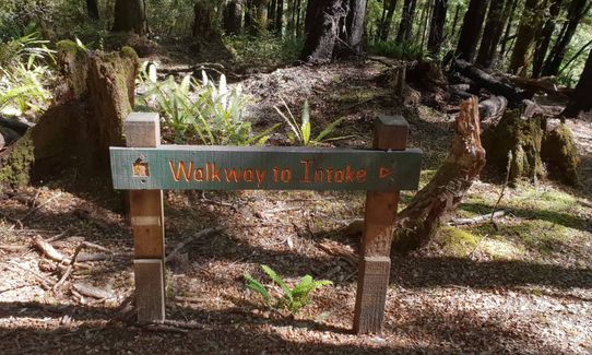
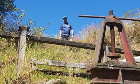
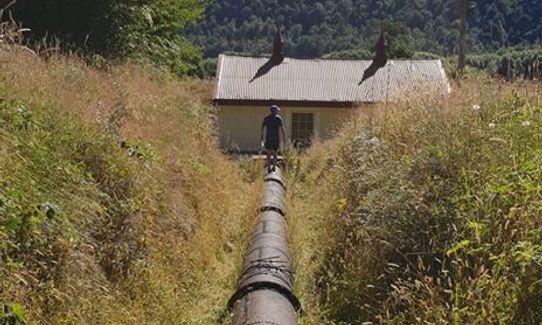
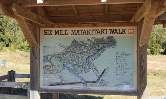
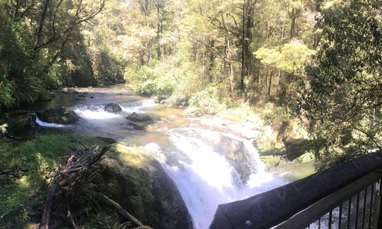
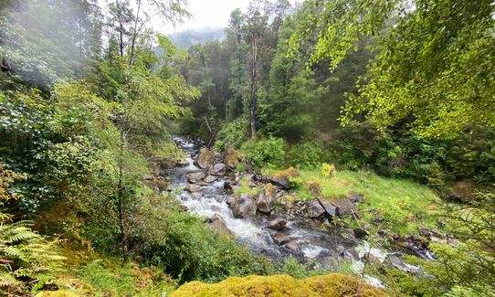
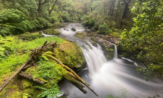
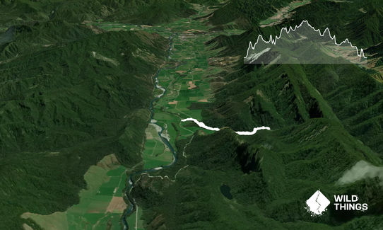
Start at the info board on Matakitaki Road. Go through gate and across paddock heading uphill to start of track (there is another gate here). The track zigzags 50 metres uphill beside the old penstock to the intake and water storage reservoir. From here it follows the water race before continuing in the forest on a higher terrace. There is a side track track (about 1.5km up) that leads to a viewing platform above the old weir which diverts some of the Six Mile Creek down the water race. Below the weir ire waterfalls and rapids, worth a look at.
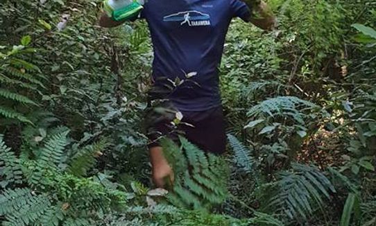
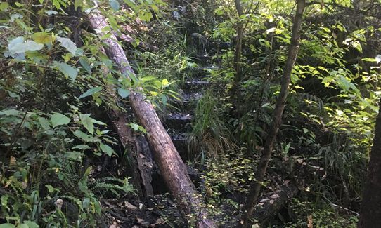
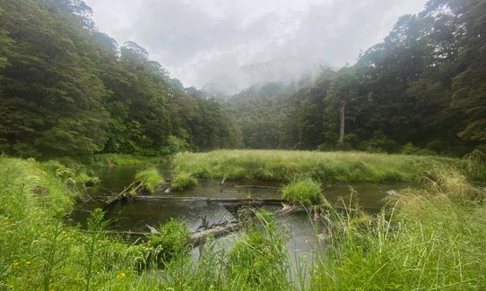
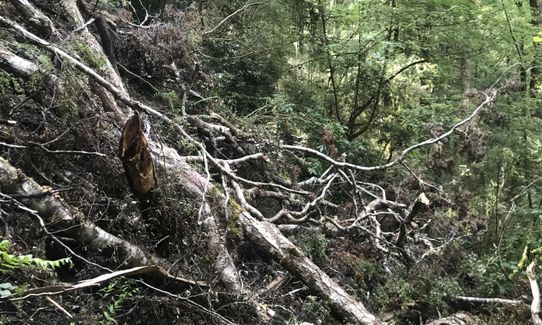
The track then continues, becoming more overgrown, and climbing gradually. You are alongside/above a river and eventually reach a clearing beside the river where it would be possible to swim and stop for a rest before returning. It may aso be possible to continue further but the track is not well marked beyond this point. On the return there is the option of a loop track which descends from the upper terrace to follow along the water race, before rejoining the main track.
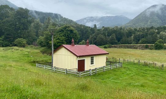
Remains of the Six Mile hydro power station which provided power to Murchison and the area until 1975. Beech forest, river, waterfall, birdlife.
If you know of any public toilets near the trail start or on the route, please login and then let us know so we can update this section.
No public transport. Small parking area near info board.
10 km
14 minutes
Unknown
No
Moderate.
The first couple of kms are easy to follow but in summer the next section was a bit overgrown so pays to check for markers
Patchy.
Short-sleeved thermal top, Seam-sealed waterproof jacket, Cellphone
None, aside from river.
Probably muddy in winter
Livestock in paddock at start. Upper part of trail has a bit of a drop on one side, some fallen trees etc.
Trail Legend
Login as a VIP to become a Trail Legend. Learn about Trail Legends.
Fastest Known Times (FKTs)
You and Six Mile - Matakitaki Walk, Murchison
As a VIP member you can record private notes for this trail, see all of your times and more.
Already have an account? Login now
I did this trail with my husband after staying the night in Murchison. It was a nice wee trail in lovely bush. The trail is over grown as you get further in, so this made it difficult to run ( I am not very confident running when I can't see where my feet are going). The short board walk was slippery, as mentioned above. We did a few loops of the side track at the end to get a few more Ks of running in.
April 24, 2022
The trail makes for a great run up to the weir viewing point but shortly after the track becomes very overgrown and there is currently a slip and tree fall making the trail end inaccessible.
January 11, 2022
This trail was absolutely perfect for me on the day... it may have been rainy and the trail overgrown in places but I loved every minute of it.... a real wee gem!
December 23, 2020
Nice trail leading to a swimming hole which would be a great private picnic spot on a sunny day. Be careful walking through the overgrown bush as I nearly stepped on a Weka scurrying across the trail. It should get the FKT given the speed it moved!
November 15, 2020
Send to your phone
Scan the below QR code to open this trail on your phone.

Tip: position the QR code in your phone camera screen.


