Last Updated: 21st Sep 2023
Poor Petes
Last Updated: 21st Sep 2023
Open
Grunt Factor: 46 ?
Gnarl Factor: 57 ?
21.0km
1280m
1265m
1115m

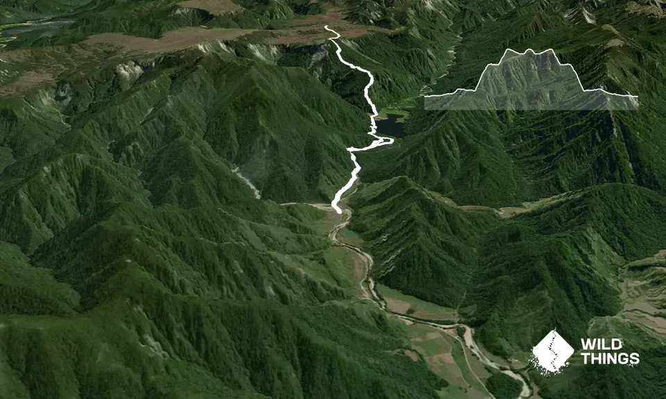
Trail Map
This Topo layer only covers NSW/ACT.
Switch to another map layer when viewing outside this area.
Switch to another map layer when viewing outside this area.


