Last Updated: 24th Jun 2025
Mole Jamieson Loop
Last Updated: 24th Jun 2025
Open
Grunt Factor: 39 ?
Gnarl Factor: 57 ?
16.0km
915m
870m
1289m


Last Updated: 24th Jun 2025
Last Updated: 24th Jun 2025
Open
Grunt Factor: 39 ?
Gnarl Factor: 57 ?
16.0km
915m
870m
1289m
Back country - remote
Loop
Undulating, some big hills
With permit
Native bush
Riverside
Open ridges/tops
Farm Road / 4WD Track
Moderate Single Track
Technical Single Track
Untracked / Route only
Average Uphill Gradient: +12.1%
Average Downhill Gradient: -11.5%
VIP Feature: Send this route to your Garmin account so you can follow the course on your Garmin device.
Login as a VIP to see the trailhead information.
3:30
Slow
2:30
Moderate
1:30
Fast
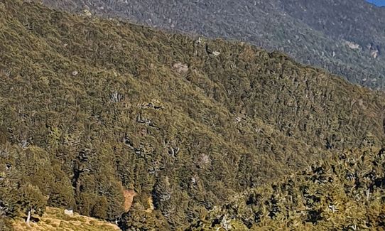
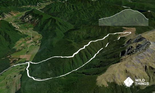
At the start of the Mole track you cross the Mole Stream, then follow the well marked trail (orange markers) climbing up through farmland into beech forest until the track drops down into the Mole Stream, which you now follow up to its head on the open rocky riverbed. Because you're in the riverbed markers are limited but you will spot the occasional one attached to trees on the sides.
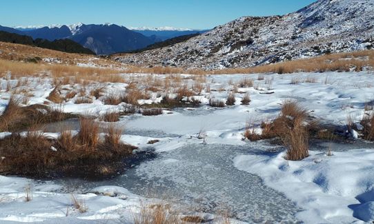
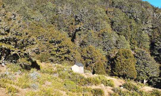
Eventually you come to a fork in the stream and there are orange track markers on the left stream. The track climbs out of the streambed but follows it up to the cute little Mole Hut .You are now on the open tussock and the track goes through thick tussock following snow poles to Mole Saddle . At the saddle the track goes north up onto a high point. Turn off left (west) onto the Jamesons Track which is marked with snow poles. The ridge before the bushline has awesome views - soak it in before the long descent down Jameson Ridge. The ridge takes you back down to the Tutaki road turn left onto the road to your car.
Lovely open alpine tops with great views.
There's a long drop at Mole Hut.
No public transport and parking for a couple of cars though you have the choice of 2 parking areas ...parking on side of road. Safe area.
35 km
43 minutes
With Permit
No
Hard.
If you're worried about navigation its best to do this trip in reverse to how I've described (clockwise) but definitely take a topo map and route desciption.
Non-existent.
Thermal leggings, Lightweight fleece top, Long-sleeved thermal top, Seam-sealed waterproof jacket, Gloves, Beanie/thermal headwear, Personal Locator Beacon (PLB), First aid kit, Extra food for emergencies, Survival bag, Compass, Map, Gaiters
The Mole Stream track has lots of water but Jameson ridge is dry.
Exposed on tops so take windproof jacket as minimum. Snow up here in winter - I did this trip in winter and used spikes on my running shoes. It was awesome!!
Don't go if heavy rain - you have to cross the Mole stream many times! If there's hunters vehicles in carpark wear fluro especially during the roar March April May.
Rivers Cafe
Murchison Fairfax street
Best in Town
Flat Rock Cafe
Kohatu junction
If going on to Nelson or Motueka stop here awesome food and great location
Trail Legend
Login as a VIP to become a Trail Legend. Learn about Trail Legends.
Fastest Known Times (FKTs)
You and Mole Jamieson Loop
As a VIP member you can record private notes for this trail, see all of your times and more.
Already have an account? Login now
Times unrealistic as often not runnable. However a great tramping loop with interesting terrain.
February 28, 2023
A nice loop. The times are very optimistic. Add 30-45mins onto the times above I think!
Slow going up the big rocks of Mole Stream. After this, in the bush, some bits are quite overgrown. But once on the saddle, it’s very fast and easy down Jameson’s track
April 5, 2021
Send to your phone
Scan the below QR code to open this trail on your phone.

Tip: position the QR code in your phone camera screen.


