Last Updated: 21st Sep 2023

Beginner - Intermediate

Save Trail Save

I've done it Done

Curtis Falls

Stratford, Taranaki

Submitted by Mike Tennent

Last Updated: 21st Sep 2023

Beginner - Intermediate

Save Trail Save

I've done it Done

Open

Grunt Factor: 12 ?

Gnarl Factor: 61 ?

5.2km

290m

290m

956m


Login as a VIP to see driving directions, distance and time.

Trail Map

Type of Run

Front country - easily accessible

Out and Back

Undulating, small hills only

Native bush

Riverside

Run Makeup

30%
28%
20%
22%

Easy Single Track

Moderate Single Track

Technical Single Track

Untracked / Route only

Average Uphill Gradient: +14.0%

Average Downhill Gradient: -14.0%

Trailhead

Login as a VIP to see the trailhead information.

Estimated Times to Run

2:00

Slow

1:10

Moderate

0:40

Fast

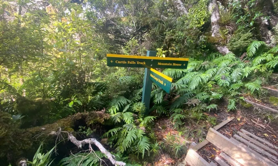
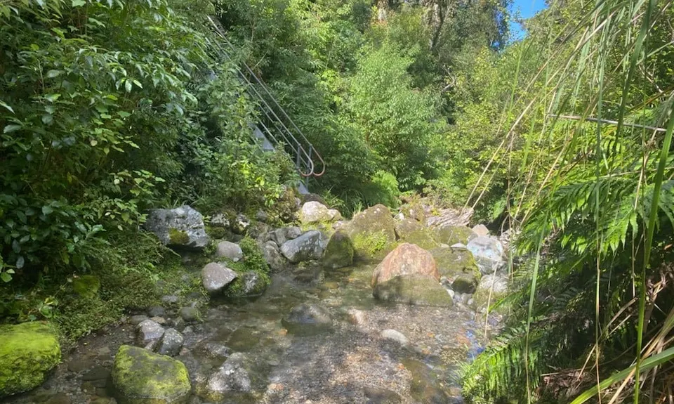
There is a large sign in front of the Mountain House pointing to the various trails. Look for Curtis Falls and then cross the road to the start of the trail. Not far into the trail it splits - it is clearly signed, so follow the Curtis Falls track which descends steeply to a stream crossing with a steel ladder on the far side. Pick you way over to that, it should be possible to keep your feet dry.

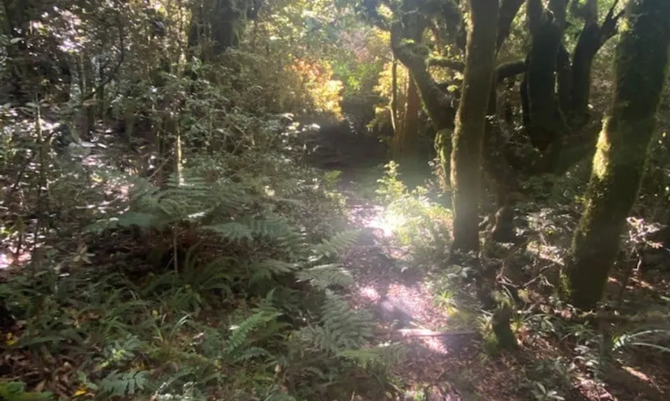
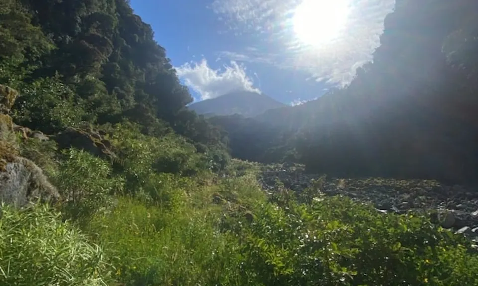
Once at the ladder stop and look back at where you came from, as it is not clearly marked when you return. Now just follow the undulating trail, over 3 small bridges until eventually at about 1.6km it starts to descend (and decend and descend some more) and you get a glimpse of the river below. So down you go and just as you are reaching the river you will see a large orange triangle with Curtis Falls handwritten on it - head left over those rocks through a small trail and over some more rocks down to the river.

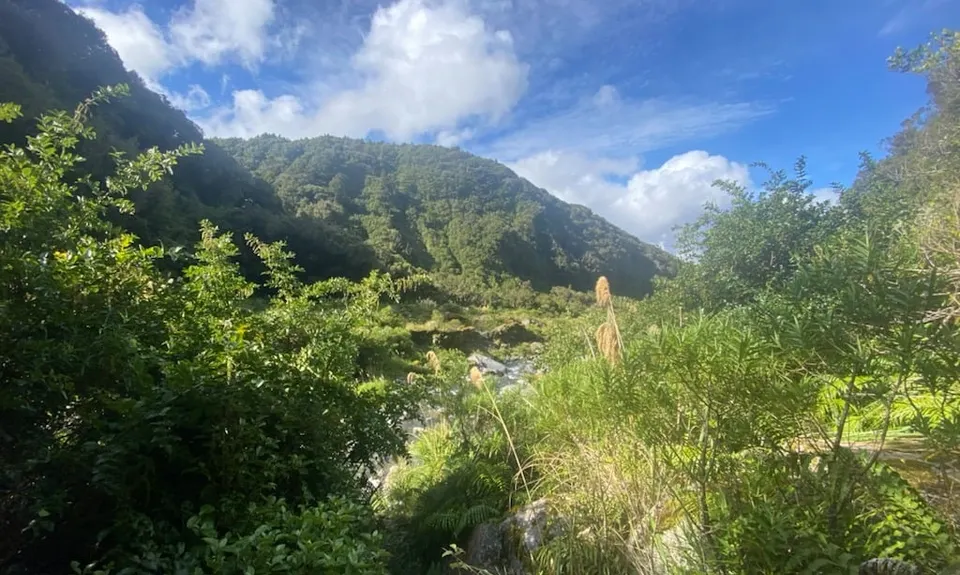
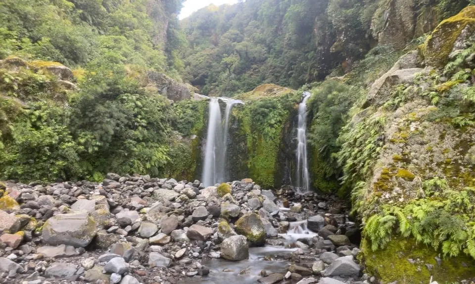
Again at this point, stop and look around, slightly downstream you will see an orange marker pole and probably a couple of rock cairns. This is what you look for on the way back to know where to leave the river and which rocks to climb over. Now, turn around and head upstream until you reach the falls. There is no correct way, but it is pretty easy. Should you need to cross the river there are plentiful sections with large rocks and once again it should be possible to keep your feet dry.

Once you have reached the falls, grab some pics and retrace your steps

Views of Mount Taranaki, a nice waterfall and some epic knarly trails.

Lots of parking

15 km

15 minutes

Unknown

No

Moderate.

Just take note to look around at the key points in the description and you will be fine.

Generally good.

Long-sleeved thermal top, Seam-sealed waterproof jacket, Gloves, Beanie/thermal headwear, Personal Locator Beacon (PLB), Whistle, First aid kit, Extra food for emergencies, Cellphone, Map

Plenty of water along the route

The river may become tough during the spring melt and after very heavy rain. The trail would almost certainly get very mushy in places during a wet winter - making it more fun!

Steep ups and downs
Frequent track sections where it is overgrown and you cannot see you feet
River rocks can be treacherous and care is needed at the river and the stream crossing

Stratford Mountain House
Right at the end of the run
http://www.stratfordmountainhouse.co.nz/
Have had several great meals here and the rooms are great too (with spa baths).

Trail Legend

MV

Matt Verry

has completed Curtis Falls once in the last year.

Learn about Trail Legends.

You and Curtis Falls

As a VIP member you can record private notes for this trail, see all of your times and more.

Register Now

Already have an account? Login now

Trail Reviews

Be the first to submit a review for Curtis Falls!

Login to submit a review

Trail Running Community

Find people who are interested in or have completed this trail run.

You must register or login to view this feature.

Register Now

Other trails nearby
Lake Dive Circuit

Lake Dive Circuit

Length: 12.6km

Level: Intermediate

York Trail Wet Foot

York Trail Wet Foot

Length: 5.6km

Level: Beginner

The Old Whangamomona Road

The Old Whangamomona Road

Length: 10.2km

Level: Beginner

Wilkie and The Enchanted Ridge

Wilkie and The Enchanted Ridge

Length: 9.3km

Level: Beginner

Find more trails and peaks nearby