Last Updated: 27th Feb 2024

Intermediate

Save Trail Save

I've done it Done

Sawyer Burn

Hawea Conservation Park, Kidd Bush Reserve hike

Hunter Valley, Otago

Submitted by Sierra Alef-Defoe

Last Updated: 27th Feb 2024

Intermediate

Save Trail Save

I've done it Done

Open

Grunt Factor: 30 ?

Gnarl Factor: 65 ?

9.8km

710m

710m


Login as a VIP to see driving directions, distance and time.

Trail Map

Type of Run

Back country - remote

Out and Back

Very hilly

Native bush

Lakeside

Open ridges/tops

Run Makeup

60%
40%

Moderate Single Track

Technical Single Track

Average Uphill Gradient: +14.5%

Average Downhill Gradient: -14.5%

Trailhead

Login as a VIP to see the trailhead information.

Estimated Times to Run

2:00

Slow

1:45

Moderate

1:30

Fast

Sawyer Burn is a gem to this region because it has TREES!

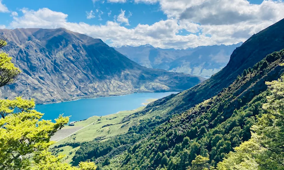
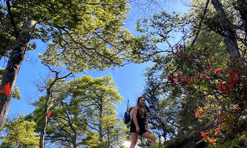
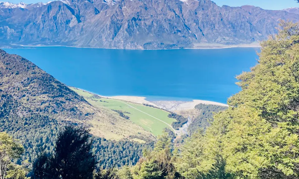
Half of the route is under forest canopy, providing a much-needed break from the full exposure of other tracks in the Hāwea region in summertime. This route also provides stunning views of Lake Hāwea and the surrounding mountains.

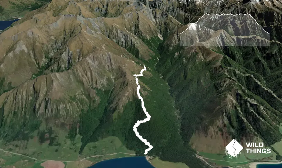
This short track starts from Kidds Bush campground on the shore of Lake Hāwea. The first half is a consistent climb through the forest on a typically well-maintained trail. When you pop out of the bushline, there is an option to follow the spur uphill to bag Sentinel Peak but for the Sawyer Burn route, keep following the orange cairns of the DOC trail to sidle around towards the hut!

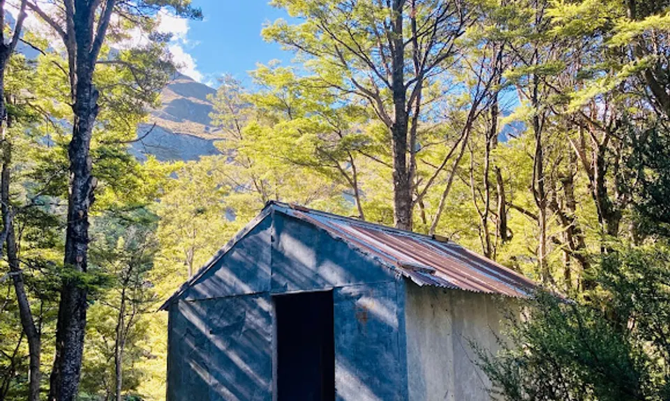
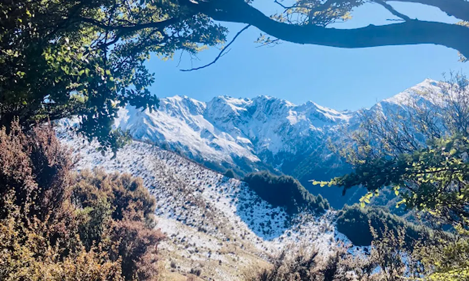
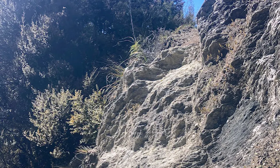
The second half of the route is mostly out of the forest and less vertical, sidling over to the Sawyer Burn valley. The out-and-back track terminates at Sawyer Burn "Hut," which would be more aptly described as a bivvy or shelter -- there is no water tank or toilets. If you need water, the stream is close to the hut (follow your ears) and the water should normally be fine to drink. While most the track is well-maintained and straightforward, there are some parts which are a bit exposed and one tiny scramble is required. Above the bushline, this track can have snow in winter, which may stay on the south-facing aspects through spring.

Sawyer Burn is a gem to this region because it has TREES! This route also provides stunning views of Lake Hāwea and the surrounding mountains.

If you know of any public toilets near the trail start or on the route, please login and then let us know so we can update this section.

Parking is available at the campsite, no other transport options available.

5 km

14 minutes

No

No

Moderate.

Follow orange triangles/cairns/snow poles to stay on the DOC track to Sawyer Burn Hut.

Non-existent.

Seam-sealed waterproof jacket, Windproof jacket, Gloves, Personal Locator Beacon (PLB), Whistle, First aid kit, Extra food for emergencies, Cellphone, Map, Crampons / microspikes (for winter conditions)

Water can be collected from the Sawyer Burn near the hut.

There is often snow above the bushline in winter, which can linger on south-facing aspects into spring.

There are some exposed section as well as one tiny scramble (pictured).

Trail Legend

Sophie Beaumont

Sophie Beaumont

has completed Sawyer Burn twice in the last year.

Learn about Trail Legends.

You and Sawyer Burn

As a VIP member you can record private notes for this trail, see all of your times and more.

Register Now

Already have an account? Login now

Trail Reviews

The first part of this track has some stunning views over the lake - even if you don't go to the hut it's worth doing the first half! I actually did this as a walk not a run, but I imagine if you ran the whole first section would be walking anyway due to the steepness, but heading around to the hut would be fairly runnable

Jennifer Tregurtha

February 10

Login to submit a review

Trail Running Community

Find people who are interested in or have completed this trail run.

You must register or login to view this feature.

Register Now

Overlapping Trails

These overlap with this trail to some degree. You may wish to combine them but please note that to qualify for FKTs on these runs you should record a separate activity for each.

Sentinel Peak

Sentinel Peak

Length: 14.8km

Level: Intermediate - Experienced