Last Updated: 21st Sep 2023

Beginner - Intermediate

Save Trail Save

I've done it Done

Hauturu High Point - West

Kerikeri, Northland

Submitted by Anne-Louise Robertson

Last Updated: 21st Sep 2023

Beginner - Intermediate

Save Trail Save

I've done it Done

Open

Grunt Factor: 19 ?

Gnarl Factor: 40 ?

12.0km

560m

560m

679m


Login as a VIP to see driving directions, distance and time.

Trail Map

Type of Run

Front country - easily accessible

Out and Back

Undulating, some big hills

Native bush

Run Makeup

5%
50%
25%
20%

Farm Road / 4WD Track

Easy Single Track

Moderate Single Track

Technical Single Track

Average Uphill Gradient: +12.1%

Average Downhill Gradient: -12.0%

Trailhead

Login as a VIP to see the trailhead information.

Estimated Times to Run

3:00

Slow

2:15

Moderate

1:30

Fast

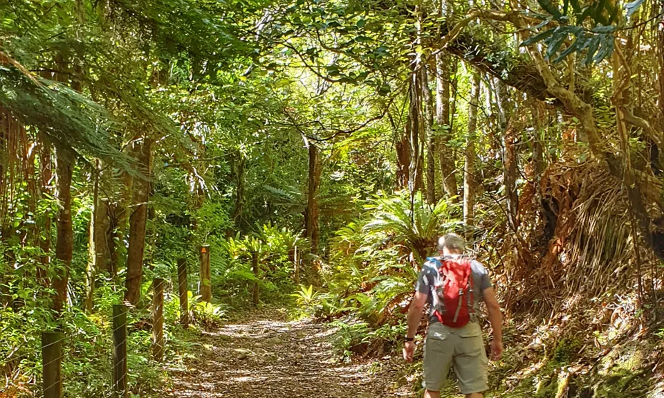
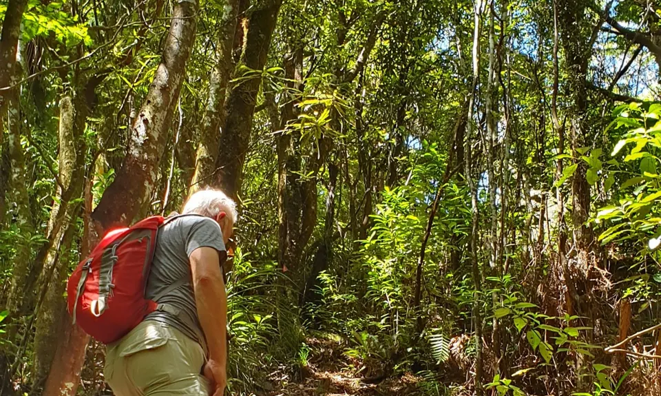
Easy going single trail through forest to start with. All runnable. It is an old bridle way so is well-formed although some areas of erosion to be careful of. Once you get to the Framptons Hut turn off the trail is much more rugged and climbs steeply. Could be muddy in wet conditions and awkward to climb. The track is well-marked but is overgrown in places.

The trail climbs gradually as it traverses along the slope through the forest. Easy underfoot though there are some boggy sections as the path crosses streams. The track is an old bridleway and you can see that it is slightly raised with clear edges for the most part but there are areas where erosion has narrowed the trail and the drop off to the edges is quite steep.

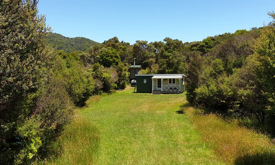
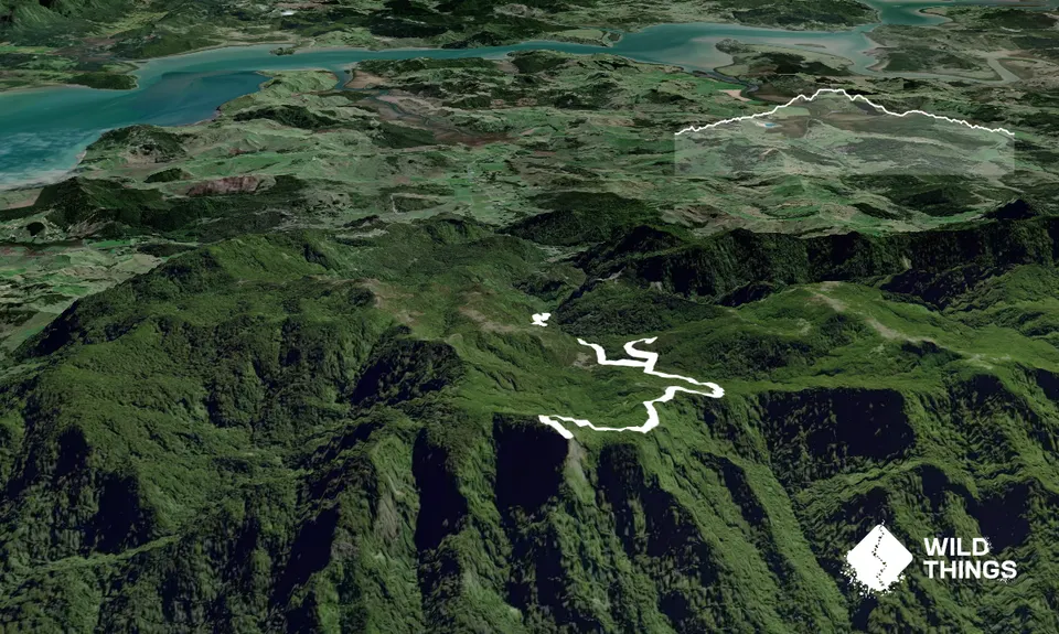
A gate marks the junction where the 4WD track to Frampton’s Hut veers off from the main trail to the left. Waima Main Range Track and Hauturu Highpoint track to the right. Another ten minutes on along a narrower path is the next junction. Right to Hauturu and straight on to follow the main track.

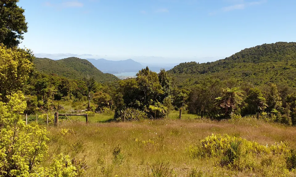
Now you start to climb! Steep and rugged in places, make good use of trees, branches and roots to navigate the muddy, rooty slopes through beautiful native forest. You emerge at a meadow and a great view and then continue along the forested ridgeline before descending steeply to a stream and then climbing back up again. At a junction you can continue down to Waiotemarama Waterfall (approx 5km) but for the summit turn left and follow the track to the trig.

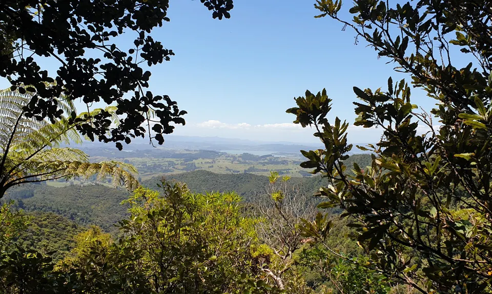
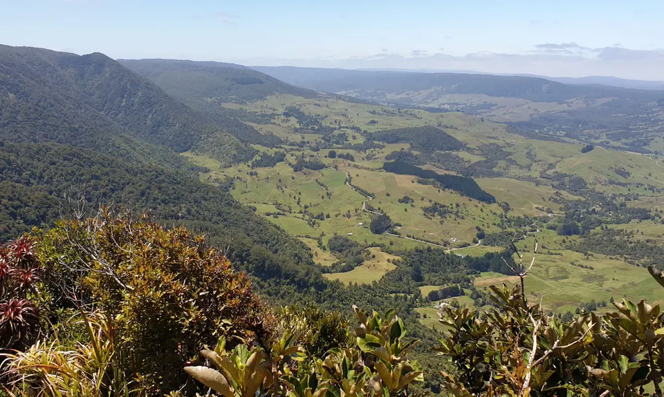
There is no view at the summit, just a wooden trig but if you continue past the trig for a few minutes you emergte at the end of the ridge to a brilliant view looking out across the Waipoua Forest and to the coast. You can also see the Waima Range to the left.

Descend by same route. At junction go through the gate to follow 4WD track to hut.

The first part of the track is an old bridleway. Framptons Hut is an old farmstead and worth visiting.

There is probably only space for one vehicle, two at a push.The space at the top is also the turning space for the residents from the two houses so pull right in to the left.

76 km

65 minutes

Unknown

No

Moderate.

The route is pretty well-marked but the sign to the summit is a bit overgrown so keep an eye out for it.

Patchy.

Short-sleeved thermal top, Seam-sealed waterproof jacket, Personal Locator Beacon (PLB), Whistle, First aid kit, Extra food for emergencies, Survival blanket, Cellphone, Compass, Map, Headtorch and spare batteries, Gaiters

Some streams and small waterfalls
Water at hut - advice is to boil

Could be very muddy after rain
Mostly in shelter of trees

No1 Parnell - Cafe
Rawene
https://no1parnell.weebly.com/about-no-1-parnell.html
Great coffee, lovely space

Trail Legend

Mark Craig

Mark Craig

has completed Hauturu High Point - West once in the last year.

Learn about Trail Legends.

You and Hauturu High Point - West

As a VIP member you can record private notes for this trail, see all of your times and more.

Register Now

Already have an account? Login now

Trail Reviews

Be the first to submit a review for Hauturu High Point - West!

Login to submit a review

Trail Running Community

Find people who are interested in or have completed this trail run.

You must register or login to view this feature.

Register Now

Overlapping Trails

These overlap with this trail to some degree. You may wish to combine them but please note that to qualify for FKTs on these runs you should record a separate activity for each.

6 Foot Track - NZ Style

6 Foot Track - NZ Style

Length: 6.8km

Level: Beginner - Intermediate

Other trails nearby
Wairakau Stream to Dukes Nose

Wairakau Stream to Dukes Nose

Length: 11.0km

Level: Beginner - Intermediate

Mahinepua Peninsula Track

Mahinepua Peninsula Track

Length: 4.8km

Level: Beginner

Stone Store to Rainbow

Stone Store to Rainbow

Length: 8.1km

Level: Beginner

Puketi Forest Loop

Puketi Forest Loop

Length: 20.8km

Level: Intermediate

Find more trails and peaks nearby