Last Updated: 5th Feb 2026
Eastern Tongariro
Last Updated: 5th Feb 2026
Open
Grunt Factor: 30 ?
Gnarl Factor: 27 ?
25.0km
650m
610m
1420m
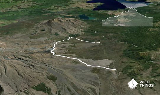
Trail Map
This Topo layer only covers NSW/ACT.
Switch to another map layer when viewing outside this area.
Switch to another map layer when viewing outside this area.


