Last Updated: 6th Nov 2023

Beginner - Intermediate

Save Trail Save

I've done it Done

The Other Mt Hikurangi

Taumarunui, Manawatu - Wanganui

Submitted by Mike Tennent

Last Updated: 6th Nov 2023

Beginner - Intermediate

Save Trail Save

I've done it Done

Open

Grunt Factor: 20 ?

Gnarl Factor: 104 ?

5.9km

520m

520m

767m


Login as a VIP to see driving directions, distance and time.

Trail Map

Type of Run

Front country - easily accessible

Out and Back

Very hilly

Native bush

Open farmlands

Open ridges/tops

Run Makeup

5%
95%

Farm Road / 4WD Track

Untracked / Route only

Average Uphill Gradient: +18.4%

Average Downhill Gradient: -18.4%

Trailhead

Login as a VIP to see the trailhead information.

Estimated Times to Run

2:00

Slow

1:30

Moderate

1:00

Fast

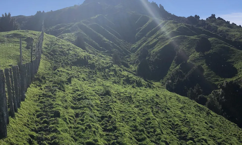
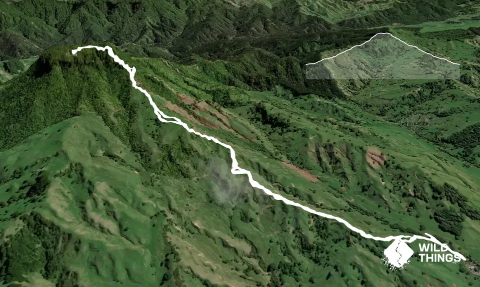
Once you have found your way to the farm and parked, head on up the driveway that heads around the left-hand side of the house. Then as the drive swings left to head up to the other house, look to your right for a gate. Head through the gate and immediately look to the fenceline to your left... and follow it.

This fenceline will take you nearly all the way to the top. Watch out you don't lean on it down the bottom though... it is electric and will be live! So slog your way up, there are gates and a couple of stiles and you can go either side of the fence. It gets tough at times but slog it out and if you need a break, then stop and take in the views! As you get towards the top, look up and try to spot the post with an electric cable. Once you have located it, head towards that. Once you reach the post you are just about to head into the bush for the final push to the top.

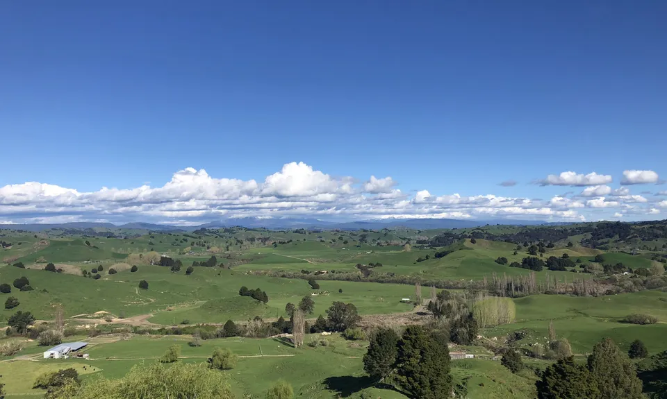
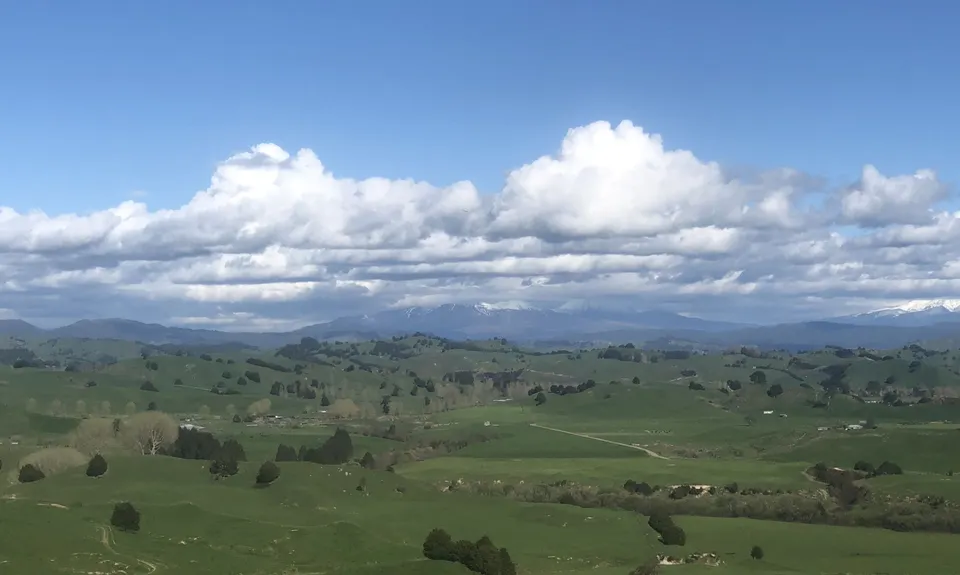
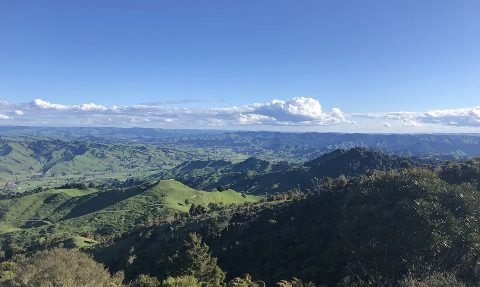
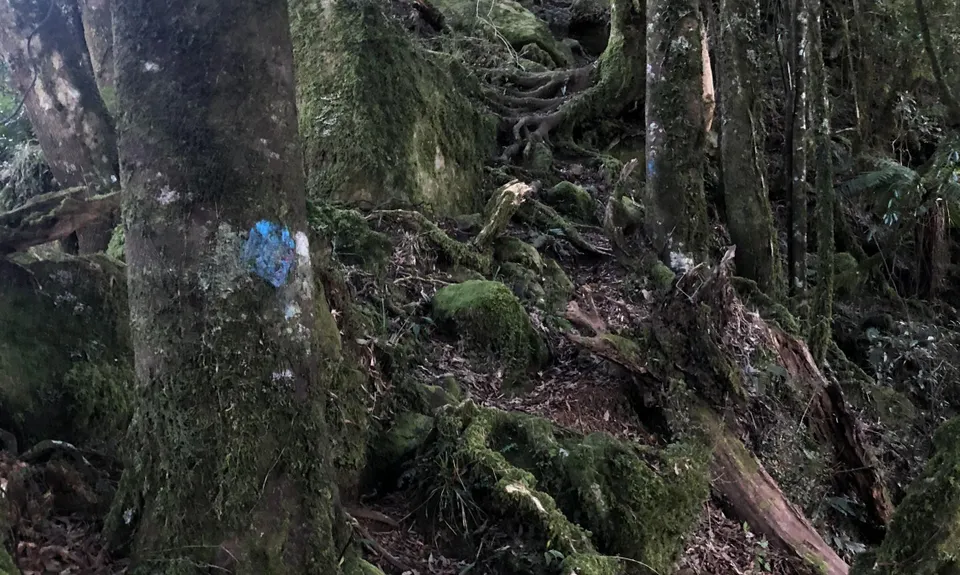
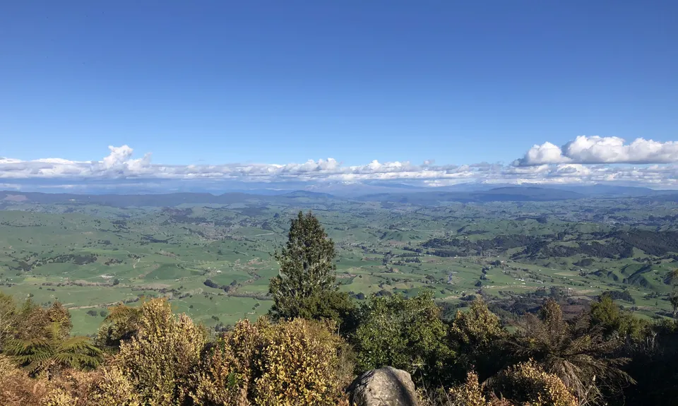
In the bush you are looking for the blue paint on the tree trunks, follow this route up through the bush to the trig and enjoy the views... 521m vertical in 2.9km... you have earned it! On a clear day you can see forever, including Ruapehu and Ngaruahoe. Drink it all in and then head back down. At first the blue marks are still there and reasonably evident, but they start to thin out and then disappear... so be careful, the downward trail drifts to the right and so I picked my way down and it popped out in the right spot... then it was just a case of re-tracing my way down the fenceline! 

This trail includes the peak Hikurangi (Taumaranui).

Parking should be pretty safe, it's on a working farm and the people seem really nice.

18 km

14 minutes

Unknown

Yes
Name: Tonia and Danny Richardson
Telephone: 07 896 7804

Hard.

Stick to the fenceline... if you see an easier line then take it, as long as it brings you back to the fence.

Also on the way down in the bush, be careful to follow the same way down if you can, once the downhill blue markings disappear, look around regularly for the uphill ones so you are on the right track.

Patchy.

Long-sleeved thermal top, Seam-sealed waterproof jacket, Windproof jacket, Beanie/thermal headwear, Whistle, First aid kit, Extra food for emergencies, Survival blanket, Cellphone, Map

No water

As mentioned previously, not at all recommended in wet or muddy conditions!

Electric fences, steep slippery sections.
This would not be a wise choice in wet conditions. It is very steep in places on grass and bare ground cut up by cattle and sheep. Unless you have fantastic grip on your shoes you should wait for dry weather.

You and The Other Mt Hikurangi

As a VIP member you can record private notes for this trail, see all of your times and more.

Register Now

Already have an account? Login now

Trail Reviews

Be the first to submit a review for The Other Mt Hikurangi!

Login to submit a review

Trail Running Community

Find people who are interested in or have completed this trail run.

You must register or login to view this feature.

Register Now

Other trails nearby
Te Maire Track

Te Maire Track

Length: 4.0km

Level: Beginner

Find more trails and peaks nearby